Industry is not the only sector moving towards the rapid adoption of drones for operations. In fact, a growing number of non-profit organizations are beginning to test the feasibility of drones for their work.
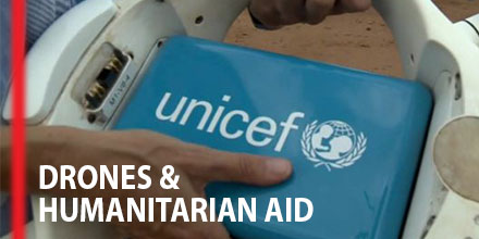
Recently, the Malawi Government and the United Nations International Children’s Emergency Fund (UNICEF) announced the launch of a unique testing corridor.
The corridor's purpose is to test the effectiveness of delivering humanitarian aid via drone.
A first of its kind in Africa, the Humanitarian UAV Testing Corridor launched in June.
Today, it is fairly common to use drones for search and rescue efforts as well to capture live images of inaccessible disaster zones. But, many believe that's just the beginning.
Given the vast area and various issues plaguing the continent, technology can play an important part in Africa's development and growth. The continents launch of humanitarian drones may very well turn out to be the vanguard in helping to tackle some of those problems.
“This humanitarian drone testing corridor can significantly improve our efficiency and ability to deliver services to the world's most vulnerable children,” Christopher Fabian, UNICEF Office of Global Innovation Principal Adviser said in reference to the program in Malawi.
Innovative drone-based healthcare deliveries
The UAV corridor’s launch follows a successful pilot project that took place in March of 2016. The study tested the drone transport of blood samples as a way to speed up HIV diagnosis in infants. The results determined UAVs were indeed a viable addition to existing transport systems used by health providers.
Now, UNICEF and the Malawian Government are taking it a step further. The plan is to test the UAV corridor for a year with participation from over a dozen organizations. Universities, companies, and non-governmental organizations all applied to take part in the program.
Currently, Malawi has one of the highest rates of HIV infections in the world. In 2014 alone, 10,000 children died from the virus.
While large numbers of young people are tested each year, it represents only a fraction of the population. Physical constraints on the country’s health system is a primary reason testing is limited. The hope is that the drone corridor will reduce the cost and wait time of HIV tests.
Humanitarian drones
The drones follow pre-programmed flight paths to carry dried blood samples between rural clinics and hospital labs.
During the pilot program, one trip took under 20 minutes to complete. The drones conducted tests at various times of day as well as in different weather conditions.
The operational advantages drones provide in these rural, underdeveloped areas are tremendous.
Malawi, with a population exceeding 18 million people, only has eight facilities that conduct HIV testing for mothers and their children. Consequently, many patients live far away from testing centers. From testing to treatment, the entire process is often delayed, sometimes by as much as two months.
Long wait times are a major issue. The sooner a child begins treatment with an antiretroviral medicine the greater the chance of survival.
The government of Malawi hopes the humanitarian corridor helps decrease HIV related deaths. But that's just the beginning.
Ultimately, one of the aims of the trial corridor is to research the viability of adopting the use of drones across the country’s health sector.
Beyond the initial cost of purchasing sUAS, their low maintenance costs mean that drones may have an advantage over traditional transportation methods.
Zipline takes to the skies in Rwanda
Malawi isn't the only country to benefit from drones delivering humanitarian aid. In fact, a company called Zipline regularly conducts humanitarian deliveries in Rwanda.
Based outside of San Francisco, Zipline describes itself as "the world's only drone delivery system at a national scale to send urgent medicines like blood to patients, no matter where they live."
In the Fall of 2016, Zipline partnered with the Rwandan health ministry to deploy 15 drones to serve 21 clinics from a single base. The company uses its fleet of sUAS to deliver critical supplies such as blood and plasma to rural hospitals.
With its forested and, at times, impassable terrain, deliveries by road are painfully slow in Rwanda. Drones have the advantage of simply flying over the rugged and difficult terrain. Deliveries that took up to eight hours by road, now happen in under a half-hour.
Financed by the Rwandan Healthy Ministry, the project is a success.
Distribution simplified
The process starts when a hospital sends an order to the Zipline distirubtion center. Local crews pack the product into a small container and load it onto the drone. The drone flies to the hospital and deploys the package, which is attached to a parachute, and returns to the distribution center. Within 5 minutes, after a staff member changes batteries and loads the drone is once again airborne after a staff member changes batteries and loads a new package.
The fleet of fixed-wing UAVs can fly missions up to 50 miles away from the distribution center. The fleets conducts nearly 500 missions a day.
In January 2018, Zipline is expanding its operations into Tanzania. The scale of the Tanzanian operation is significantly larger. The plan, in partnership with the health ministry of Tanzania, is for 120 drones operating out of 4 bases. These centers will serve more than 10 million people at 1,000 clinics across the country.
The future of humanitarian aid?
The advancement of drone technology advancing into humanitarian operations is heartening. And the pioneering projects taking place across Africa are but a fraction of what’s possible. As costs go down and expertise continues to grow, drones will simply be another tool to help deliver humanitarian aid.

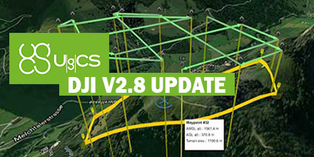 SPH Engineering released updates for both UgCS and the mobile companion, UgCS for DJI.
The update enhances the overall end-user experience as well as features for professional UAV survey mission planning.
SPH Engineering released updates for both UgCS and the mobile companion, UgCS for DJI.
The update enhances the overall end-user experience as well as features for professional UAV survey mission planning.
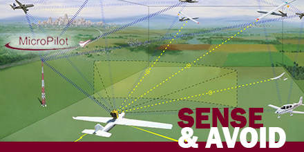 MicroPilot announced the successful integration of FLARM’s Sense and Avoid system with its autopilot.
This integration grants clients a reliable autonomous collision avoidance option for fully autonomous UAV operations.
With any form of autonomous vehicle, a primary concern is safely avoiding collisions with other craft...without the need for human intervention.
A sense and avoid system allows a UAV to do exactly that. Thus, it dramatically reduces operational risks and the need for human monitoring.
MicroPilot announced the successful integration of FLARM’s Sense and Avoid system with its autopilot.
This integration grants clients a reliable autonomous collision avoidance option for fully autonomous UAV operations.
With any form of autonomous vehicle, a primary concern is safely avoiding collisions with other craft...without the need for human intervention.
A sense and avoid system allows a UAV to do exactly that. Thus, it dramatically reduces operational risks and the need for human monitoring.
 The use of Small Unmanned Aircraft Systems (sUAS) continues to expand into various industries. And, with that expansion comes growing awareness about the need for secure communications.
Of course, for the military, security is nothing new.
In a world where data is everything, protecting secret data from malicious hackers is vital.
The use of Small Unmanned Aircraft Systems (sUAS) continues to expand into various industries. And, with that expansion comes growing awareness about the need for secure communications.
Of course, for the military, security is nothing new.
In a world where data is everything, protecting secret data from malicious hackers is vital.
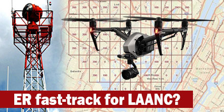 It seems the Federal Aviation Administration (FAA) finally reached a breaking point with requests to access restricted airspace.
Currently, it can take up to 90-days for an operator to get authorization to navigate controlled airspace. With more and more authorization requests pouring in, the logjam continues to get worse.
As such, the speculation is that some operators decide not to wait and fly without authorization. This may explain the increase in the number of non-compliant operations, as reported by the FAA. It is estimated that there are over 250 drone-related safety reports each month.
It seems the Federal Aviation Administration (FAA) finally reached a breaking point with requests to access restricted airspace.
Currently, it can take up to 90-days for an operator to get authorization to navigate controlled airspace. With more and more authorization requests pouring in, the logjam continues to get worse.
As such, the speculation is that some operators decide not to wait and fly without authorization. This may explain the increase in the number of non-compliant operations, as reported by the FAA. It is estimated that there are over 250 drone-related safety reports each month.
 This week, at Commercial UAV 2017, Septentrio announced the arrival of the AsteRx-m2a and AsteRx-m2a UAS GNSS OEM engines.
The two OEM boards bring the latest in precise and reliable multi-frequency, all-in-view RTK positioning and heading.
The boards also provide unmatched interference technology -- all for the lowest power consumption of any comparable product on the market today.
This week, at Commercial UAV 2017, Septentrio announced the arrival of the AsteRx-m2a and AsteRx-m2a UAS GNSS OEM engines.
The two OEM boards bring the latest in precise and reliable multi-frequency, all-in-view RTK positioning and heading.
The boards also provide unmatched interference technology -- all for the lowest power consumption of any comparable product on the market today.