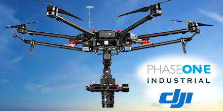
Recently, Phase One Industrial announced full integration of its iXU and iXU-RS aerial cameras with DJI’s M600 and M600 Pro drones.
Phase One Industrial was the first to deliver 100-megapixel medium format aerial cameras.
Built using DJI’s SDK, this is the latest drone platform supported by Phase One Industrial.
From photogrammetry to critical infrastructure monitoring, Phase One continues to innovate inspection tools capable of addressing diverse aerial imaging applications.
DJI M600 and M600 Pro Integration
The integration with DJI’s M600 and M600 Pro platforms is already delivering high quality results.
“The Phase One Industrial IXU camera with the DJI M600 drone, delivered extraordinary results,” said UAV Flight Systems Manager Tobias Wentzler, Lufthansa Aerial Services. “We achieved millimeter per pixel accuracy. This allowed us to inspect in exquisite detail and lift our mission results and accuracy to a new, high-end level. We identified the subtlest cracks or imperfections that were not visible to conventional inspection methods.”
Phase One Industrial’s continuous efforts to identify and develop aerial imaging solutions meet the exacting needs of aerial imaging professionals in diverse markets.
“When our clients hire us, they expect the best,” said Ron Chapple, CEO of Aerial Filmworks. “With the new Phase One Industrial aerial cameras integrated with DJI drones, Aerial Filmworks can deliver the robust performance, highest resolution and finest image quality to support our clients’ cinematic projects.
“GEO1, the survey division of Aerial Filmworks, a solutions-driven provider in the electric and gas/oil marketplace, also benefits from this development. Now, we have the right solution to help satisfy our clients’ requirements for the high resolution data and flight efficiencies.”
Phase One Aerial Camera Integration
Phase One Industrial iXU and iXU-RS aerial cameras’ integration with DJI M600 and M600 Pro drone systems include:
- 100MP and 50MP metric aerial cameras
- Smart triggering of the camera by waypoints / fixed distance / fixed time
- Support for mission planning applications (such as DJI Ground Station pro) – for waypoints missions
- Geo-tagging of all files’ location and gimbal position
- Dual remote controllers (drone and camera) enable each operator (UAV pilot and camera operator) to focus on their respective mission goals
- Industrial-grade build of the camera and aerial lenses, all of which are designed specifically for tough use in harsh environments.
The integration also provides a new iX Capture Mobile application for iOS, featuring an intuitive, user-friendly interface, and support for total remote control of the camera.
iX Capture Mobile was designed using the DJI open platform development tools, and offers various operating modes, including:
- Video Streaming
- Auto or Manual Capture settings to determine the values of the ISO, shutter speed and aperture
- Auto capture mode to enable image capturing by waypoints, fix distance or by time intervals
- Camera control via DJI Lightbridge 2 dials.
Aerial Camera Specs
Phase One Industrial’s iXU and iXU-RS series of high-resolution, metric cameras are known for their precision imaging (offering sensor resolution from 50 to 100 megapixels), small size and low weight (from 1.25 kg). These industrial-grade cameras offer direct integration with many other UAV manufacturers. In addition, they support the workflows of many leading image post processing software, such as Pix4D, Agisoft, SimActive, and others.
Designed to capture images with superior accuracy and quality, Phase One Industrial aerial cameras cover larger aerial surfaces in less time. This means less flight time needed for efficient flying.
Operators can enjoy both unprecedented visibility and a lower cost by utilizing drones rather than traditional airplane or helicopter methods. In addition, using drones offers improved worker safety across many dynamic and challenging environments. Such environments, include: power line monitoring, inspection of wind turbines, railways, roads, bridges and other civil engineering jobs.
Pricing and Availability
Phase One iXU and iXU-RS series camera systems, now with full support for DJI M600 and M600 Pro drones, are now available. Camera package prices begin from $29,000 (complete with integration kit and lens). For more information,
please contact us.

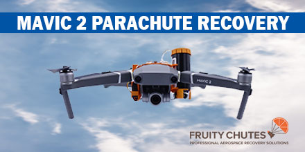 Introducing the first parachute system for the DJI Mavic 2. Designed by Fruity Chutes, the Mavic 2 Automatic Emergency Drone Parachute is lightweight, easy to use and reliable.
Easy to use, operators can pack and load the parachute without the need to send it back to the manufacturer after each use.
In addition, the parachute system is reusable. Included in the kit is a small rigger jig which allows operators to easily refold and pack the parachute.
Introducing the first parachute system for the DJI Mavic 2. Designed by Fruity Chutes, the Mavic 2 Automatic Emergency Drone Parachute is lightweight, easy to use and reliable.
Easy to use, operators can pack and load the parachute without the need to send it back to the manufacturer after each use.
In addition, the parachute system is reusable. Included in the kit is a small rigger jig which allows operators to easily refold and pack the parachute.
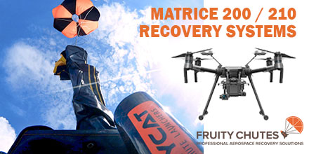 uity Chutes, the leading manufacturer of drone parachute recovery systems, adds to their line with the
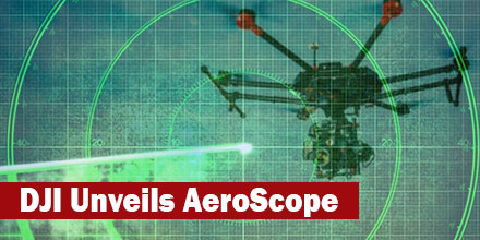 DJI continues to make moves to address the safety and security concerns of operators. There most recent response? The unveiling of AeroScope.
This new product uses existing technology to identify and monitor airborne drones to address safety, security and privacy concerns.
AeroScope uses the communications link between a drone and its remote controller to broadcast identification information. This information includes: a registration or serial number and basic telemetry, including location, altitude, speed, and direction.
DJI continues to make moves to address the safety and security concerns of operators. There most recent response? The unveiling of AeroScope.
This new product uses existing technology to identify and monitor airborne drones to address safety, security and privacy concerns.
AeroScope uses the communications link between a drone and its remote controller to broadcast identification information. This information includes: a registration or serial number and basic telemetry, including location, altitude, speed, and direction.
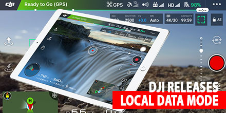 DJI recently released the new Local Data Mode to provide sensitive government and enterprise customers with enhanced data privacy.
Local Data mode stops internet traffic to and from its DJI Pilot application. It is available in the DJI Pilot app update on CrystalSky and for select Android tablets.
DJI recently released the new Local Data Mode to provide sensitive government and enterprise customers with enhanced data privacy.
Local Data mode stops internet traffic to and from its DJI Pilot application. It is available in the DJI Pilot app update on CrystalSky and for select Android tablets.