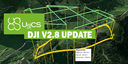
 March 23, 2017
 – Unmanned Systems Source is pleased to announce a new distribution agreement with SPH Engineering.
SPH Engineering is the creator of the popular UgCS Mission Planning Software which provides central management of all types and manufacturers of UAVs. It supports both fixed wing and multi-rotor platforms.
Supported platforms, include: DJI Phantom 4 / 4 Pro, Phantom 3 and Phantom 2, Inspire 2, Inspire 1 / 1 Pro / Raw, Mavic Pro, A3, N3, Matrice 600 / 600 Pro, Matrice 100, A2, Naza-M v2, WooKong-M, Vision2+, Ace One.
Currently, supported autopilots, include: Ardupilot, Px4 and other MAVLink compatible; InnoFlight: Jupiter JM-1; Mikrokopter; Micropilot; Microdrones; LockheedMartin: Kestrel, Indago.
"UgCS software is a great addition to our site," said Andrew Osbrink, Business Development Director at Unmanned. "Whether a customer operates a fixed wing or multi-rotor, many crafts or just one, UgCS' flexible licensing model means organizations can purchase the license that works for their situation."
The UgCS Desktop Solution
UgCS software has convenient tools for areal and linear surveys and provides direct drone control. Its modular architecture means ease of integration and simplifies adding support for new vehicles or payloads. Other features include easy route creation, an immersive 3D mission planning environmental and No-Fly zone support. In addition, it has built-in photogrammetry and geotagging tools, map customization, and more.
Users can control one or a fleet of drones on a single mission, in multi-operator mode and in multi-platform environments.
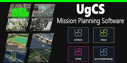
UgCS Mission Planning software options
OPEN is the free version of UgCS software. It offers limited capabilities in terms of the range of operations, functionality and support. However, it allows users insight into the software before making a purchasing decision.
For UAV hobbyists and non-professional users, the ONE license is recommended. It provides unlimited range of operations with some limitation of the advanced functions.
The PRO license is recommended for UAV professionals and land surveyors. It is the fully functional, multi-drone ground control software for professional UAV mission planning. Includes photogrammetry tools, digital elevation model (DEM) and KML file import to enable map customization. It also offers ADS-B receiver support to ensure flight safety.
And finally, the ENTERPRISE license is for companies that operate a fleet of different manufacturer drones requiring a unifying ground station solution. Features ADS-B transponder support, multi-node deployment enables operation of a central server with unlimited connection to UgCS universal control server.
About SPH Engineering
Founded in 2013, SPH Engineering employs both professionals and enthusiasts. They turn client ideas into products that address specific needs and requirements. Technology is not just a product for SPH Engineering, it's their passion.
Visit Unmanned Systems Source to shop and compare
UgCS Mission Planning license plans to find the one that is right for you.

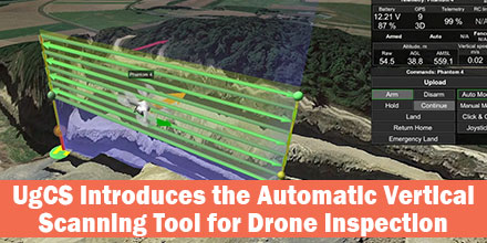 UgCS's new automatic Facade Scan tool for drone inspection mission planning is a time and cost saver for construction, engineering and mining industries.
Tools for surveying horizontal surfaces — even uneven ones — are widely available on the market and have been for some time. However, inspecting vertical surfaces is a completely different story. Previously, vertical surface inspection was a burden for professional drone users because it required a lot of manual work. But, thanks to the automatic Facade Scan tool from UgCS, that burden is no more.
UgCS's new automatic Facade Scan tool for drone inspection mission planning is a time and cost saver for construction, engineering and mining industries.
Tools for surveying horizontal surfaces — even uneven ones — are widely available on the market and have been for some time. However, inspecting vertical surfaces is a completely different story. Previously, vertical surface inspection was a burden for professional drone users because it required a lot of manual work. But, thanks to the automatic Facade Scan tool from UgCS, that burden is no more.
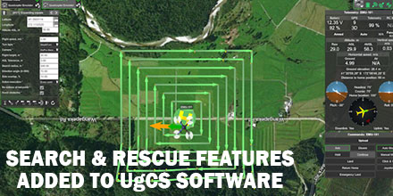 UgCS, provider of mission planning software for unmanned aircraft systems (UAS), together with public safety and disaster response UAS experts Airborne Response, developed a comprehensive search capability for drones.
The new feature allows remote pilots to more effectively conduct search and rescue operations using the UgCS platform.
UgCS, provider of mission planning software for unmanned aircraft systems (UAS), together with public safety and disaster response UAS experts Airborne Response, developed a comprehensive search capability for drones.
The new feature allows remote pilots to more effectively conduct search and rescue operations using the UgCS platform.