Tag - uav

LiDAR Sensors and INS Data

LiDAR Sensors and INS Data

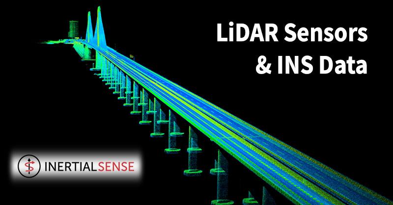
A reliable and accurate GNSS-INS sensor is a crucial element for gyro stabilization of cameras, LiDAR georeferencing and antenna tracking.

Recently, Livox Technology Company -- an independent company founded in 2016 through DJI's Open Innovation Program -- reached out to Inertial Sense.

Livox was in need of an efficient, affordable and complete INS solution to help with their aerial mapping task. Inertial Sense was ready.

Their solution? The Inertial Sense µINS – GNSS aided Inertial Navigation System.

The Inertial Sense µINS is a miniature, GNSS aided Inertial Navigation System (GNSS-INS) module. It includes all the functionality of the µAHRS and provides orientation, velocity, and position.

Users can apply RTK Base station correction data to achieve CM level precision. Sensor data from MEMs gyros, accelerometers, magnetometers, barometric pressure, and GNSS fuse for an optimal estimation.

Livox LiDAR

Currently, Livox sensor's are in use for automotive, robotics and surveying 3D Mapping Applications.

Livox offers a line of advanced sensor units. As such, companies and developers have a reliable route to incorporate this technology into survey projects and autonomous vehicle platforms.

Livox sensors’ performance, affordability, and reliability enable it for use in autonomous driving, robotics and UAV surveying and mapping.

Livox MID-40 LiDAR sensor and Inertial Sensor INS are in use in harsh environments where there are vibrations from the aerial craft. Vibrations often create big problems for most Inertial Measurement Units. 

LiDAR Sensors and INS Data

INS and GNSS are necessary to compensate for LiDAR movement -- both rotation and translation -- during drone flight.  

As the UAS flies, motion is inevitable due to air turbulence, propeller motion and other external and internal forces.

By incorporating data from an INS, it is possible to measure all LiDAR movements. This includes vibration which is required for sensor fusion and mapping.

Flying with the companion INS separates the payload from the drone. Plus, it allows Livox customers the flexibility to choose any drone platform.

To keep the cost of the survey application down, Livox integrated the tight angular accuracy INS sensors from Inertial Sense.

By using an external INS from Inertial Sense, Livox combined and synced data.

To achieve the finest detail aerial mapping, the rotation and translation measured by the INS sensor and matched to the LiDAR data needed to be accurate to the centimeter.

Development and Integration

To start the development and integration, Livox selected the µINS development kit. 

The development kits include the selected module, antennas and appropriate cables to connect to the system. Plus, it includes technical support for system integration.

Main technical characteristics: up to 1KHz IMU, 500Hz INS Update Rate; measurement range of angular resolution 0.1 degrees roll/pitch, GNSS update rate is 5Hz, power voltage 3.3 V; overall dimensions: 35.9 x 25.4 x 11.2mm, weight 10.5g.

Improved Accuracy

The end result was impressive.

Livox LiDARs paired with Inertial Sensor’s miniature, low-cost, GNSS aided Inertial Navigation System (GNSS-INS) module made aerial mapping more efficient and affordable than ever.

INS advanced algorithms provided output from MEMs inertial sensors, magnetometers, barometric pressure, and high-sensitivity GNSS receivers with centimeter accuracy to obtain fast, accurate, and reliable attitude, velocity, and position data during aerial mapping.

With accurate INS data (position and pose) from the sensors, Livox improved final data point accuracy.

Livox projected all data points to an Earth frame to build a global map. As a result, the team accurately mapped the entire 3km-long Huizhou Bay Bridge, located in Guangdong, China...down to its finest details.

Shop Inertial Sense's entire line of INS solutions at Unmanned Systems Source.

About Inertial Sense

Inertial Sense is a premier provider of robust micro inertial navigation solutions for autonomous application manufacturers.

Veronte Autopilot Integrates Advanced INS

Inertial Labs, Inc. and Embention Complete Full Integration of Inertial Navigation System (INS-P) and Veronte Autopilot.

Veronte Autopilot Integrates Advanced INS

In November 2019, Inertial Labs announced the successful benchmark integration with Embention's Veronte Autopilot.

Embention began investigating Inertial Labs as a supplier for inertial measurement units (IMU) in 2013.

In subsequent years, the Inertial Labs Inertial Navigation System (INS) became an appealing GPS-Denied navigation source for Embention.

Veronte Autopilot Integrates Advanced INS

In 2016, Embention and Inertial Labs started discussing integrating the INS-P, the professional version of the INS, with the Veronte Autopilot.

After years of work, Inertial Labs announced the integration was complete and validated through testing.

The release is now available for purchase.

Customer Favorite

Initially, Inertial Labs released the INS product line in 2006.

Today, the INS line is in wide use in many applications.

Plus, it has proven its outstanding reliability and accuracy in challenging conditions -- high vibration, extreme temperatures, and tough mission profiles.

With integration complete, the INS is fully compatible and ready for autonomous unmanned flight system applications.

Tactical Grade IMU

The IMU component is tactical grade.

It is reliable for tactical guidance, navigation, flight control, stabilization, pointing systems, and other applications.

With Angular Rates and Accelerations data transfer rate reaching up to 2000 Hz rate, the low power consuming IMU provides an excellent SWAP-C advantage over legacy IMUs based off tactical grade fiber-optic gyros (FOG).

Plus, the on-board GNSS receiver is fully configurable to reach real-time position accuracy on one centimeter.

Veronte Autopilot

The Veronte Autopilot by by Embention features many top-of-the-line options which distinguish it in the marketplace.

Such features include: extended efforts for line of sight (LOS) and beyond line of sight (BLOS) communication, intuitive and high-performing software, and a configurable navigation solution for various applications - it is fast becoming a customer favorite.

Additionally, with the navigational accuracy provided by the INS-P, the autopilot offers highly accurate navigation in a GNSS-denied environment.

Plus, it is compatible with mission critical items such as tracker antennas, flight simulators and camera payloads.

This platform solution can customize to fit the needs of the end user.

About Inertial Labs, Inc.

Established in 2001, Inertial Labs is a leader in position and orientation technologies for both commercial/industrial and aerospace/defense applications.

About Embention

Founded in 2007, Embention develops components and critical systems for UAS.

Septentrio’s GNSS/INS Receiver for UAS

Septentrio's GNSS/INS Receiver for UAS

Recently, Septentrio introduced the AsteRx-i S UAS to their product line. This GNSS/INS receiver's design is specifically for Unmanned Aerial Systems (UAS).

AsteRx-i S UAS combines GNSS technology with an industrial-grade inertial sensor. It provides high-accuracy, reliable positioning and 3D orientation (heading, roll, pitch) to aerial drones and other compact robotic systems.

Septentrio’s AsteRx-i S UAS builds on the success of their existing UAV products, AsteRx m2 and m2a UAS.

Designed for UAS

This credit card sized receiver easily integrates into any UAS and is compatible with popular autopilots such as Pixhawk and ArduPilot.

Plus, its light weight and low power consumption optimizes UAV battery life. The result? Longer flight times and improved productivity.  

It is a single-package GNSS/INS product, with an on-board IMU (Inertial Measurement Unit) and standard connectors allowing flexibility of sensor choice.

“Quick receiver integration makes the lives of our customers easier. It also speeds up their system’s time-to-market,” said Danilo Sabbatini, Product Manager at Septentrio.

“Our goal was to combine a high-performance product with a simple and flexible plug-and-play integration design, suitable for any aerial system.” 

Designed to Excel

Septentrio reliable centimeter-level positioning is based on multi-frequency, multi-constellation GNSS technology (GPS, GLONASS, Galileo, BeiDou, QZSS).

AsteRx-i S UAS combines a GNSS receiver with a high-quality IMU to deliver reliable positioning together with 3D orientation.

Septentrio’s unique GNSS – IMU integration algorithm provides continuous positioning during short GNSS outages (coasting) which can happen in flight near high structures, under bridges or during banking turns.

AsteRx-i S UAS comes with built-in industry leading Advanced Interference Mitigation (AIM+) technology.

In aerial drones, where lots of electronics are crammed into a small space, neighboring devices can emit electromagnetic radiation which interferes with GPS and GNSS signals.

AIM+ offers protection against such interference resulting in faster set-up times and robust continuous operation. A built-in power spectrum plot allows users to analyze interference, helping locate its source and mitigating it.

Shop Septentrio's complete line of UAS receivers at Unmanned Systems Source.

About Septentrio

Septentrio provides high-precision, multi-frequency, multi-constellation GPS/GNSS positioning technology for use in demanding applications. Reliable centimeter-level positioning enables machine autonomy and ensures operational continuity, efficiency and safety. Septentrio provides positioning solutions for professional applications in such industries as autonomous vehicles, robotics, construction, mapping, marine, logistics and unmanned aerial vehicles (UAVs).

Talon Amphibious – The Chagos Expedition

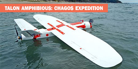
In May 2018, an expedition to the British Indian Ocean Territory launched to study the distribution of megafauna across the Chagos Archipelago. Melissa Schiele, MSc student from Imperial College London, joined the expedition. Schiele also brought an amphibious drone -- the Aeromapper Talon -- to conduct the surveys. "I was thrilled when Dr. Tom Letessier from Zoological Society of London (ZSL) chose me to help with his drone research as part of the Bertarelli Programme in Marine Science," said Schiele. "Our plan was to survey some of the islands of the Chagos Archipelago to compare distributions of megafauna around islands with nesting birds to islands with invasive rats." To accomplish this task, Schiele researched possible drones. "To our knowledge, no one had a fixed-wing water landing drone," said Schiele. 
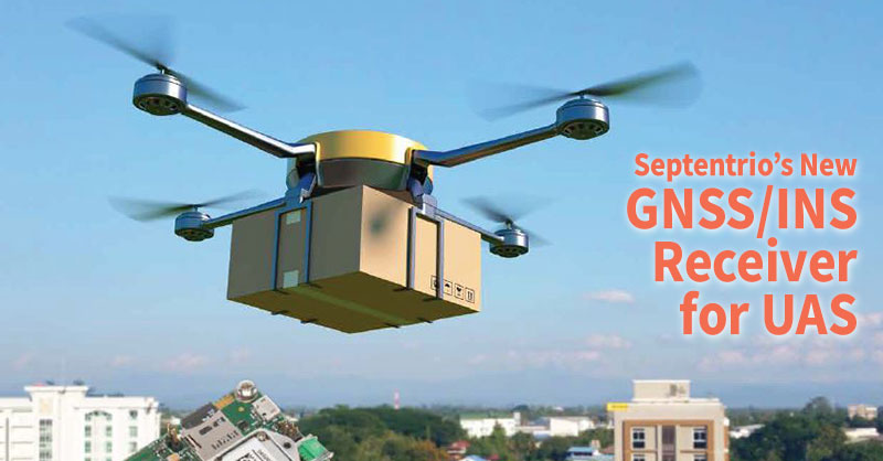
Fortunately for Schiele, there was one such drone that fit the bill -- the
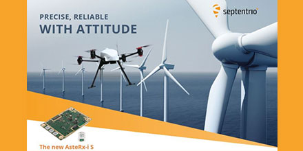
 amphibious Aeromapper Talon manufactured by Aeromao Inc.  

UAVs and Conservation Efforts

The use of Unmanned Aerial Vehicles (UAV) or drones, is gaining traction in the world of ecology and conservation. In marine environments, scientists are testing the feasibility of drones to locate megafauna as well as map large areas. Initial results are promising across the board. Many are looking to drones  to bridge the gap between ground truthing surveys (diving transects, etc.) and large-scale plane based surveys, which cover thousands of kilometers. "In April 2018, I flew to Aeromao headquarters in Canada to learn how to fly our new drones. Aeromao created the Talon - a waterproof fixed-wing drone capable of flying huge distances with the strength, stability and mechanisms of a small plane. With a two-meter wingspan, the units looked impressive. After a week of training and a successful water landing on Lake Erie, I packed up the two drones and flew from Toronto to the Maldives."  

The Chagos Expedition

"Our first deployment and retrieval of the Talon was a success. Plus, we captured our first aerial footage," said Schiele. "The drones were equipped with two cameras. One was on the belly of the fuselage; it took snapshots every second. The other camera was in the clear nose cone. It allowed live streaming of the drone flight to a screen used by the drone pilot. The images proved our original concept worked and we were able to pin point sharks, birds and large fish." Overall, the Talon performed well. There were some small water entry points which is being addressed. We also lost a few days to poor weather. For safety reasons, we did not fly in strong winds and there was little sense flying in rain. By the end of the three-week expedition, we had a suite of images and two drones in need of some TLC. This expedition is just the beginning of a very exciting, international effort into the use of water landing drones for use in marine ecology. We are learning from any mistakes we make and becoming deft at drone mechanics, too," said Schiele.  

About the Aeromapper Talon Amphibious

The Amphibious version of the Aeromapper Talon allows maritime operations by autonomously belly landing on water. Learn more about the Talon Amphibious and shop the entire line of Aeromapper UAVs at Unmanned Systems Source.

AsteRx-i S joins Septentrio’s GNSS/INS product portfolio

 
  • GNSS/INS positioning with 3D attitude: heading pitch and roll
  • Multi-constellation, multifrequency, all-in-view RTK receiver
  • AIM+ interference monitoring and mitigation system
  • High-update rate, low-latency positioning and attitude
  • Small & ultralight IMU (10 grams)
  • Robust calibration for wide temperature ranges
  The AsteRx-i S is designed around demanding requirements for size, weight, power consumption and temperature variation. It is ideal for various applications such as inspection with UAV's, UAS photogrammetry, automation, robotics, and logistics. “We are delighted to broaden our AsteRx-i GNSS/INS solutions range, bringing maximum flexibility and choice to our customers. Whether for direct georeferencing in mapping applications with UAVs, for managing containers in a port or for innovative small robots in agriculture, the compactness, affordability and robustness of the AsteRx-i range allows our customers to focus on their success.” said Francesca Clemente, Product Manager at Septentrio.  

Learn more about the AsteRx-i S and shop Septentrio's entire GNSS/INS product line at Unmanned Systems Source.

Aeromapper Releases the Talon Amphibious UAV for Long-Range Maritime Operations

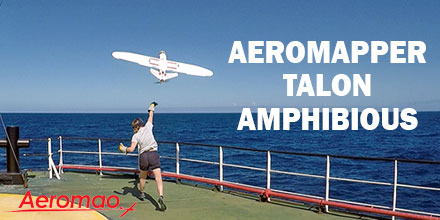
The Aeromapper Talon Amphibious by Aeromao is the world's first fixed-wing drone for commercial maritime operations that can belly land on water or parachute down. With its dual cameras and 20km video link, it’s the perfect solution for observation, data collection and mapping.  

Talon Amphibious

There are very few Unmanned Aerial Vehicles (UAV) or drones that safely land on water. Thus the Talon Amphibious, with its watertight design, is a welcome solution for all UAV maritime and freshwater applications. Even better, this amphibious unit is affordable and multi-functional. Plus, true to its fixed-wing design, it offers extended flight time, substantial payload capacity, and extensive range. The UAV is simple to retrieve from the water using a small boat. Or, the operator can land on a beach. With a cruise speed of 60kph, +30km communication range and 2-hour flight endurance, it easily covers vast areas. As such, it saves both money and time. Plus, its internal GPS beacon makes locating and retrieving the UAV easy. The Talon Amphibious is quick to assemble and deploys by hand-launch from the shore or from a maritime vessel without disruption to the GPS system. Its waterproofed fuselage and internal marine-grade components that resist saltwater corrosion, make the Talon Amphibious system uniquely suited to life on the water. There are a range of customization options available for the Talon.  

Tried and Tested

The Talon Amphibious underwent extensive testing in some of the most challenging marine conditions. Original design inspiration for the UAV came from marine ecologist and field biologists. Their work conditions include maritime vessels and remote island locations. And though these locations may appear idyllic, they present many logistical problems and constraints when it comes to gathering data. Scientists needed a UAV which could endure harsh environments such as rain, wind and waves. The Talon successfully completed operations in the British Indian Ocean Territories (BIOT) as part of a scientific expedition led by the Zoological Society of London. This is the first time that a fixed-wing amphibious UAV was used in the UK Overseas Territories. The applications of a water landing unit in marine ecological surveys, fisheries management and maritime surveillance are vast. In addition, an MSc student from Imperial College London piloted and tested the amphibious UAV. He described the unit as: “An incredible tool for gathering vast amounts of ecological and habitat data, safe in the knowledge that we can easily land anywhere near the main vessel or on the ocean. In the tropics, rain clouds can often hit out of nowhere, and with this amphibious UAV, we no longer have to worry about rain water leaking in, either.” Over 25,000 images were collected during the ecological surveys and the scientists were able to analyse the images to calculate the abundances of sharks and birds. Their camera of choice was the Garmin VIRB which allowed for geotagging of each image. The Talon Amphibious is garnering plenty of interest in the research world. Scientists and managers from around the world are looking to implement this maritime solution into their coastal project operations.  

Learn more about the Talon Amphibious and find the entire line of Aeromao products at Unmanned Systems Source.