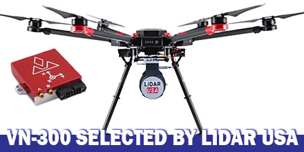
LiDAR USA announced the integration of VectorNav's VN-300 Dual-Antenna Inertial Navigation System f0r its ScanLook Revolution UAV-based mapping-system.
The combined system provides LiDAR mapping capabilities targeted at applications that require a fast, efficient and easy-to-use solution.
UAV-based LiDAR
Historically, the size, weight and power requirements of legacy LiDAR mapping systems primarily limited their use to manned aircraft. Plus, to keep costs feasible only large areas were best for mapping.
Thanks to advances in both LiDAR and INS technology, a new generation of mapping systems are emerging.
Today, LiDAR units weigh just a few hundred grams and can fit in the palm of the hand. They are also affordable enough for small businesses to develop services with a meaningful return on investment.
How it works
Mobile LiDAR mapping requires several components to work synergistically in order to provide a suitable output.
Components include: a LiDAR scanner, attitude/orientation sensor, positioning system, timing reference system and a vehicle or mobile platform.
Traditionally, users had to either piece all the components together. Or users had to buy expensive systems designed for survey applications which incorporated L1/L2 GPS receivers with RTK positioning techniques.
These types of systems also required the added expense of communicating with a reference base station or reference network system in order to maintain such accuracy.
Clearly, there was a growing need for a low-cost, easy-to-use mapping system available to a wide-range of users. A system that required no advanced training, or complex setup and expensive post-processing. Enter LiDAR USA.
Leveraging 18 years of experience, LiDAR USA developed the ScanLook Revolution system.
Why VN-300?
LiDAR USA selected the VN-300 Dual-Antenna INS to keep the Revolution small, accurate and fully featured.
“The VN-300 stood out among the rest for it’s exceptional performance in a wide range of operating conditions and especially for its small size and low weight. The VN-300 is a powerful sensor,” said Jeff Fagerman, CEO of LiDAR USA. “It’s tiny, only weighs 30 g and has performance comparable to much higher-priced systems,”
In part, LiDAR USA selected the VN-300 because it does not rely on magnetometers for heading estimation.
“Relying on magnetometers for accurate heading estimation is typically highly problematic,” according to Jakub Maslikowski, Director of Sales and Marketing at VectorNav.
The VN-300 uses two GNSS receivers and a technique known as Carrier Phase Interferometry. This technique enables the VN-300 to estimate the heading solely from GPS signal measurements when the vehicle is stationary.
Development of the Revolution was a challenging endeavor and required a lot of experimentation and fine tuning.
“Working with the VN-300 and the team from VectorNav has been excellent. They’re responsive, extremely knowledgeable and a great team to work with,” said Fagerman.

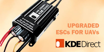 KDE Direct recently announced new features for their UAS (unmanned aerial system) UVC electronic speed controller (ESC) series and KDE Device Manager V1.32 software. Upgrades include data logging and graphing, stall protection, and motor control optimizations.
The new data graphing and logging features are accessible by updating the UVC Series ESC to the latest firmware. During a flight, the UVC Series ESC records the following:
KDE Direct recently announced new features for their UAS (unmanned aerial system) UVC electronic speed controller (ESC) series and KDE Device Manager V1.32 software. Upgrades include data logging and graphing, stall protection, and motor control optimizations.
The new data graphing and logging features are accessible by updating the UVC Series ESC to the latest firmware. During a flight, the UVC Series ESC records the following:
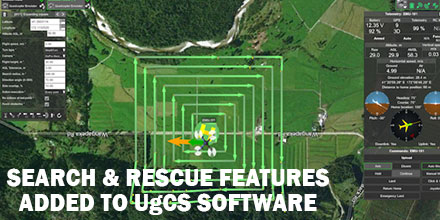 UgCS, provider of mission planning software for unmanned aircraft systems (UAS), together with public safety and disaster response UAS experts Airborne Response, developed a comprehensive search capability for drones.
The new feature allows remote pilots to more effectively conduct search and rescue operations using the UgCS platform.
UgCS, provider of mission planning software for unmanned aircraft systems (UAS), together with public safety and disaster response UAS experts Airborne Response, developed a comprehensive search capability for drones.
The new feature allows remote pilots to more effectively conduct search and rescue operations using the UgCS platform.
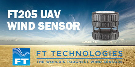 FT Technologies announced the launch of the first in a new generation of lightweight ultrasonic wind sensors -- the FT205.
Made from a graphite and nylon composite, and weighing only 100g (3.5oz), the FT205 is designed specifically for use on drones and unmanned aerial vehicles (UAVs).
FT Technologies announced the launch of the first in a new generation of lightweight ultrasonic wind sensors -- the FT205.
Made from a graphite and nylon composite, and weighing only 100g (3.5oz), the FT205 is designed specifically for use on drones and unmanned aerial vehicles (UAVs).
 GNSS receiver manufacturer Septentrio recently announced the launch of the next generation AsteRx-i. The announcement occurred at IEEE/ION Position Location and Navigation Symposium in Monterey, US.
The AsteRx-i combines Septentrio’s latest compact, multi-frequency multi-constellation GNSS engine with an external industrial grade MEMS based IMU.
It delivers accurate and reliable GNSS/IMU integrated positioning to the cm-level. It also delivers full 3D attitude at high update rates and low latency.
GNSS receiver manufacturer Septentrio recently announced the launch of the next generation AsteRx-i. The announcement occurred at IEEE/ION Position Location and Navigation Symposium in Monterey, US.
The AsteRx-i combines Septentrio’s latest compact, multi-frequency multi-constellation GNSS engine with an external industrial grade MEMS based IMU.
It delivers accurate and reliable GNSS/IMU integrated positioning to the cm-level. It also delivers full 3D attitude at high update rates and low latency.
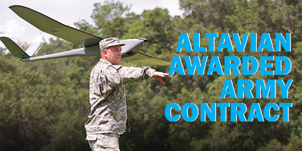 Altavian, Inc., announced they were awarded a $250MM Indefinite Delivery, Indefinite Quantity contract with the US Army.
With this award, Altavian now supports the largest small UAS program in the world. It exists under the Program Executive Office Aviation, Products Office for Tactical Unmanned Aircraft (TUAS),
The US Army Family of Systems, Unmanned Aircraft Systems (FoSUAS) includes the RQ-11, the RQ-20. It supports control and communications equipment, and other technologies fielded over the contract period of performance.
All systems are for a single, dismounted war-fighter. The design enables the individual to carry, assemble, and deploy the system for immediate over-the-hill surveillance and reconnaissance.
Altavian, Inc., announced they were awarded a $250MM Indefinite Delivery, Indefinite Quantity contract with the US Army.
With this award, Altavian now supports the largest small UAS program in the world. It exists under the Program Executive Office Aviation, Products Office for Tactical Unmanned Aircraft (TUAS),
The US Army Family of Systems, Unmanned Aircraft Systems (FoSUAS) includes the RQ-11, the RQ-20. It supports control and communications equipment, and other technologies fielded over the contract period of performance.
All systems are for a single, dismounted war-fighter. The design enables the individual to carry, assemble, and deploy the system for immediate over-the-hill surveillance and reconnaissance.