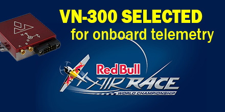
The VN-300 is now the primary source for telemetry data for Master Class race planes participating in Red Bull's Air Race World Championship.
The 2018 inaugural season event, in Abu Dhabi, marked the first time all 14 aircraft used the VN-300.
The VN-300 provides real-time telemetry data which teams use for a variety of functions.
About the Red Bull Air Race
Created in 2003, the Red Bull Air Race World Championship features the world's best race pilots. It is a pure motorsport competition combining speed, precision and skill.
Using the fastest, most agile, lightweight racing planes, pilots hit speeds of 370 km/h. Pilots endure forces up to 10 G as they navigate a low-level slalom track marked by 25-meter-high, air-filled pylons. Pilots receive time penalties for various infractions. Such penalties include: hitting pylons, incorrectly passing through the Air Gate, as well as others.
Spectators need a reference to see the difference between the pilots’ lines and speed through the racetrack. As such, Red Bull Air Race Live TV utilizes an augmented reality (AR) solution known as the Ghost Plane. The AR displays the trajectory of the pilots’ runs and provides real-time comparison in the head-to-head rounds and finals.
The Ghost Plane is driven by the position, velocity and attitude data gathered during flight from the on-board INS. Critical to the success of the Ghost Plane is the accuracy of the telemetry data. And, given the high dynamics experienced during flight, is difficult to obtain.
Importance of accurate telemetry data
For example, when a plane races through a chicane and into a vertical turn maneuver, it loses GPS signals. As such, until GPS is reacquired, the INS relies solely on the inertial sensors to provide position and velocity.
“We evaluated several different inertial navigation systems. We struggled to find one that performed in our dynamics. VectorNav’s VN-300 was the only product able to deliver the attitude, position and velocity data accuracy we require. And, it did this out of the box, no customization required. The sensor is really amazing,” said Alvaro Navas, Sport Technical Manager for the Red Bull Air Race.
VN-300
Weighing less than 30 grams, the VectorNav VN-300 is the world’s smallest dual antenna GNSS-aided INS. It is used in many applications: from autonomous vehicles to antenna pointing for satellite communication and aerial surveillance.
“We are really excited to work with Red Bull Air Race,” said Gordon Hain, VectorNav Product Manager. “We provide accurate data for the race judges and spectators and we provide valuable information to pilots and tacticians. With the VectorNav data in hand they can compare actual flight trajectories with their simulations to find areas for improvement. We look forward to working with Red Bull Air Race in the 2018 season and beyond.”
About VectorNav Technologies
VectorNav Technologies is the leading innovator and manufacturer of embedded navigation solutions using the latest in MEMS inertial sensor and GPS/GNSS technology. Since its founding in 2008, VectorNav has provided systems integrators in the military, aerospace, marine, and robotics industries around the world with SWaP-C optimized, high-performance navigation systems.
Furthermore, VectorNav has unique expertise in applying the digital filtering and sensor calibration techniques that have multiple decades of heritage in aerospace applications to the state of-the-art in MEMS inertial and GPS/GNSS technology.
About Red Bull Air Race
Created in 2003, the Red Bull Air Race World Championship has held more than 80 races around the globe. The Red Bull Air Race World Championship features the world’s best race pilots in a pure motorsport competition that combines speed, precision and skill.
In 2014, the Challenger Cup began to help the next generation of pilots develop the skills needed for potential advancement to the Master Class that vies for the World Championship.

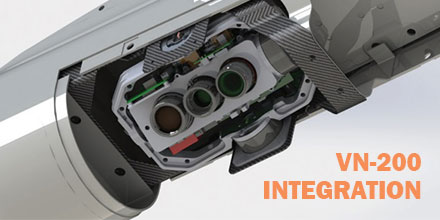 VectorNav announced that its VN-200 GPS-aided inertial navigation system (INS) was selected for integration into Overwatch Imaging‘s TK-series precision imaging payload.
The payload is for aerial smart mapping and automatic detection applications for UAVs (unmanned aerial vehicles) and manned aircraft.
VectorNav announced that its VN-200 GPS-aided inertial navigation system (INS) was selected for integration into Overwatch Imaging‘s TK-series precision imaging payload.
The payload is for aerial smart mapping and automatic detection applications for UAVs (unmanned aerial vehicles) and manned aircraft.
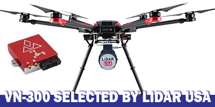 LiDAR USA announced the integration of VectorNav's VN-300 Dual-Antenna Inertial Navigation System f0r its ScanLook Revolution UAV-based mapping-system.
The combined system provides LiDAR mapping capabilities targeted at applications that require a fast, efficient and easy-to-use solution.
LiDAR USA announced the integration of VectorNav's VN-300 Dual-Antenna Inertial Navigation System f0r its ScanLook Revolution UAV-based mapping-system.
The combined system provides LiDAR mapping capabilities targeted at applications that require a fast, efficient and easy-to-use solution.
 VectorNav Technologies announced it received accreditation for the AS9100 Rev. D international aerospace standard for its Dallas, Texas headquarters.
AS9100 is a set of quality requirements established by the aerospace industry to satisfy DOD, NASA and FAA quality requirements. These quality requirements are based on ISO 9001 standards.
“Earning the AS9100 designation for our Dallas facility demonstrates we are a highly capable supplier to the aerospace industry. Operating to the highest standards of quality is a core principle for us," said Scott MacDonald, Process and Quality Engineer at VectorNav. "This certification reflects our continued commitment to ensure our processes and systems deliver products and services that exceed our customers’ quality, cost, and speed expectations.”
VectorNav Technologies announced it received accreditation for the AS9100 Rev. D international aerospace standard for its Dallas, Texas headquarters.
AS9100 is a set of quality requirements established by the aerospace industry to satisfy DOD, NASA and FAA quality requirements. These quality requirements are based on ISO 9001 standards.
“Earning the AS9100 designation for our Dallas facility demonstrates we are a highly capable supplier to the aerospace industry. Operating to the highest standards of quality is a core principle for us," said Scott MacDonald, Process and Quality Engineer at VectorNav. "This certification reflects our continued commitment to ensure our processes and systems deliver products and services that exceed our customers’ quality, cost, and speed expectations.”
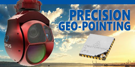 Octopus ISR Systems, a division of UAV Factory Ltd., announced the release of a new feature, "Precision Geo-Lock", for its miniature Epsilon series of gyro-stabilized gimbals.
Precision Geo-Lock combines a state-of-the-art GPS-aided inertial navigation system (GPS/INS) with dedicated software algorithms and payload operator software. It provides the user with highly accurate target geo-location, range-to-target, as well as Geo-Lock functionality and moving map user interface.
Octopus ISR Systems, a division of UAV Factory Ltd., announced the release of a new feature, "Precision Geo-Lock", for its miniature Epsilon series of gyro-stabilized gimbals.
Precision Geo-Lock combines a state-of-the-art GPS-aided inertial navigation system (GPS/INS) with dedicated software algorithms and payload operator software. It provides the user with highly accurate target geo-location, range-to-target, as well as Geo-Lock functionality and moving map user interface.