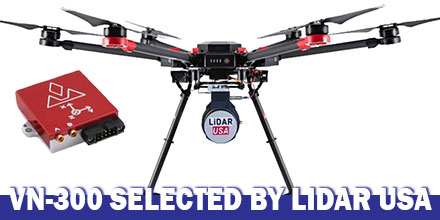
LiDAR USA announced the integration of VectorNav's VN-300 Dual-Antenna Inertial Navigation System f0r its ScanLook Revolution UAV-based mapping-system.
The combined system provides LiDAR mapping capabilities targeted at applications that require a fast, efficient and easy-to-use solution.
UAV-based LiDAR
Historically, the size, weight and power requirements of legacy LiDAR mapping systems primarily limited their use to manned aircraft. Plus, to keep costs feasible only large areas were best for mapping.
Thanks to advances in both LiDAR and INS technology, a new generation of mapping systems are emerging.
Today, LiDAR units weigh just a few hundred grams and can fit in the palm of the hand. They are also affordable enough for small businesses to develop services with a meaningful return on investment.
How it works
Mobile LiDAR mapping requires several components to work synergistically in order to provide a suitable output.
Components include: a LiDAR scanner, attitude/orientation sensor, positioning system, timing reference system and a vehicle or mobile platform.
Traditionally, users had to either piece all the components together. Or users had to buy expensive systems designed for survey applications which incorporated L1/L2 GPS receivers with RTK positioning techniques.
These types of systems also required the added expense of communicating with a reference base station or reference network system in order to maintain such accuracy.
Clearly, there was a growing need for a low-cost, easy-to-use mapping system available to a wide-range of users. A system that required no advanced training, or complex setup and expensive post-processing. Enter LiDAR USA.
Leveraging 18 years of experience, LiDAR USA developed the ScanLook Revolution system.
Why VN-300?
LiDAR USA selected the VN-300 Dual-Antenna INS to keep the Revolution small, accurate and fully featured.
“The VN-300 stood out among the rest for it’s exceptional performance in a wide range of operating conditions and especially for its small size and low weight. The VN-300 is a powerful sensor,” said Jeff Fagerman, CEO of LiDAR USA. “It’s tiny, only weighs 30 g and has performance comparable to much higher-priced systems,”
In part, LiDAR USA selected the VN-300 because it does not rely on magnetometers for heading estimation.
“Relying on magnetometers for accurate heading estimation is typically highly problematic,” according to Jakub Maslikowski, Director of Sales and Marketing at VectorNav.
The VN-300 uses two GNSS receivers and a technique known as Carrier Phase Interferometry. This technique enables the VN-300 to estimate the heading solely from GPS signal measurements when the vehicle is stationary.
Development of the Revolution was a challenging endeavor and required a lot of experimentation and fine tuning.
“Working with the VN-300 and the team from VectorNav has been excellent. They’re responsive, extremely knowledgeable and a great team to work with,” said Fagerman.
