Tag - drones

FAA Approves Nine New LAANC Service Providers

The Federal Aviation Administration (FAA) announced nine new partners to its Low Altitude Authorization and Notification Capability (LAANC) initiative. LAANC is an innovative collaboration between the FAA and the drone industry. The initiative provides near real-time processing of airspace authorizations for Part 107 drone operators nationwide who fly in controlled airspace.  

LAANC Expands

Following the FAA’s successful prototype, the initiative was simultaneously opened to additional air traffic control facilities and to new industry partners. The five-month on-boarding process that began in April resulted in nine new LAANC partners. Those partners include: Aeronyde, Airbus, AiRXOS, Altitude Angel, Converge, DJI, KittyHawk, UASidekick and Unifly. The nine joined five companies – AirMap, Harris Corp., Project Wing, Skyward and Thales Group. All met the technical and legal requirements to provide LAANC Services.  

How it Works

LAANC uses airspace data, including UAS facility maps, which shows the maximum altitude around airports where the FAA may authorize operations under Part 107 in controlled airspace. Drone operators can interact with industry developed applications and obtain near real-time authorization from the FAA. LAANC, a foundation for developing the Unmanned Aircraft Systems Traffic Management System (UTM),is now available at nearly 300 FAA air traffic facilities across the country, covering approximately 500 airports. Next year, from January 7 to February 8 and from July 8 to August 9, the FAA will accept applications from parties interested in becoming LAANC service providers. This is not a standard government acquisition; there is no Screening Information Request (SIR) or Request for Proposal (RFP) related to this effort. Interested parties can find information on the application process here.

Reliable Operation in a Multi-Drone Environment

From their military origins a few decades ago -- carrying sophisticated systems and running remote, cross-boarder missions -- drones are now commercial and industrial platforms. 
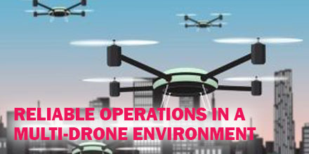
Today, drones play a significant role in the next generation of automated and autonomous vehicles. The vision of multiple drones filling in the public sky, running various missions smoothly is slowly becoming a reality.  

Operational Reality

In fact, drone operation in such an environment is so challenging that stable and reliable communication is crucial. The communication infrastructure must provide carrier-class availability, ensuring control and telemetry signals are available in real-time. And, that critical data flows between the drone and operation control centers. In addition, automated airspace management systems must guarantee full coordination between different vehicles using the same air space. These systems are called UTM (Unmanned Traffic Management) systems. The dynamic nature of the drone’s operation should have a ‘network’ planning perspective rather than a ‘link’ based perspective. All drones utilize RF (radio frequencies) to communicate with their respective ground stations and, eventually, with each other. As frequency bands and channels are scarce and are also used by other platforms such as Wi-Fi systems, interference is the major obstacle for reliable communication. The more drones in a given area, the more fragile each link becomes due to other system interference. This poses a significant challenge for inter-operability of multi-drones in a given environment.

Communication Challenges in a Multi-Drone Environment

For example, the delivery market is one of the most complex drone applications. It requires running multiple drones in parallel, by different service providers. Some of the related communication challenges include:
  • Near-End Interference – generated by other drones launched from the same or nearby network operating centers.
  • Far-End Interference – generated closer to the landing area, from Home Routers such as WIFI or other systems operating nearby such as agriculture drone systems.
  • In-Flight interference – from other drones flying nearby, Radio Control (RC) recreational vehicles.
  • BVLOS operation – flying in an urban area can generate signal loss and fading due to high-rise buildings and other obstacles.
  • Terrain Obstacles – rural operation may introduce signal fading due to Fresnel zone blocking by a hilly terrain.
  • Interoperability with mobile networks – utilizing dual combined communication can increase reliability but must include a smooth switch-over mechanism when the public network is congested or out of reach.
Each challenge is complex and requires a different solution. However, the overall requirements from a drone communication system operating in a crowded sky must include dynamic configuration, fast response to changes and transparency to the user. Eventually, the entire operation will be fully automated from takeoff to landing.

Solutions for Reliable Operation in a Multi-Drone Environment

There are different solutions for overcoming these and other challenges. Some relate to the core technology utilized by the communication systems themselves, such as features that can guarantee higher reliability due to diversity and redundancy. Others relate to switch-over mechanisms between different technologies, utilizing the LTE/5G networks for long range urban operation for example. Minimizing interference on one hand, and greater immunity to interference by switching frequencies in-flight on the other hand, are also crucial for a secured safe operation. By integrating and adopting such capabilities as a standard by the drone operator’s community, alongside with administrative and airspace usage coordination systems, we can overcome many of above challenges and guarantee a reliable and safe operation in a multi drone environment.  

Shop Mobilicom's complete line of data link solutions at Unmanned Systems Source.

KDE Direct Upgrades UAV Electronic Speed Controllers

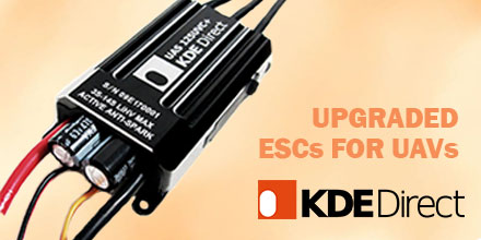
KDE Direct recently announced new features for their UAS (unmanned aerial system) UVC electronic speed controller (ESC) series and KDE Device Manager V1.32 software. Upgrades include data logging and graphing, stall protection, and motor control optimizations. The new data graphing and logging features are accessible by updating the UVC Series ESC to the latest firmware. During a flight, the UVC Series ESC records the following:
  • Drive Voltage
  • Drive Current
  • Temperature
  • Motor Drive Power
  • Input Throttle
  • Output Throttle
  • RPM
  • Power Consumption
The new KDE Device Manager is customizable and has a new assortment of graphing features to view the ESC data log. The latest update also features a variety of display options, changeable units, and printing. The data log also offers a number of other intuitive features. Users can save data logs as well as upload a data log from a previous flight. Additionally, users can change the data log speed to allow the ESC to record more data. KDE have added the ability to record multiple flights and see all use time. This allows users to keep track of flights in a way that makes the most sense to accomplish their goals. All KDE ESC’s now have the option to turn on Stall Protection. This advanced algorithm allows for the immediate shutdown of electronics during propeller impact or alternate unsafe event. Stall protection also guards the ESC from damage and detects if a propeller is blocked. A number of motor control optimizations have also been added to the KDE Device Manager. The motor control algorithm on KDE’s ESCs have been optimized specifically to particular UAS Multi-Rotor Brushless Motors. This can be accomplished by selecting which motor is being used in the KDE Device Manager, and provides greater efficiency and overall improvements on the motor control.  

Shop KDE Direct's line of ESCs, motors and propellers at Unmanned Systems Source.

FAA Warns Drone Flyers: Save a Life, Stay Away from Wildfires

If you fly your drone anywhere near a wildfire, you could get someone killed. That’s the stern warning the Federal Aviation Administration (FAA) and U.S. wildland fire agencies have for pilots of unmanned aircraft who interfere with fighting wildfires. Unauthorized drone flights are a serious risk to first responders and anyone in the fire’s path.  

Authorized missions only

Authorized drone missions by the proper authorities can yield valuable information to firefighters. Such missions help detect hotspots, chart a fire’s spread and the progress in controlling a blaze. But when an unauthorized drone is spotted, it may force all authorized helicopter and airplane operations to cease. Unauthorized drone flights create collision hazards to firefighting aircraft. They also distract pilots who are already operating in stressful and challenging conditions. Wildland fire agency reports give a sense of how a single errant drone can disrupt operations: “Drone spotted by pilot at eye level during [helicopter] bucket work… spotted a drone over fire. All helicopter operations shut down…UAS incursion stopped aerial firefighting assets… UAS intrusion into TFR (Temporary Flight Restriction). Helicopters disengaged from fire….” A disruption to any efforts to fight wildfires is incredibly dangerous...and simply not worth it.  

Disruptions can cost a life

“If you own a drone, DO NOT fly near or over a wildfire,” said Dan Elwell, FAA Acting Administrator. “It’s against the law, and firefighting aircraft could be grounded, disrupting time-critical firefighting efforts. Your hobby is not worth another person’s life.” “Most members of the public would never dream of standing in front of a fire engine to stop it from getting to a wildfire, but that’s essentially what they’re doing to aerial firefighting aircraft when they fly a drone over or near a wildfire,” said Jennifer Jones, spokesperson with the U.S. Department of Agriculture Forest Service at the National Interagency Fire Center in Boise, Idaho. If unauthorized drone operations interfere with wildfire suppression, law enforcement, or emergency response efforts, those drone operators could face civil penalties that exceed $20,000 and potential criminal prosecution. Anyone who witnesses or has information about an unauthorized drone flight over or near a wildfire should immediately contact local law enforcement. Deterring interference with first responders, as well as giving way to other aircraft in the sky, becomes more important as drone use expands exponentially. The FAA’s rules for flying unmanned aircraft are clear: Keep your drone away from other aircraft operations, including aerial firefighting missions. You just might save someone’s life.

UgCS Unveils New Search Pattern Planning Feature for UAS

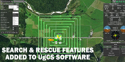
UgCS, provider of mission planning software for unmanned aircraft systems (UAS), together with public safety and disaster response UAS experts Airborne Response, developed a comprehensive search capability for drones. The new feature allows remote pilots to more effectively conduct search and rescue operations using the UgCS platform.  

Software Enhancements

The new enhancements provides users with a variety of quickly customizable search patterns. Such patterns include the “expanding square” and “creeping line” which can easily deploy in emergency and non-emergency situations. Based on the flight altitude input by the operator, the UgCSsoftware automatically calculates key variables. These variable include, the course heading and track spacing necessary to provide the prescribed coverage area for a search target. “The new enhancements to the UgCS mission planning software allow remote pilots, at every skill level, to quickly plan and implement a professional search mission with a UAS,” said Tom “Oaty” Oatmeyer, Chief Pilot at Airborne Response.  

Expert Lends Expertise

Oatmeyer is an air rescue expert with 28 years of experience piloting helicopters for both the U.S. Air Force and the Miami-Dade Fire Rescue department. Oatmeyer worked directly with the UgCS development team to bring the new features to fruition. “The new UgCS search feature is designed to make searching for a target with a drone as simple and reliable as possible,” said Janis Kuze, Sales Director of SPH Engineering. “We look forward to our continued work with Airborne Response to further enhance capabilities and implement additional features.” Airborne Response and UgCS reached an agreement for Airborne Response to offer the UgCS mission planning software, and associated training, to public safety and emergency response professionals throughout the U.S. “When lives are on the line, every second counts,” asserts Oatmeyer.“UgCS now represents another valuable link in the UAS technology chain to enhance the public safety mission.”

VectorNav INS Selected for UAV LiDAR Mapping System

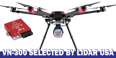
LiDAR USA announced the integration of  VectorNav's VN-300 Dual-Antenna Inertial Navigation System f0r its ScanLook Revolution UAV-based  mapping-system. The combined system provides LiDAR mapping capabilities targeted at applications that require a fast, efficient and easy-to-use solution.  

UAV-based LiDAR

Historically, the size, weight and power requirements of legacy LiDAR mapping systems primarily limited their use to manned aircraft. Plus, to keep costs feasible only large areas were best for mapping. Thanks to advances in both LiDAR and INS technology, a new generation of mapping systems are emerging. Today, LiDAR units weigh just a few hundred grams and can fit in the palm of the hand. They are also affordable enough for small businesses to develop services with a meaningful return on investment.  

How it works

Mobile LiDAR mapping requires several components to work synergistically in order to provide a suitable output. Components include: a LiDAR scanner, attitude/orientation sensor, positioning system, timing reference system and a vehicle or mobile platform. Traditionally, users had to either piece all the components together. Or users had to buy expensive systems designed for survey applications which incorporated L1/L2 GPS receivers with RTK positioning techniques. These types of systems also required the added expense of communicating with a reference base station or reference network system in order to maintain such accuracy. Clearly, there was a growing need for a low-cost, easy-to-use mapping system available to a wide-range of users. A system that required no advanced training, or complex setup and expensive post-processing. Enter LiDAR USA. Leveraging 18 years of experience, LiDAR USA developed the ScanLook Revolution system.  

Why VN-300?

LiDAR USA selected the VN-300 Dual-Antenna INS to keep the Revolution small, accurate and fully featured. “The VN-300 stood out among the rest for it’s exceptional performance in a wide range of operating conditions and especially for its small size and low weight. The VN-300 is a powerful sensor,” said Jeff Fagerman, CEO of LiDAR USA. “It’s tiny, only weighs 30 g and has performance comparable to much higher-priced systems,” In part, LiDAR USA selected the VN-300 because it does not rely on magnetometers for heading estimation. “Relying on magnetometers for accurate heading estimation is typically highly problematic,” according to Jakub Maslikowski, Director of Sales and Marketing at VectorNav. The VN-300 uses two GNSS receivers and a technique known as Carrier Phase Interferometry. This technique enables the VN-300 to estimate the heading solely from GPS signal measurements when the vehicle is stationary. Development of the Revolution was a challenging endeavor and required a lot of experimentation and fine tuning. “Working with the VN-300 and the team from VectorNav has been excellent. They’re responsive, extremely knowledgeable and a great team to work with,” said Fagerman.  

Shop VectorNav's entire line of solutions at Unmanned Systems Source.