We know more about the universe than we do about the oceans.
As such, it is no surprise that researchers are looking for new ways to understand the ocean.
Of particular interest is the sea surface microlayer (SML) which is identified as the top 1 millimeter of the ocean surface.
Removing the mystery
The SML is where all gas exchange between the atmosphere and the ocean occurs. However, the processes that control carbon dioxide transport and transformation in oceans remain largely unknown.
To better understand the overall health of the ocean, scientists need to model the transfer of gases between the atmosphere and the ocean. Such a model would allow for the creation of regional and global budgets of carbon, nutrients and pollutants.
When waves break on the surface of the ocean, mixing occurs. This allows gas from the atmosphere to enter the water and water from the ocean to enter the atmosphere.
Scientists know a lot about mixing at wind speeds between 6 and 30 knots. However, there is still much to discover at lower speeds.
Flat water working conditions
The SML is an oily film which is more prevalent when the water is calm. In flat water conditions it is fair to suspect that the micro-layer suppresses waves and decreases mixing.
This is why the science team on the R/V Falkor journeyed to the flat water conditions found off the coast of Darwin, Australia.
One reason so little is known about the SML is that the mere presence of the boat disturbs the microlayer, making it nearly impossible to get accurate, untainted data.
Studying this microlayer entails a few challenges. Research vessels must travel far out into the ocean to find flat water conditions. And, once there, the research equipment must operate away from the boat to get undisturbed Microlayer data.
So, how does a researcher collect ample undisturbed SML data and not blow the budget?
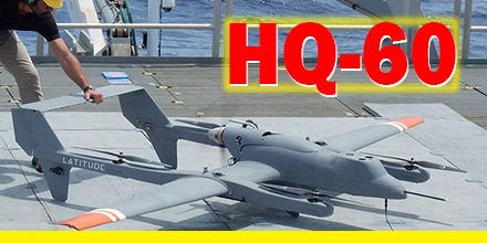
Enter Latitude and the HQ-60's real-world-tested VTOL capabilities.
HQ-60 hybrid VTOL
Based on previous work with NOAA and the R/V Oscar Elton Sette off the coast of Hawaii, the Latitude team was up to the task.
The unique design of the HQ-60 enables vertical take off and landing. Thus, the small footprint of the R/V Falkor was not an issue.
Furthermore, HQ-60 operators programmed the vehicle to perform a specific flight pattern at various elevations. This program ensured that the vehicle could replicate the pattern as often as needed.
The HQ-60's maximum payload capacity of 20 lbs. put the researcher’s skills to the test. However, three years of effort culminated in a custom design which fit into the HQ-60’s payload bay.
Payload choice
Researchers selected Hyperspectral cameras to record varying colors of the water in high wavelength resolution.
By correlating ocean colors with the chemical and biological composition of the samples, the team linked oceanic processes with the color spectrum of seawater.
With this information, researchers can use satellite imagery to calibrate ocean color and connect them to specific biochemical processes.
The HQ-60, can map vast ocean areas with no disturbance. Plus, the HQ-60 performed these operations at very little cost and at unprecedented speed, rate and efficiency.
The operation
The team prepped the HQ-60 and, using its VTOL systems, launched from a 40 foot by 40 foot area.
Once it autonomously transitioned to forward flight, the aircraft remained near the ship as system functionality
Upon completion of the system check, the aircraft traveled up to 6 miles away to take readings of the SML over undisturbed water. Typically, data collection operations lasted 3 hours.
Once completed, the aircraft traveled back to the ship, completed a final systems check and landed on the deck of the Falkor.
The unique design of the HQ-60 -- with its compact size, payload capacity and flight endurance -- makes it a reliable solution for a variety of missions.
Find out more about Latitude Engineering's
HQ-40 and
HQ-60 at Unmanned Systems Source.

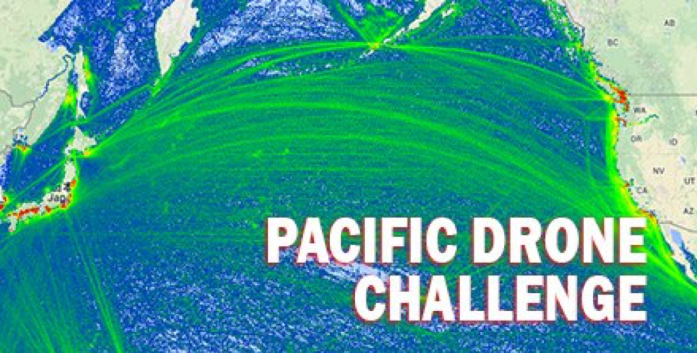 What lies between the Pacific coasts of Japan and Silicon Valley?
About 4,500 miles of ocean, of course! A distance easily traveled by commercial airlines but certainly beyond the reach of non-military drones.
But is that about to change?
Yes. If, that is, a winner emerges from the Pacific Drone Challenge.
What lies between the Pacific coasts of Japan and Silicon Valley?
About 4,500 miles of ocean, of course! A distance easily traveled by commercial airlines but certainly beyond the reach of non-military drones.
But is that about to change?
Yes. If, that is, a winner emerges from the Pacific Drone Challenge.
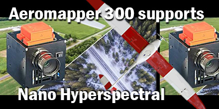 Recently, Aeromao Inc., delivered an Aeromapper 300 to the University of Brasilia in Brazil. The customized UAV arrived ready to integrate the Nano-Hyperspectral camera from Headwell Photonics.
After initial approval, the team completed the custom integration in just a few weeks.
Recently, Aeromao Inc., delivered an Aeromapper 300 to the University of Brasilia in Brazil. The customized UAV arrived ready to integrate the Nano-Hyperspectral camera from Headwell Photonics.
After initial approval, the team completed the custom integration in just a few weeks.
 Often, one of the biggest obstacles to the widespread adoption of any new technology is the initial uncertainty of the regulation landscape.
For example, consider the promise of self-driving cars. While the technology is advancing by leaps and bounds, the much-needed test-driving hours are constrained by red tape. Without real-world testing the acceptance and adoption of this technology stalls.
Thankfully, drones are further down the road in terms of both societal acceptance and utilization. As the regulation landscape settles, the largest growth of drones is still ahead.
Today, more and more industries utilize drones to perform functions that were once unimaginable. Public Safety Agencies are beginning to harness their potential, as well. And, though they are some integration obstacles, advanced planning can reduce the pain.
Often, one of the biggest obstacles to the widespread adoption of any new technology is the initial uncertainty of the regulation landscape.
For example, consider the promise of self-driving cars. While the technology is advancing by leaps and bounds, the much-needed test-driving hours are constrained by red tape. Without real-world testing the acceptance and adoption of this technology stalls.
Thankfully, drones are further down the road in terms of both societal acceptance and utilization. As the regulation landscape settles, the largest growth of drones is still ahead.
Today, more and more industries utilize drones to perform functions that were once unimaginable. Public Safety Agencies are beginning to harness their potential, as well. And, though they are some integration obstacles, advanced planning can reduce the pain.
 MicroPilot recently announced the successful interface of SightLine Applications’ landing assist functionality with MicroPilot’s autopilots.
This new functionality gives integrators the option of a robust landing assist feature. As such, it helps reduce operator workload and training requirements. This feature rolls out in version 3.7.1016 of MicroPilot’s HORIZONmp software.
MicroPilot recently announced the successful interface of SightLine Applications’ landing assist functionality with MicroPilot’s autopilots.
This new functionality gives integrators the option of a robust landing assist feature. As such, it helps reduce operator workload and training requirements. This feature rolls out in version 3.7.1016 of MicroPilot’s HORIZONmp software.
 The use of Small Unmanned Aircraft Systems (sUAS) continues to expand into various industries. And, with that expansion comes growing awareness about the need for secure communications.
Of course, for the military, security is nothing new.
In a world where data is everything, protecting secret data from malicious hackers is vital.
The use of Small Unmanned Aircraft Systems (sUAS) continues to expand into various industries. And, with that expansion comes growing awareness about the need for secure communications.
Of course, for the military, security is nothing new.
In a world where data is everything, protecting secret data from malicious hackers is vital.