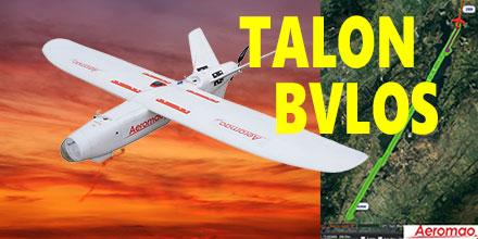
Recently, Aeromao's Aeromapper Talon successfully completed an autonomous mission to a target located 30km away.
The Talon maintained strong communications and its control link throughout the entire mission.
This mission successfully demonstrated the potential for Beyond Visual Line of Sight (BVLOS) operations for the Talon.
The Aeromapper Talon costs only a fraction compared to systems with similar capabilities.
Aeromapper Talon Demonstrates BVLOS
The Aeromapper team carried out the mission in the Andes Mountains of South America. The location of the flight was situated at 2,800m above sea level. The flight had a cruise altitude of 250m agl. Fifty percent of the flight traversed a body of water. The Talon traveled a total distance of 60km in its one hour flight.
With a flight endurance of 2-hours, the Talon had enough flight time left to travel an additional 30km. However, the operators decided to bring the UAV back due to peaks in excess of 3,500 m above sea level in the flight path.
Currently, the team is planning a future mission to demonstrate 50km reach capabilities.
Aeromao's Aeromapper 300 also uses the same long range communication system as the Talon.
The demand for BVLOS missions continues to grow throughout the industry. Applications for such missions include: power line and pipeline monitoring, roadways survey, surveillance and wildlife control, as well as long linear missions.
Powerful solution for linear mission challenges
"We receive many requests from clients who need to fly linear missions sometimes to survey thousands of kilometers of pipelines, power lines or roadways," said Mauricio Ortiz of Aeromao. "We ourselves have completed hundreds of kilometers of linear projects, and know very well the challenges of these types of operations."
The Aeromapper Talon is proving a solid solution given the specific capabilities demanded for these applications. Aeromapper Talon performs well in all:
- Ability to operate in difficult terrain and with a mobile GCS with reliable and strong communications.
- Quick deployment and easy operation: the Aeromapper Talon is flight ready in 15 minutes. It is one of the easiest UAVs to operate.
- Several cycles of takeoff and landings per day from different locations: here the hand-launch and parachute landing are pretty much a MUST have. A large area survey needs the flexibility of operating from virtually anywhere.
- Reliable and easy to repair in the field, as well as affordable with interchangeable spare parts.
Complete UAV solution, multiple fronts
Additionally, the Aeromapper Talon is also a multi-mission payload complete solution. It is a great choice for various applications, such as agriculture, centimeter accurate surveys, surveillance, and monitoring. Payloads available include:
- 24 Mp RGB + with Parrot Sequoia simultaneously: complete full surveys at high resolution and get vegetation data in a single flight.
- 24 Mp RG + Thermal Infrared: Ideal for pipeline or wildlife monitoring.
- Forward looking day / night payload: An affordable surveillance and observation platform with long range video streaming. All systems are easily swappable.
- Micasense RedEdge: A swappable payload option with serious agriculture power.
- GNSS PPK: Eliminates GCPs and achieves up to 3 cm of accuracy for engineering projects. Also available as a swappable payload.
- Pix4DMapper Aeromao Edition: serious post processing power with the most exhaustive power available. In an affordable bundle package with the complete UAV system.
- Agisfot Photoscan Pro: Affordable and flexible post processing software to become a post-processing Ninja.
Shop Aeromao's entire line of affordable UAV solutions at Unmanned Systems Source.

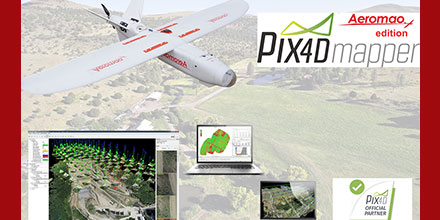 In celebration of its fourth year as an official partner of Pix4D, Aeromao has special offers on Pix4DMapper Aeromao edition and other Pix4D related products.
These offers expire December 31, 2018.
In celebration of its fourth year as an official partner of Pix4D, Aeromao has special offers on Pix4DMapper Aeromao edition and other Pix4D related products.
These offers expire December 31, 2018.
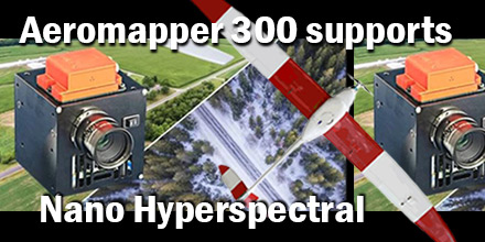 Recently, Aeromao Inc., delivered an Aeromapper 300 to the University of Brasilia in Brazil. The customized UAV arrived ready to integrate the Nano-Hyperspectral camera from Headwell Photonics.
After initial approval, the team completed the custom integration in just a few weeks.
Recently, Aeromao Inc., delivered an Aeromapper 300 to the University of Brasilia in Brazil. The customized UAV arrived ready to integrate the Nano-Hyperspectral camera from Headwell Photonics.
After initial approval, the team completed the custom integration in just a few weeks.
 In December Aeromao Inc., completed a full photogrammetric survey mission of an island with an Aeromapper Talon UAV...in one flight. The survey took place in collaboration with Foresight Surveyors.
One of the most unique and exotic islands in the Maldives, the Talon surveyed a total area of approximately 251 acres or 1 Sq. Km. at a GSD of 2cm/pixel.
In December Aeromao Inc., completed a full photogrammetric survey mission of an island with an Aeromapper Talon UAV...in one flight. The survey took place in collaboration with Foresight Surveyors.
One of the most unique and exotic islands in the Maldives, the Talon surveyed a total area of approximately 251 acres or 1 Sq. Km. at a GSD of 2cm/pixel.
 March 4, 2015 – Aeromao’s Aeromapper UAV product line along with their extensive payload options are now available at Unmanned Systems Source. Aeromao’s Aeromapper EV2, Aeromapper Talon, and