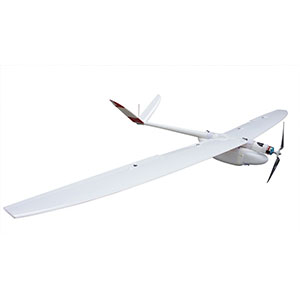
Aeromapper 300
Industrial grade fixed-wing drone designed for mapping and surveying.
- Description
- Specifications
Description
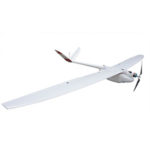
The Aeromapper 300 (AM300) is a carbon fiber & Kevlar rugged — industrial grade, fixed-wing drone designed for mapping and surveying.
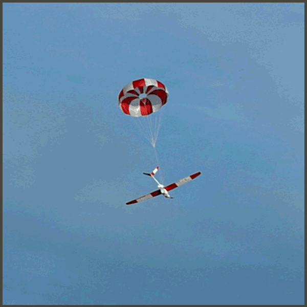
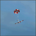
Easily hand-launched and recovered via a convenient parachute system, users can choose between a wide range of payloads to address different application needs.
Its standard 24 Mp RGB camera with optional PPK module can be quickly swapped for hyperspectral sensors, multispectral or thermal infrared cameras.
A fully modular design, 1.5 hours of endurance and a guaranteed long-range communications link up to 30kms of distance from the operators makes this the UAV of choice for the professional surveyor.

Large Coverage
The AM300 is ideal for medium to large projects, long linear survey requests or when BVLOS (Beyond Visual Line of Sight) is a necessity.
Per flight, the AM300 can cover up to 6.5 sq.km at 3 cm/pixel with the 24 Mp camera or 4.7 sq.km at 1.5 cm/pixel, double the resolution with the 42 Mp RGB optional camera upgrade.
The AM300 can cover larger areas by conducting several flights per day or by flying at higher altitudes — provided regulatory bodies allow.
Cameras are installed in panoramic orientation for most optimal area coverage with maximum side overlap. The complete system is ready for takeoff by a single operator in approximately 10-minutes after arriving at the field.
Optional Payloads
The AM300 is also available with our Post-Processing Kinematic (PPK) GNSS dual frequency receiver for the highest level of accuracy on your deliverables with no Ground Control Points.
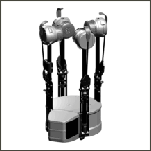
Additionally, the AM300 can carry dual sensors to cut data acquisition time and costs in half. Aeromao can also customize the UAV with other payloads and/or devices to deliver exactly what the customer requires.
Fully Tested, Easy to Operate
As usual, the AM300 is delivered fully flight tested prior to delivery and with all the accessories the user will require.
Operators training is also available but not required. Online training or hands-on training is available. The UAV system is extremely easy to use by anyone with basic technical knowledge.
Aeromao guarantees the AM300 is the toughest and most durable UAV you will use at unrivaled price. It is a proven and mature UAV operating in 25 countries since 2015. It is tested over the course of thousands of flight hours and in all kinds of conditions — from desert to arctic weather.
System includes
- Aeromapper 300 Unmanned System Ready to Fly
- One set of batteries for 1.5hrs of flight time
- 30 Km Link System
- Sony 24 mp camera with 20mm lens
- 20mm lens
- Lipo Battery Charger
- User’s Manual & Documentation
- Heavy duty carrying cases
- Mission Planner GCS software
Aeromapper 300 Key Features

PPK solves the biggest problem in the drone mapping process by increasing the accuracy of the deliverables within centimeters and eliminating the need for Ground Control Points.
The Aeromapper 300 can be ordered with a geodetic – dual frequency – survey grade GNSS PPK receiver for direct georeferencing of the imagery. It is provided with dedicated GPS software to easily and automatically process the data.
The 42Mp camera option along with PPK module offers unparallel ground resolution and 2-3 cm absolute accuracy on your deliverables.
This level of performance plus the price point of the UAV system translates in unrivaled productivity per acre that no other drone system can rival.


The ideal tool for survey & precision agriculture when used with any of our multispectral camera options available.
Use the Micasense Rededge MX in a swappable configuration, or our exclusive dual camera setup featuring Parrot Sequoia+ simultaneously with a 24 Mp RGB camera, to capture visible and non-visible spectral bands along with high resolution RGB imagery in a single flight.
Another swappable popular setup for thermal maps is the dual configuration of 24 Mp RGB camera along with a Flir Vue Pro camera (640×512 res). It provides very high resolution georeferenced thermal maps for a variety of industrial and inspection tasks, such as oil & gas, or powerline long distance inspection missions, for example.


The Aeromapper 300 is also an ideal platform for Hyperespectral sensors such as the Nano Hyperespec from Headwall which is used in Geology, Mining, Precision Agriculture, Environmental applications and infrastructure inspections
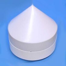
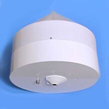
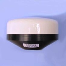
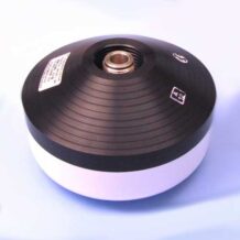
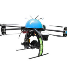
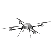
Customizable and multi-payload: the Aeromapper 300 is a fully modular platform with a large payload bay capable of can hosting a number of sensors.
We offer custom engineered solutions to fit the specific needs of our clients so that the sensors are easily swappable.


Field-proven BVLOS capabilities: since early 2016 the Aeromappers demonstrated a 30km communication & control link range in a BVLOS operation case.
Although the parachute is the main recovery method of the Aeromapper 300 it can also be deployed at any moment during the flight should the user decides to do so.
The Aeromaper 300 can land in very tight areas with extraordinary precision.


The Aeromapper 300 has great wind resistance, up to 50 km/h winds. Its size also makes it a better platform than small sub 1Kg drones because it is much more stable and robust, generally resulting in better quality data acquired.
Small drones shake too much in windy or turbulent conditions, making necessary several passes over the area to ensure quality data is gathered or excessive overlap needed, slowing up the entire data collecting process.
The UAV system includes everything you need at an unrivaled price: flight tested Aeromapper 300 UAV system, survey grade 24 Mp camera, long-range telemetry communication system, carrying case, one battery set, battery charger, handheld controller, Documentation and User Manual, and unlimited customer support. Users just need to add a laptop.


Easily create complete survey missions in minutes with just a few clicks. Monitor the development of your mission, UAV health status, complete flight information or send commands to the UAV from up to 30km away, all with the versatile Mission Planner software.
Sense & avoid: monitor live air traffic near the area of operation and report to adjacent traffic the position and altitude of your drones with ADS-B transceiver (by uAvionix).

Additional Options
The Aeromapper 300 is available with additional options, including:
- Aeromapper 300 + Pix4D Mapper Aeromao Professional Edition (bundle)
- Aeromapper 300 with 42MP RGB and PPK upgrade
- GNSS PPK Upgrade
- Agisoft Metashape Professional Unlimited
- Parrot Sequoia+ and 24MP RGB
- FLIR Vue Pro and 24MP RGB dual setup
- Micasense Rededge MX
- 42MP RGB Camera: Sony DSC-RX1R II
- ADS-B live air traffic and transponder
- FLIR Duo R and FLIR Duo Pro R: thermal +4K video/stills
- Micasense Altum
- Hands-on flight training
- Online flight training
Please email info@shopunmanned.com to request pricing on any of the options listed.
About Aeromao
Aeromao is a company with the vision of becoming a worldwide leader in UAV innovation by creating the most versatile, small unmanned vehicles for civil applications. Aeromao is backed by years of experience and a history of innovative endeavors in the area of UAVs for high-precision mapping and aerial photography uses.
- Wing span: 3.0 m
- Takeoff: Hand launch.
- Take-off Weight: 5350 gr.
- Cruise Speed: 62 Km/h.
- Maximum speed: +90 Km/h – Great stability and minimal roll & pitch oscillations in gusty conditions thanks to its low dihedral, small lateral profile and V tail rudder control = no gimbal required for cameras & sensors.
- Parachute recovery system: Ultra compact parachute with Kevlar lines. Very easy to pack in 2 minutes. Instructions provided.
- Endurance: 90 Mins.
- Take-off: Fully automatic.
- Landing: Aircraft repeat passes over desired landing area at 40m until parachute is deployed via a single switch. Belly landing possible with pilot assistance in auto stabilization mode. Automatic parachute release on waypoint also available upon request.
- Autopilot: Pixhawk.
- Range: +30 kms data links, 433 Mhz.
- Max. Altitude: 4500 masl.
- Failsafe: Automatically returns to home & loiter upon loss of RC link.
- Flight modes: Manual, Stabilize, Return to Home, FBW, Auto & More.
- Wind Tolerance: up to 40 km/h. 25km/h for parachuting down.
- Telemetry: Battery status, alt, ground speed, compass, attitude, distance traveled, time on air (speech enabled), wind vector and much more.
- Moving map display: Drone position and heading, commands on map, fly to point on map, altitude changes, mission route, and more.
- Low battery warning: Visual and audible alarm warnings. Thresholds are user definable.
- Mission Planning: Altitude, side and length-wise overlaps, orientation of the lines, start & end waypoints, flying speed and overshoots are user definable. Drone automatically calculates flight time, distance between images and triggers camera automatically. Distance between lines is calculated automatically according to desired side overlap.
- Weather: All weather performance. The Aeromappers can fly in light rain. All it’s electronics are enclosed.
- Payloads: 24Mp standard. 36Mp camera available.