Urban Air Mobility (UAM) represents a new era in air transportation.
The goal of UAM is to develop a safe and efficient air transportation system. Within this system, everything from small package delivery drones to passenger-carrying air taxis safely and efficiently operate over towns and cities.
However, before UAM is declared fully viable in populated areas, government, industry and academic partners are researching its practicalities.
Drones are currently in use in relatively underpopulated rural areas. However, cities are an entirely different matter.
One of the challenges? Cities have very different terrains. Building lined streets create “urban canyons”. The effect of these ‘urban canyons’ on drone operations is not yet fully understood.
For example, a breeze funneled into the relatively narrow gap between buildings, can dramatically increase wind speed. As well, the heat from city surface temperatures can produce unexpected thermals.
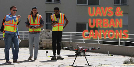
To study such urban canyon effects, a team from Embry-Riddle Aeronautical University and Gaetz Aerospace Institute took off to Kosovo.
Acquiring permission to fly in a densely populated area in the United States was going to be a challenge. So the team identified Kosovo as an alternative.
The team flew the DJI S1000, an eight-motor ‘octocopter’ drone, in two cities – Janjeva and Prishtina.
They rigged the drone with special instrumentation including two FT205 sensors. The team mounted the sensors orthogonally to measure both horizontal and vertical wind fluctuations.
Temperature, humidity and air pressure were also measured.
The team – combining wind speed, direction and temperature information gained from the anemometers along with aerial photos captured by the drone – generated 3D models showing 3D wind components.
With the help of the FT205 sensors, the team measured the wind turbulence in an urban canopy. This information is hugely helpful to companies looking into urban air mobility.
This data improves understanding of an aircrafts flight environment in urban areas.
“Within the atmospheric ‘boundary layer’ in cities, the wind constantly shifts as it flows over hot asphalt, followed by cooler green spaces, water-filled canals, and structures of various shapes and sizes,” said Dr. Kevin Adkins, Associate Professor of Aeronautical Science at Embry-Riddle Aeronautical University. “To map those unseen changes, researchers have traditionally simulated urban environments in wind tunnels or with computer models. For the first time, Embry-Riddle faculty and students have captured real-world data to create a three-dimensional map of drone routes.”
“Nobody else has been studying the urban atmospheric boundary layer in this particular way,” said Adkins. “Many companies are now working on drone-based package delivery, infrastructure inspection and urban air mobility. We need a better understanding of airflows and microclimates in cities so that these new technologies can operate as safely as possible.”
Find out more about the study.
“We were able to make multiple urban boundary layer measurements, right smack downtown in Prishtina, in an urban canyon with 14-story buildings on either side.”
“The FT205 wind sensors were perfect for our operations. Their light weight and accurate measurement contributed immensely to the success of the project. The sensors have been on the road, traveled halfway round the world and back again, and have stood up well!”
Shop FT Technologies line of drone and pole mounted sensors at Unmanned Systems Source.
 Battery life.
This continues to be one of the biggest challenges for drone operators.
Currently, the average flight time of most consumer drones is limited to around 20 minutes. Of course, this number varies depending on many things – weather conditions, payload, etc.
Ultimately, though, battery life continues to be a challenge for long flight operations. Eventually, a drone must return and recharge or switch out batteries before operations can continue.
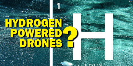
Battery manufacturers, of course, continuously work to improve battery technology. But, there may be a completely new solution on the horizon…hydrogen fuel cells.
Recently, researchers in Sydney, Australia, successfully conducted UAV test flights using hydrogen-powered fuel cells. The results were promising.
Hydrogen is one of the cleanest energies available on earth.
Though hydrogen fuel comes with some risks, the National Hydrogen Association argues that most are overblown. With careful use by qualified professionals, hydrogen may provide the answer to the challenge of a short battery life.
The research in Sydney seem to bear this out. Previously, the team tested hydrogen-only fuel cells and determined they were a viable energy source for drones.
The most recent tests used a triple hybrid propulsion system which included a combination of batteries, hydrogen fuel cells and a super capacitor.
The hybrid propulsion system helped researchers improve the robustness and flexibility of hydrogen fuel powered drones. Plus, the hydrogen fuel provided much greater range and endurance when compared to electric powered UAVs.
As such, if the technology develops it could have a revolutionary effect on the drone industry. Benefits include longer flight time, improved flight efficiency, and the development of more advanced UAVs.
If the finding by the scientists in Sydney and by other similar projects are anything to go by, it would seem that hydrogen powered drones are the wave of the future.
For one, the use of hydrogen enables drone operators to conduct their work for longer periods without interruptions. Plus, continued development of this technology would eventually result in decreased cost and greater implementation.
Advantages of using hydrogen fuel cells extend beyond improved efficiency and flight times, too.
Plus, vehicles powered by hydrogen fuel cells have faster take-off, enhanced climbing ability and more stable flying.
The fuel is more environmentally friendly. It produces no carbon dioxide emissions. In addition, hydrogen-powered drones tend to be much quieter than conventional electric powered ones.
Currently, the price tag of this technology is a hindrance to many potential users. Driving down hydrogen fuel cell costs is one of the challenges of widespread adoption of this technology.
Researchers in Sydney believe the hybrid solution they implemented could be key to lowering costs. And hybrid technology, similar to hybrid cars which utilize a combination of fossil fuel and electric batteries, may be one way to gain widespread adoption.
With so many benefits, hydrogen-powered drones could indeed be the wave of the future.
 In recent years, it’s fair to say that drones have come a long way in terms of mainstream acceptance.
From the initial skepticism of both the ordinary public and commercial entities, drones moved beyond niche hobbyists to one of the most in-demand technologies.
Now, the technology is disrupting the road construction industry, as well.
With the advancement in sUAS coupled with lowered cost, drones use continues to expand into more and more applications.
In most cases, drones offer improved efficiency in data collection. Plus, UAVs reduce operational costs by replacing manned aircraft needs and streamlining operations. In addition, drones access environments that may be inaccessible or dangerous for personnel.
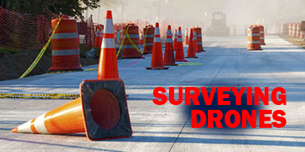
Now, drones are expanding into a new application: road construction and paving projects. This application expansion paves the way for greater efficiency and reduced costs for the industry. In addition, thanks to ever improving software, drones provide precise data collection, as well.
Detailed 3-D survey maps depicting topography, utility lines, drainage slopes, existing hazards — plus, high resolution images and video — efficiently secures the data required for building plans and blueprints.
This new tool-set may transform the industry.
Cost reduction may be one of the biggest drivers for the wide spread adoption of drone use in the road construction industry.
After all, large infrastructure projects require tremendous sums of money. Any cost savings are welcome.
For instance, replacing manned survey aircraft with a properly equipped fleet of drones. Furthermore, drones offer capabilities such as lower flight altitudes, hovering functions, and more.
Additionally, training and licensing drone operators is less expensive and quicker than securing a pilots license.
The use of the technology is not limited to large multinationals and governmental agencies. Privately run construction companies benefit, too. Improved efficiency allows for faster project completion and the ability to move onto new ones.
Drone technology also helps improve the safety of construction sites. A drone can replace risky operations such as manned aircraft or abseiling crews.
Drone use for road construction surveying is still in its infancy. And, though governmental legislation lags behind the technology, construction companies continue to adopt this technology. The future for survey drones is very bullish, indeed.
 The race to develop vehicles powered by clean energy is well on its way. Currently, electric and hybrid cars are readily available on the market. As for drones, most already rely on “clean energy” in the form of lipo batteries, to operate.
Solar energy is one sector, however, where exploration is still in its infancy.
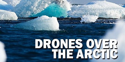
Recently, researchers from the Autonomous Systems Laboratory and Glaciologists from ETH Zurich collaborated on a special project: Sun2Ice. The goal? Develop a solar-powered drone and test its ability to monitor glaciers over the vast expanse of the Arctic.
Given the size and immensity of glacial landscapes, the challenge for scientists was designing a vehicle that offered extended flight times. To accomplish this, the team looked to harness the power of the sun.
The end result was AtlantikSolar, a UAV equipped with solar panels that allowed it to stay aloft for days.
In terms of finding an optimal place to test this developmental craft, the Polar Regions — with its continuous daylight — proved ideal. The research team hoped to use the midnight sun to create perpetual unmanned flight conditions. And, thus, provide the UAV the endurance required to survey the vast landscape.
Guillaume Jouvert, a Hydraulics, Hydrology and Glaciology senior researcher, and Thomas Stastney, a PHD student in Autonomous systems at ETH Zurich, lead the project. They put together two teams from their respective fields to attempt that goal.
As can be expected with any event that requires the weather to play nice, things didn’t quite go according to plan. But the results of the test still provided some useful insight. Qaanaa, a small town in Northwestern Greenland, served as the epicenter. This test location is surrounded by several calving glaciers, accessible by plane, yet still well connected. Tests were to occur in June 2017. However, when the team arrived a takeoff and landing spot identified months earlier, was no longer viable.
The UAV’s payload included a ground-facing camera and additional sensitive equipment. Rough landings were out of the question. So began a week of feverish work to create a suitable landing site for the UAV. Additional delays included heavy fog that lasted for several days. Despite the setbacks, clear skies opened up at the end of June. The tests could finally start.
The first test flight for AtlantikSolar’s was a 24-hour circular trip. The solar-powered craft took off on June 20.
Unfortunately, 12-hours into the flight, the test was cut short as thick fog returned to the region. Still, the team collected vital data. Remarkably, despite poor sunlight and stronger than expected winds, battery levels were still high, at 60 percent.
The data suggested that AtlantikSolar was on pace to achieve 20-hours of uninterrupted flight, despite the poor weather conditions. The data also suggested that 24-hour continuous flight time was achievable given the right conditions. Additionally, the results convinced researchers that the drone was ready to begin surveying glaciers. Unfortunately, the weather wasn’t done yet.
It wasn’t until July 3 that the weather cleared for the second launch. AtlantikSolar approached its first glacier less than two hours after take-off. The UAV captured images of the calving front of Bowdoin Glacier despite winds of up to 15 m/s buffeting the unmanned aircraft. AtlantikSolar successfully returned to Qaanaaq after 5-hours of flight covering 230km.
The drones’ battery still retained nearly a full charge, showing the true potential of solar-powered UAVs. In addition, the team discovered the beginnings of a break forming at the front of the large glacier. AtlantikSolar’s mapping information allowed glaciologists to visit Bowdoin in time and monitor the cracks progression until it finally broke away.
Beyond surveying the arctic, solar-powered drones have tremendous application potential. Geographic locations which enjoy long periods of uninterrupted sunshine are particularly applicable. Solar-powered UAVs, like AtlantikSolar, are low-cost vehicles with the added benefit of using renewable energy.
The results achieved by Guillaume and Thomas along with their respective teams show that harnessing the power of the sun to power vehicles is feasible in the right conditions. Of course, there is a need for additional research and development before such vehicles become commonplace. But, with the promising results achieved by AtlantikSolar, it seems like solar-powered drones are well on their way.
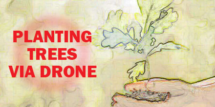 A former NASA engineer is harnessing the potential of drone technology for a very ambitious project.
The project? Ecosystem restoration.
More precisely, scaling reforestation projects to a size previously unimaginable.
The goal? Plant 1 billion trees every year…via drone.
Lauren Fletcher spent 20 years at NASA as an engineer before founding BioCarbon Engineering. The startup’s entire focus is reforestation. More precisely, reforestation via the use of drones.
BioCarbon Engineering plans to combat deforestation and restore global forests with a unique solution. Their platform takes the best data available and enables local specialists to restore their landscapes both quickly and affordably.
Advancements in technology facilitated the large-scale harvesting of forests. Now, in a process known as clear cutting, acres of forests are harvested in a single day. Each year, it is estimated that clear-cutting is responsible for the disappearance of 26 billion trees around the world.
Reforesting such vast areas is a challenge.
The end result? Trees are cut down much quicker than they are replaced.
Industrial-scale deforestation around the world is threatening to upset the ecosystem’s balance. To combat the danger, reforestation projects continue to gain prominence.
Through various initiatives, many countries are actively working to replace trees.
Traditionally, reforestation is done by hand. On average, a single individual can plant 3000 seeds or saplings in a day. This method is labor intensive and time consuming which makes closing the gap on deforestation frustratingly slow.
BioCarbon Engineering believes technology holds the answer. Drone technology can speed up and improve the process of replanting trees. They hope to improve the replanting rate to a projected 36,000 plants per day…or 1 billion trees in a year.
Because terrains can vary, using drones to plant trees and regenerate forests is not meant to replace the human element, but complement it.
BioCarbon’s plan? Modify consumer drones so they can plant seeds and tree saplings. But that’s just the start. What follows is a simple, yet clever way of using the drones to improve the speed and efficiency of replanting efforts.
First, drones fly over a potential site, take photographs and conduct an aerial surveys. The team then creates a 3D aerial map and a “seeding” plan suitable for the terrain.
The team developed specialized pods which contain germinated seeds packed in a nutrient-rich substance. These bio-degradable pods sustain and protect the young plant until it can take root.
The pods load into a pressurized canister aboard the drone and fire into the ground. Drones fly a path that is roughly 3-6 feet above the ground. The number of drones in operation depends on the size of the site.
BioCarbon estimates that just two drone pilots operating multiple UAVs can plant up to 36,000 saplings a day.
If successful, the company’s approach would significantly improve global reforestation efforts.
Today, some of the highest rates of deforestation occur in Latin America, Brazil, Malaysia, and the Philippines. Additionally, parts of Africa face the same issue. This may explain why Fletcher and BioCarbon are targeting projects in South Africa and the Amazon jungle first.
In addition to improving reforestation efforts, drones can also access areas that are inaccessible to humans. Plus, BioCarbon believes this technology can help improve the overall health of local ecosystems. For example, pods can help spread various fungi and micro-organisms that improve soil quality as well as diversify the species of trees replanted in the forest.
The efforts of BioCarbon is another example of drone use for humanitarian purposes. The company’s goals align with the UN’s plan to restore up to 300 billion trees by the year 2030. And, tree planting drones may just bring that goal within reach.
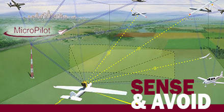 MicroPilot announced the successful integration of FLARM’s Sense and Avoid system with its autopilot.
This integration grants clients a reliable autonomous collision avoidance option for fully autonomous UAV operations.
With any form of autonomous vehicle, a primary concern is safely avoiding collisions with other craft…without the need for human intervention.
A sense and avoid system allows a UAV to do exactly that. Thus, it dramatically reduces operational risks and the need for human monitoring.
FLARM is a traffic awareness and collision avoidance technology used by light aircraft and UAVs.
When integrated with MicroPilot’s autopilot, the system alerts the autopilot of nearby aircraft, along with its velocity and altitude. The autopilot uses the information to avoid the aircraft. Thus, it autonomously prevents a collision without a single input from the human operator.
With increasingly crowded airspace and the popularity of UAVs, a reliable sense and avoid system is quickly becoming a necessity. This is especially true for beyond visual line of sight (BVLOS) and other autonomous operations.
This new system should give operators the confidence to use their UAVs to the full extent of their abilities.
“FLARM has been in use for over a decade helping manned aircraft avoid midair collisions,” says FLARM. “We are very happy to see that UAVs are the next type of vehicle that benefit from FLARM, and that UAVs are becoming visible to manned aircraft.”
This integration may give UAV manufacturers the confidence to market larger and longer-range UAVs. Consequently, it also gives operators the confidence to conduct long-range BVLOS operation. Combined, this technology furthers the utility and viability of UAVs.
Started in 1994, with 1000 clients in over 85 countries, MicroPilot is the world leader in professional autopilots for UAVs and MAVs. MicroPilot offers a family of lightweight UAV autopilots that can fly fixed-wing, transitional, helicopter, and Multirotor UAVs. MicroPilot also provides complementary products such as the XTENDERmp SDK, and trueHWIL2.
Shop MicroPilot’s line of autopilots at Unmanned Systems Source.
