When it comes to insuring personal possessions, many are tempted to decide against getting coverage if the law does not specifically require it.
People are even more resistant if the cost to cover the item is higher than the cost to replace the item. That's just common sense, right?
Maybe.
Insurance can be an important part of planning for the unexpected, particularly if a business is involved.
If you use drones in your organization, or are looking to do so, it makes sense to get insurance coverage for your air vehicles...just as you would for your terrestrial kind.
There are several advantages to insuring your drone. For one, it enables you to recoup any losses due to mishap, crash or theft. And, even more importantly, drone insurance could potentially win you more clients. Many individuals simply won't work with a company that is not insured.
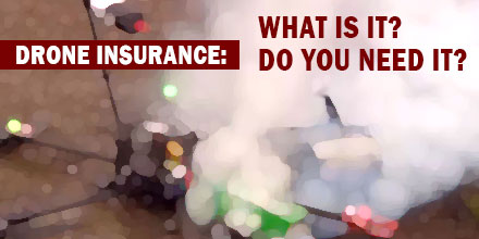
But what is drone insurance and do you need it? And, if you're operating a drone-based business, what kind of insurance coverage do you need? Is it different from drone insurance? Read on to find out if drone insurance is the right move for you.
Drone Insurance Coverage
Similar to other insurance policies, drone insurance provides coverage in the event of a mishap, accident or theft of the drone and any related equipment. This coverage can also include other ground-based and non-pilot crew in addition to drone operators. Drone insurance policies commonly comprise two parts; damage to the drone itself, and liability, which cover any damage and claims from third-parties.
For additional peace of mind, your chosen insurer should also offer coverage for third party liability, personal injury, and premises liability. This provides insurance for any damage to your company’s buildings or those of a customer or private owner.
Drone Insurance 101
The process of getting drone insurance is similar to securing coverage for a home or vehicle. Some companies may require additional information, such as: proof of training, maintenance logs, operating manuals, a record of parts or add-ons. Such documentation proves that you are operating your vehicle in a safe, conscientious manner. It also improves your chance of acquiring more favorable insurance rates.
In terms of selecting coverage, it depends on a few factors including the primary way you employ your drone and the environments in which you operate. A drone used to take real estate photography may need different coverage than a drone used to inspect bridges. Identifying these potential hazards is a key to choosing the right amount of coverage.
Drone Insurance Costs
When it comes to cost there are, of course, many variables. What type of drone a you're flying? How many drones do you need to cover? What are your potential operating liabilities? How much coverage do you need to protect yourself and your equipment?
For example, a commercial-use policy for top end drones, such as the Yuneec Typhoon H or the DJI Phantom 4, costs between $600-$800 per year with coverage up to $1 million in liability.
Another factor that influences cost is your flight experience. Of course, costs rise depending on the size of liability coverage you require.
Each insurance company structures their policies differently. Some only cover single units while others are willing to insure multiple drones. One option for fleet owners is a policy that offers coverage for both liability and physical damage using a pricing model for one UAV. As long as only one UAV is flown at a time, there is no additional cost to cover additional drones in the fleet.
How to Get Drone Insurance
To insure your drone, simply get in touch with any of the insurance companies listed below. In addition to proof of any ongoing or completed drone pilot training, here’s what you’ll need to ensure that you get the best possible insurance policy for your business:
- A minimum of 50 – 100 hours of piloting and flying UAVs
- An FAA Drone pilot licence
- Maintenance Logs
- Type of Coverage; liability/ Hull
- Details of Leases, or Proof of Ownership
- Information pertaining to how the drone is used and operational environments
To ensure you get the best coverage for your dollar, you will need to shop around. Get quotes from a number of companies, compare costs and coverage and decide which one is right for you.
A word of caution, it is possible to lose your coverage if any of the policy providers’ conditions are not met. These include but are not limited to: failure to log flight and maintenance data, operating a drone without proper identification details or serial numbers, and instances of unethical flying.
For commercial operations based in the United States the following companies offer drone, UAV, and UAS insurance policies. Providers include Allianz, Avalon Risk Management, Aviation Insurance, Berkley Aviation, Skyvuse, UAV Protect, Verifly, Starr Aviation, and many others. There are many drone-specific insurers but others offer a broader range of insurance products.
Filing Claims
Unfortunately, mishaps do occur and when that happens you'll need to file a claim. It's a good idea to review your policy and understand the claim process
before an incident occurs. That way there are no surprises.
Most often, the first step is to notify your insurance company as soon as possible. Depending on the incident, you may also need to notify local authorities. To expedite the entire process, cooperate with the insurance company. Provide any information needed quickly and efficiently.
Though there are many advantages to drone insurance, particularly for commercial drone operators, ultimately the decision is up to you, the operator.

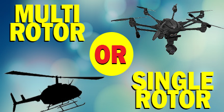 Although multi-rotor drones get most of the attention in the UAV world today, they’re not the only option for a flight project. But why would someone choose a multi-rotor over a single-rotor...or vice versa? Read on to learn the differences between the two, as well as their strengths and weaknesses.
A key difference between the two, not surprisingly, is the number of rotors each offers. A multi-rotor aerial vehicle has several rotors that keep it airborne. In contrast, a single-rotor vehicle has one rotor plus a tail rotor to control its heading.
Although multi-rotor drones get most of the attention in the UAV world today, they’re not the only option for a flight project. But why would someone choose a multi-rotor over a single-rotor...or vice versa? Read on to learn the differences between the two, as well as their strengths and weaknesses.
A key difference between the two, not surprisingly, is the number of rotors each offers. A multi-rotor aerial vehicle has several rotors that keep it airborne. In contrast, a single-rotor vehicle has one rotor plus a tail rotor to control its heading.
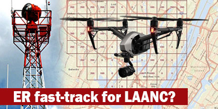 It seems the Federal Aviation Administration (FAA) finally reached a breaking point with requests to access restricted airspace.
Currently, it can take up to 90-days for an operator to get authorization to navigate controlled airspace. With more and more authorization requests pouring in, the logjam continues to get worse.
As such, the speculation is that some operators decide not to wait and fly without authorization. This may explain the increase in the number of non-compliant operations, as reported by the FAA. It is estimated that there are over 250 drone-related safety reports each month.
It seems the Federal Aviation Administration (FAA) finally reached a breaking point with requests to access restricted airspace.
Currently, it can take up to 90-days for an operator to get authorization to navigate controlled airspace. With more and more authorization requests pouring in, the logjam continues to get worse.
As such, the speculation is that some operators decide not to wait and fly without authorization. This may explain the increase in the number of non-compliant operations, as reported by the FAA. It is estimated that there are over 250 drone-related safety reports each month.
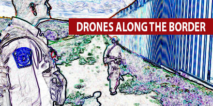 The steady advance of Small Unmanned Aircraft Systems (sUAS) into real-world environments, continues.
In September, the U.S. Customs and Border Protection (CBP) announced a new pilot program. The program, executed by the U.S. Border Patrol, evaluates the use of sUAS within the CPB operational environment.
Tests sites, already identified, include three USBP sectors. The program kicks off within the Tucson sector with plans to expand to Rio Grande Valley and Swanton later this year.
The steady advance of Small Unmanned Aircraft Systems (sUAS) into real-world environments, continues.
In September, the U.S. Customs and Border Protection (CBP) announced a new pilot program. The program, executed by the U.S. Border Patrol, evaluates the use of sUAS within the CPB operational environment.
Tests sites, already identified, include three USBP sectors. The program kicks off within the Tucson sector with plans to expand to Rio Grande Valley and Swanton later this year.
 New and emerging technologies tend to enhance existing industries and services. In addition, emerging technologies also help create new industries and services.
Unmanned aerial vehicles are one of the biggest trends due in part to their potential use across a range of service and industry applications.
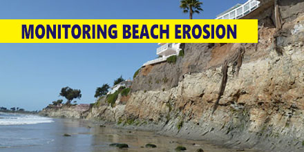
One such emerging application is coastline monitoring.
New and emerging technologies tend to enhance existing industries and services. In addition, emerging technologies also help create new industries and services.
Unmanned aerial vehicles are one of the biggest trends due in part to their potential use across a range of service and industry applications.
One such emerging application is coastline monitoring.
 A gust of wind. Interruption or loss of the control link. Pilot error. A dreaded flyaway.
There are many ways to lose a drone.
But when you think about the various hazards surrounding flight, outright loss may not come to mind. In fact, loss of a drone during flight is more common than you may think.
Of course, today’s drones are more and more automated and most come equipped with GPS. But that doesn’t mean things can’t and don’t go wrong…because they do. In the event of a catastrophe, the odds of finding your drone improve based on the steps you take before such an event occurs.
A gust of wind. Interruption or loss of the control link. Pilot error. A dreaded flyaway.
There are many ways to lose a drone.
But when you think about the various hazards surrounding flight, outright loss may not come to mind. In fact, loss of a drone during flight is more common than you may think.
Of course, today’s drones are more and more automated and most come equipped with GPS. But that doesn’t mean things can’t and don’t go wrong…because they do. In the event of a catastrophe, the odds of finding your drone improve based on the steps you take before such an event occurs.