When it comes to insuring personal possessions, many are tempted to decide against getting coverage if the law does not specifically require it.
People are even more resistant if the cost to cover the item is higher than the cost to replace the item. That's just common sense, right?
Maybe.
Insurance can be an important part of planning for the unexpected, particularly if a business is involved.
If you use drones in your organization, or are looking to do so, it makes sense to get insurance coverage for your air vehicles...just as you would for your terrestrial kind.
There are several advantages to insuring your drone. For one, it enables you to recoup any losses due to mishap, crash or theft. And, even more importantly, drone insurance could potentially win you more clients. Many individuals simply won't work with a company that is not insured.
But what is drone insurance and do you need it? And, if you're operating a drone-based business, what kind of insurance coverage do you need? Is it different from drone insurance? Read on to find out if drone insurance is the right move for you.
Drone Insurance Coverage
Similar to other insurance policies, drone insurance provides coverage in the event of a mishap, accident or theft of the drone and any related equipment. This coverage can also include other ground-based and non-pilot crew in addition to drone operators. Drone insurance policies commonly comprise two parts; damage to the drone itself, and liability, which cover any damage and claims from third-parties.
For additional peace of mind, your chosen insurer should also offer coverage for third party liability, personal injury, and premises liability. This provides insurance for any damage to your company’s buildings or those of a customer or private owner.
Drone Insurance 101
The process of getting drone insurance is similar to securing coverage for a home or vehicle. Some companies may require additional information, such as: proof of training, maintenance logs, operating manuals, a record of parts or add-ons. Such documentation proves that you are operating your vehicle in a safe, conscientious manner. It also improves your chance of acquiring more favorable insurance rates.
In terms of selecting coverage, it depends on a few factors including the primary way you employ your drone and the environments in which you operate. A drone used to take real estate photography may need different coverage than a drone used to inspect bridges. Identifying these potential hazards is a key to choosing the right amount of coverage.
Drone Insurance Costs
When it comes to cost there are, of course, many variables. What type of drone a you're flying? How many drones do you need to cover? What are your potential operating liabilities? How much coverage do you need to protect yourself and your equipment?
For example, a commercial-use policy for top end drones, such as the Yuneec Typhoon H or the DJI Phantom 4, costs between $600-$800 per year with coverage up to $1 million in liability.
Another factor that influences cost is your flight experience. Of course, costs rise depending on the size of liability coverage you require.
Each insurance company structures their policies differently. Some only cover single units while others are willing to insure multiple drones. One option for fleet owners is a policy that offers coverage for both liability and physical damage using a pricing model for one UAV. As long as only one UAV is flown at a time, there is no additional cost to cover additional drones in the fleet.
How to Get Drone Insurance
To insure your drone, simply get in touch with any of the insurance companies listed below. In addition to proof of any ongoing or completed drone pilot training, here’s what you’ll need to ensure that you get the best possible insurance policy for your business:
- A minimum of 50 – 100 hours of piloting and flying UAVs
- An FAA Drone pilot licence
- Maintenance Logs
- Type of Coverage; liability/ Hull
- Details of Leases, or Proof of Ownership
- Information pertaining to how the drone is used and operational environments
To ensure you get the best coverage for your dollar, you will need to shop around. Get quotes from a number of companies, compare costs and coverage and decide which one is right for you.
A word of caution, it is possible to lose your coverage if any of the policy providers’ conditions are not met. These include but are not limited to: failure to log flight and maintenance data, operating a drone without proper identification details or serial numbers, and instances of unethical flying.
For commercial operations based in the United States the following companies offer drone, UAV, and UAS insurance policies. Providers include Allianz, Avalon Risk Management, Aviation Insurance, Berkley Aviation, Skyvuse, UAV Protect, Verifly, Starr Aviation, and many others. There are many drone-specific insurers but others offer a broader range of insurance products.
Filing Claims
Unfortunately, mishaps do occur and when that happens you'll need to file a claim. It's a good idea to review your policy and understand the claim process
before an incident occurs. That way there are no surprises.
Most often, the first step is to notify your insurance company as soon as possible. Depending on the incident, you may also need to notify local authorities. To expedite the entire process, cooperate with the insurance company. Provide any information needed quickly and efficiently.
Though there are many advantages to drone insurance, particularly for commercial drone operators, ultimately the decision is up to you, the operator.

 New and emerging technologies tend to enhance existing industries and services. In addition, emerging technologies also help create new industries and services.
Unmanned aerial vehicles are one of the biggest trends due in part to their potential use across a range of service and industry applications.
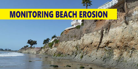
One such emerging application is coastline monitoring.
New and emerging technologies tend to enhance existing industries and services. In addition, emerging technologies also help create new industries and services.
Unmanned aerial vehicles are one of the biggest trends due in part to their potential use across a range of service and industry applications.
One such emerging application is coastline monitoring.
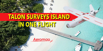 In December Aeromao Inc., completed a full photogrammetric survey mission of an island with an Aeromapper Talon UAV...in one flight. The survey took place in collaboration with Foresight Surveyors.
One of the most unique and exotic islands in the Maldives, the Talon surveyed a total area of approximately 251 acres or 1 Sq. Km. at a GSD of 2cm/pixel.
In December Aeromao Inc., completed a full photogrammetric survey mission of an island with an Aeromapper Talon UAV...in one flight. The survey took place in collaboration with Foresight Surveyors.
One of the most unique and exotic islands in the Maldives, the Talon surveyed a total area of approximately 251 acres or 1 Sq. Km. at a GSD of 2cm/pixel.
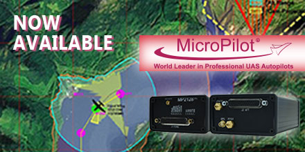 April 4, 2017 – Unmanned Systems Source is pleased to announce a new distribution partnership with MicroPilot, producers of full-featured UAV autopilots.
“MicroPilot is a world leader in small autopilot systems for UAS,” said Drew Osbrink, Business Development Director for Unmanned Systems Source.
"The MicroPilot product line is a great fit for customers looking for a reliable solution to manage complex autonomous behaviors for their UAS platforms,” said Osbrink.
Introduced in 2004 and weighing only 28 grams, MicroPilot's MP2x28g2 raised the bar around the world for functionality and value in small UAV autopilots. Paired with this full-feature UAV autopilot, the MicroPilot HORIZONmp ground control software provides a user-friendly, point-and-click interface for mission planning, parameter adjustment, flight monitoring, and mission simulation.
Building on the success of these proven innovations, MicroPilot now offers a series of autopilots, software, accessories, and customized UAV training and integration services.
April 4, 2017 – Unmanned Systems Source is pleased to announce a new distribution partnership with MicroPilot, producers of full-featured UAV autopilots.
“MicroPilot is a world leader in small autopilot systems for UAS,” said Drew Osbrink, Business Development Director for Unmanned Systems Source.
"The MicroPilot product line is a great fit for customers looking for a reliable solution to manage complex autonomous behaviors for their UAS platforms,” said Osbrink.
Introduced in 2004 and weighing only 28 grams, MicroPilot's MP2x28g2 raised the bar around the world for functionality and value in small UAV autopilots. Paired with this full-feature UAV autopilot, the MicroPilot HORIZONmp ground control software provides a user-friendly, point-and-click interface for mission planning, parameter adjustment, flight monitoring, and mission simulation.
Building on the success of these proven innovations, MicroPilot now offers a series of autopilots, software, accessories, and customized UAV training and integration services.
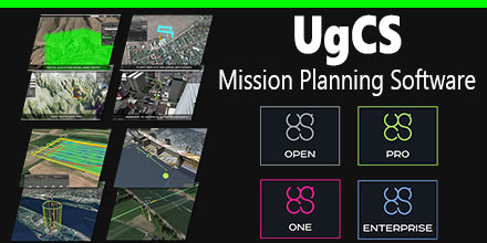 March 23, 2017 – Unmanned Systems Source is pleased to announce a new distribution agreement with SPH Engineering.
SPH Engineering is the creator of the popular UgCS Mission Planning Software which provides central management of all types and manufacturers of UAVs. It supports both fixed wing and multi-rotor platforms.
Supported platforms, include: DJI Phantom 4 / 4 Pro, Phantom 3 and Phantom 2, Inspire 2, Inspire 1 / 1 Pro / Raw, Mavic Pro, A3, N3, Matrice 600 / 600 Pro, Matrice 100, A2, Naza-M v2, WooKong-M, Vision2+, Ace One.
Currently, supported autopilots, include: Ardupilot, Px4 and other MAVLink compatible; InnoFlight: Jupiter JM-1; Mikrokopter; Micropilot; Microdrones; LockheedMartin: Kestrel, Indago.
"UgCS software is a great addition to our site," said Andrew Osbrink, Business Development Director at Unmanned. "Whether a customer operates a fixed wing or multi-rotor, many crafts or just one, UgCS' flexible licensing model means organizations can purchase the license that works for their situation."
March 23, 2017 – Unmanned Systems Source is pleased to announce a new distribution agreement with SPH Engineering.
SPH Engineering is the creator of the popular UgCS Mission Planning Software which provides central management of all types and manufacturers of UAVs. It supports both fixed wing and multi-rotor platforms.
Supported platforms, include: DJI Phantom 4 / 4 Pro, Phantom 3 and Phantom 2, Inspire 2, Inspire 1 / 1 Pro / Raw, Mavic Pro, A3, N3, Matrice 600 / 600 Pro, Matrice 100, A2, Naza-M v2, WooKong-M, Vision2+, Ace One.
Currently, supported autopilots, include: Ardupilot, Px4 and other MAVLink compatible; InnoFlight: Jupiter JM-1; Mikrokopter; Micropilot; Microdrones; LockheedMartin: Kestrel, Indago.
"UgCS software is a great addition to our site," said Andrew Osbrink, Business Development Director at Unmanned. "Whether a customer operates a fixed wing or multi-rotor, many crafts or just one, UgCS' flexible licensing model means organizations can purchase the license that works for their situation."
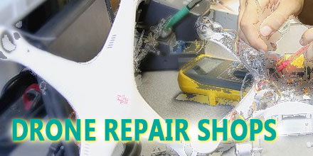 Today, thanks to a continued decrease in price, drones are now a fairly mainstream product. The skies, which were once the domain of experienced pilots, are filling with newbie operators trying their hand at drone flight.
As such, some have discovered that “ready-to-fly” – as many drones are marketed – can really mean, “ready-to-crash”. Of course, even veteran operators experience the odd mishap or two.
When it inevitably occurs, a crash can impact the vehicle in a number of ways – from slight damage to outright destruction or complete loss of the vehicle.
So, what should you do in the event your drone requires repairs?
While some may have the skill and confidence to make their own repairs, other may hesitate. After all, these technological wonders, though more affordable, still cost hundreds of dollars. For the hesitant, perhaps a professional drone shop is the answer.
But, what should you look for when choosing a shop? How do you get about getting your drone fixed? And how much will it cost?
Read on to discover answers to these commonly asked questions.
Today, thanks to a continued decrease in price, drones are now a fairly mainstream product. The skies, which were once the domain of experienced pilots, are filling with newbie operators trying their hand at drone flight.
As such, some have discovered that “ready-to-fly” – as many drones are marketed – can really mean, “ready-to-crash”. Of course, even veteran operators experience the odd mishap or two.
When it inevitably occurs, a crash can impact the vehicle in a number of ways – from slight damage to outright destruction or complete loss of the vehicle.
So, what should you do in the event your drone requires repairs?
While some may have the skill and confidence to make their own repairs, other may hesitate. After all, these technological wonders, though more affordable, still cost hundreds of dollars. For the hesitant, perhaps a professional drone shop is the answer.
But, what should you look for when choosing a shop? How do you get about getting your drone fixed? And how much will it cost?
Read on to discover answers to these commonly asked questions.