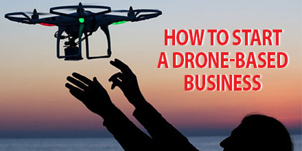
How to Start a Drone-Based Business – A Beginners Guide
Drone is one of the buzzwords of 2016 as Unmanned Aerial Systems continue to enhance and disrupt various industries.
The capabilities and benefits of UAV’s has led many to adopt this technology. This technology has also created a myriad of additional commercial opportunities, as well.
Simply creating a successful business enterprise based on drones is not enough. Effective implementation requires careful planning and training.
With this in mind, we’ve created a guide on how to start a drone-based business for beginners.
Preparation and groundwork
If you’re interested in a drone-based business, your project starts with understanding your UAV. Familiarize yourself with your devices’ operational manual before putting it together and flying it.
Understand the FAA’s rules on flying drones and abide by them. The Know Before You Fly educational campaign offers valuable information on air traffic fundamentals and operating procedures. It is a great online resource for novice drone pilots.
Another vital component of preparation is training. Novice drone pilots need to learn how to operate their remotely piloted aircraft skillfully and safely.
Training also helps reduce operational expenses and minimize downtime due to damaged or destroyed equipment. Basics include: take-off and landing, roll, pitch, and yaw, capturing images and video.
The preparation work you do truly is the foundation on which you build your business; the better your preparation, the better your outcome.
Learning the tricks of your trade
Drones are used for a wide range of applications. As such, pilots must practice and become proficient at the piloting challenges their particular application entails.
For those in the aerial photography and cinematography sector, capturing photos and videos from the air may take some time; this is just as true for seasoned photographers.
Capturing images via drone involves different vantage points and a moving camera. And, of course, particular applications require the development of particular skill sets. For example, wedding photos and video require different angles and shots than real estate photography and videography. Applications involving aerial surveillance and mapping utilize different sets of technical aspects altogether.
No matter the business, practice ensures quality work conducted at the highest possible standard.
Permits and getting your drone-based business certified
Preparation and groundwork is invaluable but it amounts to nothing if you cannot fly due to regulatory restrictions.
As a new and growing sector, drone regulations are a work in progress. However, the basic rule of thumb is that commercial drone use is currently prohibited by the FAA. Companies that wish to use drones for commercial purposes must apply to the FAA for a Section 333 Waiver, which are issued on a case by case basis.
Granting of commercial drone use permits by the FAA began in 2014. To date over 1,500 companies have certified their businesses. Today, acquiring a permit for your drone-based business is pretty straight forward. With advice from a lawyer who specializes in drones, your business can get certified and permitted without too much hassle.
Before you apply, familiarize yourself with the FAA’s guidelines on submitting an application for an exemption. Also, review the section 333 guidelines to learn what you’re required to submit to receive authorization.
Once you understand the requirements, you’re ready to file your application on the public docket.
Currently, blanket exemptions are in force which allow commercial operators to fly below 200 feet and use aircraft that weigh less than 55 pounds. Operators must follow restrictions such as keeping a certain distance away from airports and manned aircraft, as well as daytime and visual line of sight rules.
For any requirements that fall outside of the blanket exemptions, commercial drone operators need to wait for their permit before they can begin operations.
Choosing the right drone for your business
Unmanned aerial systems have quickly evolved from a pastime for drone enthusiasts to indispensable tools in a variety of sectors. But each industry requires a drone that meets certain requirements. Drone selection is usually based on the services you’ll provide.
While most drones are similar in design and operation, some are packaged for particular applications. Industry specific drones are often equipped with unique payloads and technologies.
The DJI’s Phantom 4 and the Parrot Disco FPV, for example, are popular choices for aerial photography and video. Depending on your budget, the technology and ability of the drone, there is a wide array from which to choose that range in price from $300 up to well over $1000.
Drones designed for surveying and/or mapping purposes come at a higher price tag because of the hardware and software requirements for such applications.
Professional surveying drones can cost up to $10,000 or more, depending on the model. Usually, these systems are packaged with surveying specific technologies such as RGB and NIR cameras, high resolution imaging, longer flight times, autonomous flight, and faster speeds.
For the budget conscious, less expensive drones can capture aerial surveying images and inspection. However, creating a professional business with a quality product does require investment in a more robust system.
Lastly, an investment in a good drone requires further expenditure on accessories and software. Items such as spare batteries to limit down-times, replacement parts in the event of crashes, and software such as photo editing tools and data storage are essential in keeping a drone-based business running smoothly.
Looking To Purchase A Drone? Check Out These Great Options
Based on the number of commercial exemptions granted by the FAA, the interest in creating drone-based businesses is very high. And though the industry is still in its infancy, it’s vital to market your business.
The digital age has made it a little easier to market your business. Platforms such as the internet and social media are valuable resources to help level the playing field somewhat. Other recommendations include joining and contributing to professional UAV organizations that exist around the country and online. Networking with business professionals in the field can establish you and your organization as an authoritative voice in the sector.
Likewise, an online advertising budget can help increase your brand’s reach. Advertising online is less costly than traditional marketing methods and can reach millions of potential customers and clients.
UAVs are extremely popular right now, and there is no better time to start a business in the sector. With preparation, effort and investment your drone-based business can succeed.
Other Resources
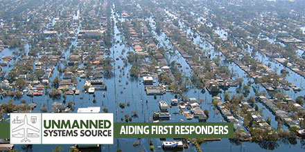
Unmanned Systems to the Rescue
Unmanned advancements help first responder’s efforts
When disaster strikes we look to the men and women in emergency services to render aid to those affected. Thanks to advances in technology, first responders now have unmanned systems to help in those efforts.
Currently, unmanned helpers include Unmanned Aerial Vehicles and robots equipped with sensors, cameras, and even microphones.
Unmanned Systems impact on an industry
The impact of unmanned technologies in emergency and disaster situations continues to grow. Drones offer numerous advantages including: rapid deployment, the ability to assess dangerous environments from a safe distance, minimize risk to workers, and more.
Operators can change drone equipment to adjust to changes in the environment. A night-vision camera can be quickly exchanged for an infrared camera to read heat signatures of survivors. Programmable flight paths ensure complete coverage of an area.
All these advantages can significantly impact the number of lives saved in the event of a disaster.
Extending relief workers’ reach
UAVs are particularly helpful in reaching areas that are inaccessible.
Drones equipped with high resolution imagers can provide pictures, stream live video and create before and after snap shots of the affected site. Emergency workers can use this information to determine a plan of action – where to deploy, areas to avoid, identify survivors, and more.
What’s more, drones can re-deploy to get the most accurate data in what is usually a very active and changing situation. Officials can use the data to continuously adjust and respond accordingly.
First responders aren’t the only ones who benefit from drone use in emergency situations. Drone manufacturers can use feedback from operators in the field to improve the overall performance of the product, thus improving capabilities for future relief efforts.
The challenge of the amateur operator
Unfortunately, the growing use of drones also has a downside. As more enthusiasts take to the skies, they can pose a risk to active emergency situations.
Many well-intended users believe they are providing assistance when, in fact, their efforts can hamper and even derail relief efforts. Such situations require formal training, expertise and collaboration with disaster and emergency relief officials. Operators functioning on their own volition are a risk to personnel on the ground.
Rescue organizations continue to advise drone enthusiasts, not officially involved in efforts, to restrain themselves and stay away from active emergency situations.
A growing array of unmanned systems
Rescue personnel can choose from an ever increasing array of unmanned systems.
For example, RoboSimian is a highly dexterous robot that can access areas deemed too risky for humans. This robot can scan, assess as well as manipulate its environment. Currently, RoboSimian can close a valve, pick up an object and remove impediments.
Certain situations require even more sophisticated technology – such as detecting movement under piles of debris.
Developed by NASA’s Jet Propulsion Laboratory, FINDER (Finding Individuals for Disaster and Emergency Response) utilizes low power radar to detect imperceptible movements beneath rubble. FINDER’s radar emits a low power radio signal that bounces off debris and changes if movement is detected.
As with robots and UAVs, FINDER is an important tool that enables rescuers to locate those in need and provide assistance quickly and efficiently.
A bright future
Given the advantages unmanned systems offer, emergency and disaster relief agencies will continue to adopt this technology. For the agencies involved in planning and executing search and rescue operations, the deployment of UAVs, robots and additional technology is a positive development.
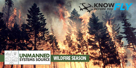
“Know Before You Fly” Urges Operators to Stay Away from Wildfires, Adhere to Temporary Flight Restrictions
WASHINGTON — The Know Before You Fly campaign today urged operators of unmanned aircraft systems (UAS) to respect temporary flight restrictions (TFRs) over and around wildfires as this year’s wildfire season makes an early start.
Wildfires or other hazardous conditions often lead to authorities putting in place TFRs, which allow first responders to do their jobs unimpeded and without danger to their aerial support.
Temporary Flight Restrictions
Violating the TFR may endanger the safety of the operation, and in some cases may ground search and rescue crews until the airspace is cleared, allowing the wildfire to spread. But TFRS do not just apply to wildfires.
For stadium events ranging from concerts to NASCAR races to the Super Bowl, model aircraft flights and unmanned aircraft operations are generally restricted. More information about the types of TFRs may be found here.
To check for TFRs in your area, visit the FAA TFR list at http://tfr.faa.gov/tfr2/list.html. Additionally, download the FAA’s B4UFLY app, available on the App Store or Google Play, to find up-to-date information on TFRs.
No one should be flying within a TFR that restricts UAS and/or model aircraft operations.
Standard flight guidelines for operators
At all other times when flight is permitted, Know Before You Fly would like to remind recreational flyers to follow these guidelines to keep the skies safe for all:
Fly no higher than 400 feet
Fly within visual line of sight
Stay well clear of other aircraft
Never fly within 5 miles of an airport without contacting airport authorities or air traffic control
Keep well away from emergency response efforts, such as fires
Beware of FAA airspace requirements (http://www.faa.gov/uas/tfr/)
If you are flying for commercial purposes, please adhere to the FAA small UAS regulations, which can be found here.
Know Before You Fly was launched by the Association for Unmanned Vehicle Systems International (AUVSI) and the Academy of Model Aeronautics (AMA) in partnership with the FAA with the goal of spreading awareness about safe and responsible use of UAS. For more information on safe and responsible flying, visit KnowBeforeYouFly.org or follow @FlyResponsibly on Twitter.
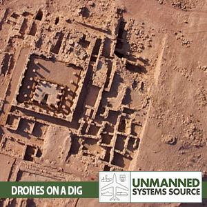
Archeologist’s Latest Tool: Drones
The use of Unmanned Aerial Vehicles (UAVs) and all their forms – drones, multi-rotors, and quad-copters – has exploded in recent years. This explosive growth, coupled with increased affordability, has transformed the way industries approach business.
The film and photography industry are such an example; drone technology now provides access to views that were previously the domain of helicopters and fixed wings.
The advantages of drone-based imaging are many, and unmanned aircraft are fast becoming an indispensable tool to various industry professionals, including archaeologists. Drones offer archaeologists the ability to survey existing and future excavation sites in detail as well as provide a different perspective to workers on the ground.
Transforming the Science of Archeology
By using UAVs for surveying, archaeologists capture a wider view of an entire site and can also identify possible areas of interest. While drone use is especially helpful before the start of an excavation, some professionals in the field are now using them during digs.
One reason drones have become a crucial piece of equipment in archeology is their ability to provide low altitude shots, close ups, wide angles, and oblique shots. Archaeologists have long employed balloons and kites fitted with cameras to get aerial shots of the site. But now drones, such as DJI’s Phantom and the Yuneec Typhoon, capture these same shots extremely well and deploy quickly.
Other benefits of drone use in archeology include the ability to fly in most weather conditions, something that is not always possible with balloons or kites. Drones are also capable of reaching less accessible areas such as wooded areas or the interior of caves.
Plus, these vehicles can capture/record detailed two and three dimensional data of large areas that would otherwise require a lot of time and effort when done by people on the ground.
Aside from the limitations caused by battery life, drone system operating costs are negligible once they are up and running.
In addition to flying stability, drones appeal to archeologists because of their relative affordability. Additionally, archeologists also cite the fact that the machines are lightweight and easy to transport. Plus, their size and discrete nature is perfectly suited for sites that receive visitors.
The Future of Drone Use in Archeology
The majority of archaeologists employing multi-rotors in the field appreciate that they are relatively easy to fly and operate and come ready to use out of the box.
This ease of use means that many archeologists are fast becoming comfortable piloting these crafts – taking off, landing, and taking pictures with ease. Other archaeologists prefer to hire qualified drone pilots. The scope and difficulty of each particular project usually determines if a professional operator is needed.
In terms of future trends, most industries like archeology will continue to benefit from advances in drone technology that help extend flight durations. Continued advances in automation will also be a significant factor as well as improvements to imaging technology.
The ability to use imaging data to recreate archeology sites as 3D models or digital terrain is an indispensable part of any archeologists work and yet more is on the way.
For example, drone-mounted systems such as ground penetration radar would be a major advance not only for surveying known locations but for finding new and, as yet, undiscovered sites of historical importance.
The future is bright
While most archeologists and academic researchers using drones are already familiar with flying the UAV’s, there is still a place for commercial drone services to thrive within this industry. It is clear that drone use has already transformed archeology work, and future trends point to the science’s increased reliance on unmanned aerial vehicles.
UAVs May Help Extend Tornado Warning Times
The growth of UAV applications in recent years has led to a surge of innovation in Industry and Scientific Research. Weather Forecasting and accurate storm path prediction is one such area that continues to benefit from the unique capabilities UAVs offer – including the possibility of lengthening tornado warning times up to 3-fold.
Currently, Meteorologists employ Doppler radar to help predict where a Tornado will hit to within 20 minutes. But Doppler radars has its limitations; it cannot measure air pressure directly and it is also designed to monitor higher altitudes.
Acquiring detailed air pressure measurements from ground level to 1000 feet, known as the “sweet spot”, has been problematic. UAV technology may hold the key to obtaining detailed and localized measurements, thus increasing accuracy.
Cloud-Map project takes shape
Jamey Jacob, a professor of Mechanical and Aerospace Engineering at Oklahoma State University, believes UAV technology may be the key to obtaining detailed and localized measurements, thereby increasing accuracy.
Jacob recently outlined the fundamentals of the project, Cloud-Map, at AUVSI’s XPONENTIAL 2016 in New Orleans, Louisiana.
Cloud-Map is a joint project between four Midwestern universities: Oklahoma State University, University of Nebraska-Lincoln, University of Oklahoma, and University of Kentucky. Together with the National Science Foundation they aim to triple the warning time for tornados and to improve weather predictions nationwide in general through the use of UAVs.
Droning in on the “sweet spot”
The project envisions a network of drones deployed directly from weather stations. Typically, most weather stations have a tower that reaches 30 feet into the air. Cloud-Map aims to extend this reach up to one thousand feet through the use of drones to collect data up to the altitude where Doppler radar currently covers.
This overlap in data collection should help Meteorologists get a better picture of air pressure movements nationwide and predict the path of tornadoes, hurricanes, and other extreme weather events with more accuracy.
This fleet of drones will be designed to operate up to 5,000 feet but will hone in on that all-important “sweet spot” of weather forecasting – 1000 feet above the ground – and will capture temperature, pressure and humidity data.
Currently, weather balloons are used to measure air pressure but once released they rise roughly 1,000 feet in a minute. So, while they do capture air pressure at low altitudes, they do so only for about 60 seconds before continuing their trajectory up into the stratosphere.
Designing for the Unknown
There are a lot of unknowns with the proposed deployment of UAV technology into harsh and extreme weather environments. Currently the Cloud-Map team is designing the vehicle to withstand winds up to 120 mph – essentially a Cat-3 hurricane – and still maintain critical data transmission from inside extreme weather events such as a tornado.
Jacob announced that Cloud-Map’s prototypes have been successfully stress-tested in lab conditions that prove they can withstand the extreme pressures from turbulent wind speeds without shattering. One drone reportedly sent back measurements from inside a storm that had winds gusting up to 30 mph.
But further field tests are still needed to determine if a UAV can safely operate in much more violent storms while maintaining stable flight control and the transmission of usable data. The Cloud-Map team is also considering the use of smaller multi-rotor drones which some believe may handle such extreme conditions better than larger UAVs.
Extending warning times
The advent of a UAV capable of withstanding tornado-strength winds would give scientists a new opportunity to learn more about this phenomena from a safe remote location. And with better understanding could come extended warning times and increased opportunity for individuals to seek cover from these deadly weather events.
In addition to the low-altitude drones, Cloud-Map is also developing a top-down weather measurement UAV called MARIA. The plan is to create a fixed-wing platform that would fly above a storm still in its early stages of development and drop sensor packets from above directly into the storm’s path.
More testing of the next iteration of UAV prototypes will be conducted by the Cloud-Map team in June.
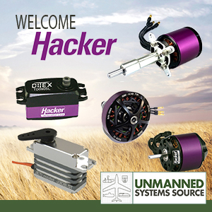
Hacker Motors’ product line now at Unmanned Systems Source
May 19, 2016 – Unmanned Systems Source is pleased to announce our latest distribution partner, Hacker Motors. Hacker Motor’s specializes in high quality, brushless motors and controllers for commercial and industrial purposes.
Hacker products include the complete line of brushless motors and controllers ranging from 25 watts to 15,000 watts for RC, UAV and industrial applications. Hacker also offers in-runners and out-runners to direct drive and geared, Hacker likely has a quality lightweight motor to fit your needs.
Unmanned Systems Source also offers Hacker’s DITEX telemetry servos which incorporate the latest in digital position encoders and a powerful 32-bit processor for a truly digital servo. DITEX servos also offer programmability, via a USB adapter and the manager software, and delivers numerous data points to compatible telemetry systems.
“I think developers and integrators will be really pleased with the power, programmability and price-point that the DITEX provides,” said Drew Osbrink, Solutions Engineer for Unmanned Systems Source.