 The National Institute of Standards and Technology (NIST) recently issued a Unmanned Aerial Systems (UAS) competition.
The challenge? Design and build a cost-effective drone that carries the biggest payload and stays airborne the longest. The top ten designs in the Unmanned Aerial Systems Flight and Payload Challenge compete for prize awards totaling $432,000.
Hosted by NIST Public Safety Communications Research Program, the challenge consists of three stages. Stage 1, concept paper submission, closes January 29, 2018 at 3pm ET.
In addition, finalists will showcase the UAS with paid travel to the NIST Robotics Lab and the 2018 PSCR Stakeholder conference.
Results from the UAS Flight and Payload Challenge support the public safety community and its stakeholders.
Currently, one of the barriers for UAS used in a public safety realm is payload versus flight time. Multi-rotor UAS offer users many capabilities. However, limited flight time is still a very real challenge. Flight time is further reduced with the addition of a payload.
Of course, payload capacity, energy source and flight time are all linked. Optimized design trade-offs can provide greater efficiency and flexibility.
The focus of this design challenge is to keep the UAS, and its payload, airborne for the longest time possible.
Such enhanced capacity supports first responders’ communication technology on the ground while they conduct their search.
The advancement of UAS research will help search and rescue operations support payloads for wireless communications or other life-saving goods to save lives.
There are no fees or qualifications needed to enter the first stage. Stage 1 winning ideas are eligible for remaining stages of the competition.
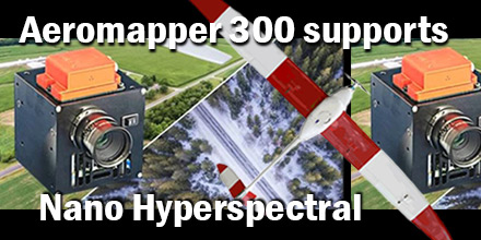 Recently, Aeromao Inc., delivered an Aeromapper 300 to the University of Brasilia in Brazil. The customized UAV arrived ready to integrate the Nano-Hyperspectral camera from Headwell Photonics.
After initial approval, the team completed the custom integration in just a few weeks.
When it comes to finding a UAV dependable enough to trust such an expensive sensor, the Aeromapper UAV line, from Aeromao, are an obvious choice. The UAV’s are affordable, dependable, easy to use, offer parachute recover, and a great level of customer support.
In addition, the payload bay of the Aeromapper 300 enclosed the Nano hyperspectral camera. Thus, protected by the carbon fiber/Kevlar pod of the aircraft. The Aeromapper 300 comes with a quick swappable mount which can accommodate other sensors, as well as the RGB 24 Mp camera, included.
The Headwall’s Nano-Hyperspec® sensor is a completely integrated hyperspectral camera designed for the VNIR (400-1000nm) spectral range, with interchangeable lens capability. Plus, a key advantage of the Nano-Hyperspec is that it also includes 480GB of on-board data collection/storage, plus attached GPS/IMU functionality.
Basic Specifications:
Aeromao Inc., a Canadian company, is the manufacturer and developer of a series of turnkey unmanned aerial vehicles for mapping, surveying, precision agriculture and remote sensing. The product line includes the Aeromapper 300, Aeromapper TALON, and the Aeromapper EV2.
Shop Aeromao’s entire line of UAVs at Unmanned Systems Source.
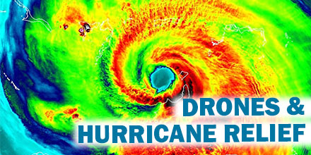 2017 brought some of the most powerful storms of the decade, resulting in over $188 billion in damages.
Just three major storms of the Atlantic hurricane season — Harvey, Irma and Maria — ran up the majority of the damages.
Manned aircraft, though incredibly helpful, are often too large and heavy to land in areas affected by these storms. As such, many aid and relief organizations are looking for unorthodox solutions. Enter drones.
Recently, the American Red Cross teamed up with the UPS Foundation in an effort to bring drones to natural disaster sites. But they aren’t the only organization looking to use drones for disaster relief.
Following Hurricane Irma, the FAA issued 132 airspace authorizations for drones to aid in recovery and response efforts.
When it comes to disaster relief work, drones offer many advantages over manned aircraft.
Rapid deployment is one such advantage. Thanks to a small footprint, drones can launch quickly — there is no need for a lengthy runway that is free from debris. Instead, drones can deploy from a variety of scenarios that are conducive to the hostile conditions surrounding relief work.
As such, drones can quickly perform a wide variety of critical tasks, such as: finding people in need of help, surveying the scope of the disaster, delivering supplies, etc.
Drones can also deliver life jackets and rescue ropes to areas ground-based rescuers can’t access as well as predict further flooding and provide estimates of how long specific areas will remain underwater.
In preliminary research conducted last year in Europe, drones found isolated people significantly faster than ground-based rescue teams.
The Air National Guard found use for UAVs typically deployed in combat operations. These long-endurance UAVs are especially helpful when it comes to conducting aerial survey.
Such survey are incredibly helpful and are used for a variety of purposes. Surveys provide a better understanding of the measure and scope of the destruction zone. They help inform which areas may need the most urgent assistance. And, they help identify passable routes for emergency crews to get to those in need.
Commercial drone companies in Florida conduct aerial surveys to provide clear shots of damaged homes. This information, in turn, is given to insurance companies so that they can act quickly on claims.
Florida Power deploys dozens of drone teams following a storm. The teams use the drones to access areas not available by other means. These quick aerial surveys help the company identify areas that need to have electricity restored.
The Red Cross is also beginning to use drones for relief work.
Their pilot program uses CyPhy Works’ Persistent Aerial Reconnaissance and Communications (PARC) platform. The platform provides continual power to drones flying stationary and up to 400 feet in the air via a tether.
The tethered drone allows for uninterrupted surveillance for weeks at a time. Equipped with a 30X zoom camera, the drones can survey several miles. Such surveys allow users to assess the impact of a disaster in order to best direct relief efforts.
Drones played a growing and invaluable role in hurricane relief efforts in 2017. As the hurricane season ramps up, it is likely that drone use will continue to improve natural disaster relief efforts for years to come.
As stated by FAA Administrator Michael Huerta, “I don’t think it’s an exaggeration to say that the hurricane response will be looked back upon as a landmark in the evolution of drone usage in this country.”
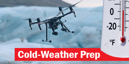 Flying drones in cold weather is not an issue for many operators. After all, there is not much that keeps them from flying, even extremely cold weather.
Besides rain and high winds, a drop in temperature is usually not enough to keep a pilot grounded.
Today, a majority of multi-rotors can withstand temperatures ranging from 32-145 degrees Fahrenheit. For specific thresholds, check the user manual which came with the drone. However, drone operations in cold-weather do require adequate preparation.
Of course, there are a variety of cold-weather conditions that could endanger a drone’s function. However, ice is one of the biggest issues an operator needs to guard against. At all costs, avoid any ice build-up on the device.
If a drone’s wings or propellers become covered by ice, it can alter its load distribution and thereby affect its aerodynamics.
Condensation is of particular concern. In cold-weather flights, freezing air flows over the warm body of the drone which can form into condensation. It can then settle and freeze on the surface of the drone affecting the UAVs flight performance. Furthermore, when the ice melts it can cause further damage by seeping into the drone’s internal electronics.
Unless a pilot is aware and confident in the drones overall IP-rating, it is simply good practice to avoid flying in rainy conditions.
Obviously, drones are machines made up of various electrical components. As such, these components are affected by moisture just like any other electronic. Water can seriously damage motors, camera’s and other parts.
If caught in rain or snow, cease operations immediately and remove any water by wiping down the drone.
Cold weather impacts batteries differently than warm weather. As such, batteries need to be adjusted accordingly.
In cold weather, the chemical response within the battery slows. This results in the reduction of flight time. Depending on the temperature, flight time can reduce by up to 20%. Extreme drops in temperature can also result in a sudden reduction in power. In some instances, extreme temperatures can result in complete battery failure.
Best practices for cold-weather battery care include:
To get longer life and flying time out of your batteries always ensure they are fully charged in preparation. These and any spares should be stored somewhere warm such as a suitable carrier during transit to avoid degradation.
A sensible idea is to hover “on the spot” for a few seconds after takeoff. This allows the battery to warm up prior to full flight.
Finally, be sure to also take it easy on the throttle during flight and consider bringing in the drone to land once you have less than 30% of power left as a precaution. This is where having spare batteries or a portable charger come in and it helps to guard against any sudden loss of power midair.
Another consideration is altitude. Flying in high altitudes means the propellers must spin faster to compensate for thinner air. As such, the batteries drain more quickly which means shorter flight times.
Local weather can also greatly impact the length of drone flight. Areas described as ‘dry’ versus areas with more humidity in their air certainly affect a drones performance.
Ground conditions are another factor. For example, puddles of water of packs of snow can damage a landing drone. In such conditions, weighted sheets can provide a dry surface on which to land – thereby minimizing contact with any moisture.
Last but not least, it’s a good idea to look after the pilot, as well.
Essential supplies, such as: gloves, goggles, scarves, layers of warm clothes, and hot drinks can keep pilots safe in the elements. Packing extra cloths to wipe down the drone after operations, is also helpful.
Flying drones in cold weather is possible. Simply keep in mind the tips above to ensure a safe, efficient flight…despite the temperature.
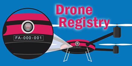 Recently, U.S. Department of Transportation Secretary, Elaine L. Chao, announced that the total number of drones registered with the Federal Aviation Administration (FAA) eclipsed one million.
Chao made the announcement at the annual Consumer Electronics Show (CES) in Las Vegas, NV.
The 1 million registrants include 878,000 hobbyists and 122,000 commercial users. Hobbyists receive one identification number for all the drones they own. Commercial, public and other drones are individually registered.
“The tremendous growth in drone registration reflects the fact that they are more than tools for commerce and trade. Drones can save lives, detect hazardous situations and assist with disaster recovery,” said Chao. “The challenge is to remove unnecessary hurdles to enable the safe testing and integration of this technology into our country’s airspace.”
Once again, drone registration with the FAA is mandatory for hobbyist and recreational operators.
On Dec. 12, President Donald Trump signed the 2018 National Defense Authorization Act, which applies primarily to defense funding. However, it also included a measure reinstating the requirement for hobbyists to register drones with the FAA.
Last May, a federal judge ruled that the agency exceeded its authority to regulate hobbyist and recreational drones, a category Congress specifically excluded.
Currently, the FAA requires registration for drones weighing between .55 and 55 pounds for both commercial and recreational use.
Hobbyists and other users whose drones meet these requirements can register using the FAA’s web-based registry system. Registration costs $5 and is valid for three years. Some unmanned aircraft must still be registered using the agency’s paper-based traditional aircraft registration system.
Those who fail to register can face civil and criminal penalties, according to the agency.
Additionally, the registration process helps educate drone operators who may be entirely new to aviation. As drone registrants go through the process they also learn about and agree to the FAA’s operating rules. Plus, registration helps increase airspace security by identifying drones with their owner.
The agency also uses the registration database to push important safety messages to drone users.
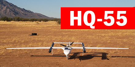 The HQ-55, the newest airframe from Latitude Engineering, recently completed a successfully flight.
This flight marked the completion of a Phase 1 National Oceanic Atmospheric Administration (NOAA) Small Business Innovation Research (SBIR).
On December 12, 2017, the Part 107 compliant aircraft successfully preformed multiple auto-hovers and a short flight.
Phase II will involve refinement of the design and testing of the automated launch and recovery from a moving ship. This ship-borne capability will dramatically improve the capabilities of atmospheric and oceanic researchers around the world.
In addition, the vehicle will provide one of the highest payload capacities and range of any part 107 compliant aircraft.
Find other Latitude Engineering products at Unmanned Systems Source.
