
Drones in Hurricane Relief
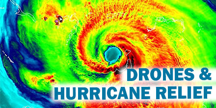 2017 brought some of the most powerful storms of the decade, resulting in over $188 billion in damages.
Just three major storms of the Atlantic hurricane season — Harvey, Irma and Maria — ran up the majority of the damages.
Manned aircraft, though incredibly helpful, are often too large and heavy to land in areas affected by these storms. As such, many aid and relief organizations are looking for unorthodox solutions. Enter drones.
Growing demand
Recently, the American Red Cross teamed up with the UPS Foundation in an effort to bring drones to natural disaster sites. But they aren’t the only organization looking to use drones for disaster relief.
Following Hurricane Irma, the FAA issued 132 airspace authorizations for drones to aid in recovery and response efforts.
The advantages
When it comes to disaster relief work, drones offer many advantages over manned aircraft.
Rapid deployment is one such advantage. Thanks to a small footprint, drones can launch quickly — there is no need for a lengthy runway that is free from debris. Instead, drones can deploy from a variety of scenarios that are conducive to the hostile conditions surrounding relief work.
As such, drones can quickly perform a wide variety of critical tasks, such as: finding people in need of help, surveying the scope of the disaster, delivering supplies, etc.
Drones can also deliver life jackets and rescue ropes to areas ground-based rescuers can’t access as well as predict further flooding and provide estimates of how long specific areas will remain underwater.
In preliminary research conducted last year in Europe, drones found isolated people significantly faster than ground-based rescue teams.
Air National Guard
The Air National Guard found use for UAVs typically deployed in combat operations. These long-endurance UAVs are especially helpful when it comes to conducting aerial survey.
Such survey are incredibly helpful and are used for a variety of purposes. Surveys provide a better understanding of the measure and scope of the destruction zone. They help inform which areas may need the most urgent assistance. And, they help identify passable routes for emergency crews to get to those in need.
Florida Power
Commercial drone companies in Florida conduct aerial surveys to provide clear shots of damaged homes. This information, in turn, is given to insurance companies so that they can act quickly on claims.
Florida Power deploys dozens of drone teams following a storm. The teams use the drones to access areas not available by other means. These quick aerial surveys help the company identify areas that need to have electricity restored.
Red Cross and CyPhy
The Red Cross is also beginning to use drones for relief work.
Their pilot program uses CyPhy Works’ Persistent Aerial Reconnaissance and Communications (PARC) platform. The platform provides continual power to drones flying stationary and up to 400 feet in the air via a tether.
The tethered drone allows for uninterrupted surveillance for weeks at a time. Equipped with a 30X zoom camera, the drones can survey several miles. Such surveys allow users to assess the impact of a disaster in order to best direct relief efforts.
Drones played a growing and invaluable role in hurricane relief efforts in 2017. As the hurricane season ramps up, it is likely that drone use will continue to improve natural disaster relief efforts for years to come.
As stated by FAA Administrator Michael Huerta, “I don’t think it’s an exaggeration to say that the hurricane response will be looked back upon as a landmark in the evolution of drone usage in this country.”