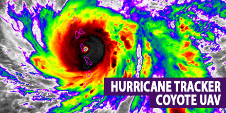
Coyote UAV recently deployed to track and model Hurricane Maria
 The scientific community continues its quest to better understand hurricane behavior.
Recently, The National Oceanic and Atmospheric Administration (NOAA) deployed six Raytheon Coyote UAVs to track and model Hurricane Maria.
The Coyotes flew directly into the storm and provided researchers an unprecedented view of the hurricane. The UAVs launched from a NOAA WP-3D Orion – fondly dubbed the “hurricane hunter”.
The Coyote operated in the lower part of the hurricane, an area impossible for manned aircraft to reach.
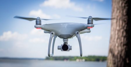
Coyote UAV: at your disposal
“Our expendable Coyote UAVs are delivering vital information about these potentially deadly storms; and that can help save lives,” said Dr. Thomas Bussing, Raytheon vice president of Advanced Missile Systems.
The Coyote gathered and transmitted continuous storm data directly to the National Hurricane Center, all while navigating winds exceeding 100 miles per hour. NOAA scientists hope to gain better understanding of hurricane storm behavior by evaluating the data collected.
Researchers can also fly Coyotes throughout the storms, revisiting key locations inside hurricanes to obtain the most robust data possible.
The hope is that researchers can use all this data to improve the accuracy of hurricane forecasts.
History of the Coyote UAV
Developed originally for military use, the Coyote is a small, expendable UAV. It can launch via air or ground and is often deployed in situations that are too dangerous for manned aircraft. It boasts over an hour flight endurance and travels up to 50 miles from its host.
The Coyote is just one part of Raytheon’s family of high-tech weather forecasting technology. Additional weather technology includes: the Visible Infrared Imaging Radiometer Suite instrument aboard NOAA’s Suomi NPP spacecraft, the common ground system for the Joint Polar Satellite System, and the Advanced Weather Interactive Processing System – a powerful forecast toolkit that helps meteorologists make sense of the massive amounts of weather data that modern sensors collect.