 Documenting, investigating and reconstructing accident scenes is time consuming. And, depending on the site, it can also pose risks for reconstruction specialists.
The work, though, is vital.
The data gathered from reconstructing an accident helps officials identify what went wrong. It also informs future decisions to improve overall traffic safety.
The pressure to clear the roads as quickly as possible following an incident, is enormous. However, documenting the accident is vital…and some can stretch over a considerable area. Photographing, measuring and capturing all the details using traditional methods takes considerable time and energy.
So, it should come as no surprise that some public safety departments are testing the feasibility of drone use for reconstruction efforts.
As technology advanced, the possibility of creating 3D models via drone became a reality.
Currently, data gathering methods include a mixture of photography, laser scanners and total stations to produce a 3D point cloud of the site. And, it often requires personnel trained in surveying.
Drones may help reconstruction specialists document incidents more quickly and accurately than traditional methods.
One drone flight can collect vital image data. This image data, coupled with advances in photogrammetry software, is highly dynamic. Specialists can create 3D point cloud, a model, measurable orthomosaics, and detailed reports. And, importantly, all the data is there for further analysis.
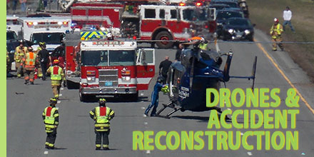
Recently, a number of public safety officials in North Carolina gathered to observe the possibility of drone use for accident investigations.
The scenario played out at the Buncombe County Public Safety Training Facility. The demonstration involved a head-on vehicle collision. Two reconstruction teams quickly jumped into action.
One team was the State Highway Patrol Collision Reconstruction Unit. The other team was the Division of Aviation UAS flight team…using drones.
The Highway Patrol team completed the reconstruction in 1 hour 51 minutes. The UAS team completed the same work in 25 minutes.
Sophisticated flight planning software means there is less need for highly specialized training to document accident scenes. Processing the data after, is another story.
However, in situations where specialized personnel are unavailable or unable to get to the scene, flying a drone over the scene and capturing important data is a viable option.
The future of drone use for accident reconstruction is just in the beginning stages. However, the benefits of capturing information quickly, securing the safety of personnel and clearing roads faster means it is only a matter of time before drones are an important public safety tool.
