News

Watch: Unmanned Systems Source Presentation at Arizona UAS 2016

In this video, Andrew Osbrink gives a presentation on the business of Unmanned Systems Source, the customers we support, and where the future of the UAV market is heading. Recorded September 2016 at the Arizona UAS conference in Phoenix Arizona.

Apple May Harness Drone Technology To Improve Apple Maps Accuracy

Apple has supposedly begun work on a drone-powered alternative to keep their Apple Maps service up to date and faster that their current fleet of sensor and camera-outfitted vans and vehicles. According to a report by Bloomberg Technology, Apple intends to use drones to examine street signs and track changes to streets and roads. Additionally, the report indicates that monitoring construction projects is also a major goal of the project, which has not yet been fully approved by the FAA. While Apple usually does not respond to inquiries regarding future plans and technologies they will be using, there was an FAA exemption granted on March 22, 2016 for Apple to "operate an unmanned aircraft system to conduct data collection, photography, and videography". In the application, Apple stated they would be using many different drones from DJI, Intel, and Parrot, with data collection services managed by a company called Aibotix GmbH. In the application, Apple also addressed potential safety hazards of using the drones and how they intend to mitigate the risk:
The proposed operations do not create any hazard to users of the NAS or pose a threat to national security. The Aircraft are battery operated with a maximum flight time of less than 25 minutes. The Aircraft weigh less than 55 pounds. The Aircraft will be operated at or below 400 feet AGL within the visual line of sight of the pilot in command. UAS operations will be over private or controlled access property with the permission of the owner/controller or authorized agent.
You can read the full FAA exemption filed by Apple here. If Apple begins mapping efforts as intended, they may face some obstacles considering that current FAA exemptions still do not allow you to fly over people or roads. How Apple intends to navigate around these restrictions is still up in the air (no pun intended). Digital maps are essential to both the Apple and Google ecosystems, with consumers and developers alike both relying on the accuracy of the maps to travel to and from locations, and develop applications that use the map features. Accuracy is key, and if Apple can improve its current mapping efforts to match or beat Google, they will be well positioned for growth and user adoption.

UK Releases Revised Set of Drone Operation Rules Ahead of Holiday Season

The United Kingdom has released a simplified set of guidelines regarding drone operations in preparation for a holiday season that is expected to bring thousands of new drones into the homes of consumers. In an effort to make it easier for drone owners to remember the guidelines, the Civil Aviation Authority (CAA) has released the following mnemonic to make it easy to remember the rules:

  • Don't fly near airports or airfields
  • Remember to stay below 400ft (120m) and at least 150ft (50m) away from buildings and people
  • Observe your drone at all times
  • Never fly near aircraft
  • Enjoy responsibly

The CAA is responsible for the UK's airspace and aviation operations, and although they do have a full explanation of drone operator rules, it seems fitting that they would try and simplify the rules for first time drone buyers who may not be aware of the regulations after purchasing, or receiving a drone as a gift.

In a CAA press statement, Andrew Sage, an air traffic control provider at the NATS, said:

Drones are an incredible, inspiring technology but it's vital that people are using them safely.  With the number of reported drone incidents on the rise, it's important that people understand their legal obligations and fly safe, having fun whilst ensuring other users of the UK's airspace aren't put at risk.

Through research, the CAA found that the UK public had concerns regarding drone use, so hopefully the simplifications done to the drone code will ensure that even first time drone operators know the basics of how to safely fly their drones in UK airspace.

Looking To Purchase A Drone? Check Out These Great Options

How to Start a Drone-Based Business – A Beginners Guide

drone_business
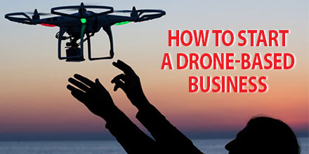
Drone is one of the buzzwords of 2016 as Unmanned Aerial Systems continue to enhance and disrupt various industries.

The capabilities and benefits of UAV’s has led many to adopt this technology. This technology has also created a myriad of additional commercial opportunities, as well.

Simply creating a successful business enterprise based on drones is not enough. Effective implementation requires careful planning and training.

With this in mind, we’ve created a guide on how to start a drone-based business for beginners.

Preparation and groundwork

If you’re interested in a drone-based business, your project starts with understanding your UAV. Familiarize yourself with your devices’ operational manual before putting it together and flying it.

Understand the FAA’s rules on flying drones and abide by them. The Know Before You Fly educational campaign offers valuable information on air traffic fundamentals and operating procedures. It is a great online resource for novice drone pilots.

Another vital component of preparation is training. Novice drone pilots need to learn how to operate their remotely piloted aircraft skillfully and safely.

Training also helps reduce operational expenses and minimize downtime due to damaged or destroyed equipment. Basics include: take-off and landing, roll, pitch, and yaw, capturing images and video.

The preparation work you do truly is the foundation on which you build your business; the better your preparation, the better your outcome.

Learning the tricks of your trade

Drones are used for a wide range of applications. As such, pilots must practice and become proficient at the piloting challenges their particular application entails.

For those in the aerial photography and cinematography sector, capturing photos and videos from the air may take some time; this is just as true for seasoned photographers.

Capturing images via drone involves different vantage points and a moving camera. And, of course, particular applications require the development of particular skill sets. For example, wedding photos and video require different angles and shots than real estate photography and videography. Applications involving aerial surveillance and mapping utilize different sets of technical aspects altogether.

No matter the business, practice ensures quality work conducted at the highest possible standard.

 Permits and getting your drone-based business certified

Preparation and groundwork is invaluable but it amounts to nothing if you cannot fly due to regulatory restrictions.

As a new and growing sector, drone regulations are a work in progress. However, the basic rule of thumb is that commercial drone use is currently prohibited by the FAA. Companies that wish to use drones for commercial purposes must apply to the FAA for a Section 333 Waiver, which are issued on a case by case basis.

Granting of commercial drone use permits by the FAA began in 2014. To date over 1,500 companies have certified their businesses. Today, acquiring a permit for your drone-based business is pretty straight forward. With advice from a lawyer who specializes in drones, your business can get certified and permitted without too much hassle.

Before you apply, familiarize yourself with the FAA’s guidelines on submitting an application for an exemption. Also, review the section 333 guidelines to learn what you’re required to submit to receive authorization.

Once you understand the requirements, you’re ready to file your application on the public docket.

Currently, blanket exemptions are in force which allow commercial operators to fly below 200 feet and use aircraft that weigh less than 55 pounds. Operators must follow restrictions such as keeping a certain distance away from airports and manned aircraft, as well as daytime and visual line of sight rules.

For any requirements that fall outside of the blanket exemptions, commercial drone operators need to wait for their permit before they can begin operations.

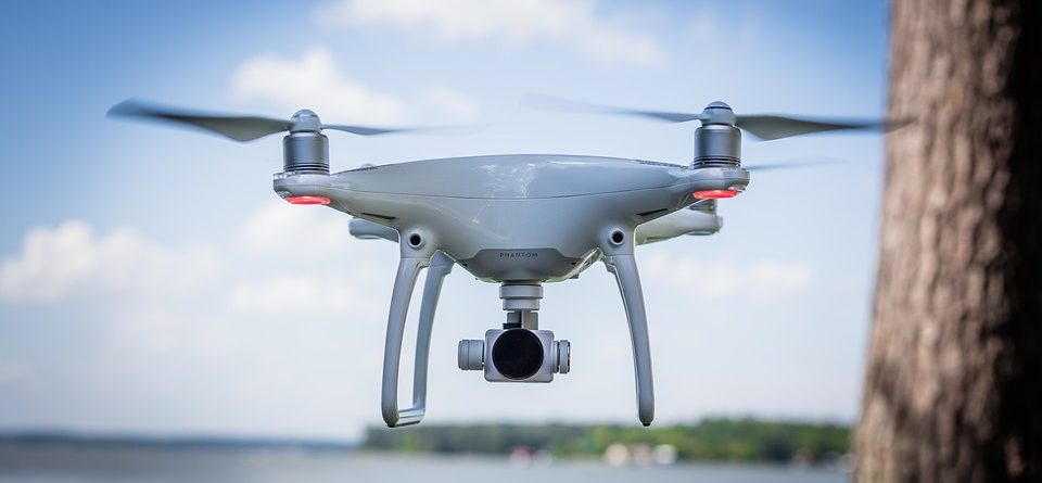
Choosing the right drone for your business

Unmanned aerial systems have quickly evolved from a pastime for drone enthusiasts to indispensable tools in a variety of sectors. But each industry requires a drone that meets certain requirements. Drone selection is usually based on the services you'll provide.

While most drones are similar in design and operation, some are packaged for particular applications. Industry specific drones are often equipped with unique payloads and technologies.

The DJI’s Phantom 4 and the Parrot Disco FPV, for example, are popular choices for aerial photography and video. Depending on your budget, the technology and ability of the drone, there is a wide array from which to choose that range in price from $300 up to well over $1000.

Drones designed for surveying and/or mapping purposes come at a higher price tag because of the hardware and software requirements for such applications.

Professional surveying drones can cost up to $10,000 or more, depending on the model. Usually, these systems are packaged with surveying specific technologies such as RGB and NIR cameras, high resolution imaging, longer flight times, autonomous flight, and faster speeds.

For the budget conscious, less expensive drones can capture aerial surveying images and inspection. However, creating a professional business with a quality product does require investment in a more robust system.

Lastly, an investment in a good drone requires further expenditure on accessories and software. Items such as spare batteries to limit down-times, replacement parts in the event of crashes, and software such as photo editing tools and data storage are essential in keeping a drone-based business running smoothly.

Looking To Purchase A Drone? Check Out These Great Options


Launching your business and getting the word out

Based on the number of commercial exemptions granted by the FAA, the interest in creating drone-based businesses is very high. And though the industry is still in its infancy, it’s vital to market your business.

The digital age has made it a little easier to market your business. Platforms such as the internet and social media are valuable resources to help level the playing field somewhat. Other recommendations include joining and contributing to professional UAV organizations that exist around the country and online. Networking with business professionals in the field can establish you and your organization as an authoritative voice in the sector.

Likewise, an online advertising budget can help increase your brand’s reach. Advertising online is less costly than traditional marketing methods and can reach millions of potential customers and clients.

UAVs are extremely popular right now, and there is no better time to start a business in the sector. With preparation, effort and investment your drone-based business can succeed.

Other Resources

DJI Inspire 2 and Phantom 4 Available for Pre-Order

 INSPIRE 2 Available for Pre-Order

DJI is enhancing the imaging potential of the Inspire 2 by expanding its line of interchangeable Zenmuse cameras, which are designed for aerial imaging and communicate directly with the aircraft’s gimbal and flight controllers. For situations that require a balance between weight and image quality, the new Zenmuse X4S has a 1-inch, 20-megapixel sensor with 11.6 stops of dynamic range and a 24 mm equivalent focal length. The Zenmuse X4S offers aperture control (f2.8-11) and a mechanical shutter that cancels rolling shutter distortion. The new Zenmuse X5S has a larger Micro Four Thirds sensor with 20.8 megapixels and an incredible 12.8 stops of dynamic range. The Zenmuse X5S camera now supports 8 lenses from wide angles to zooms. It shoots 20fps continuous burst DNG RAW (20.8 MP). In the future, a handheld mount will be available for the Zenmuse X4S and X5S cameras, bringing those cameras down to the ground for more flexible filmmaking.

PRICE AND AVAILABILITY

The U.S. retail price of the Inspire 2 aircraft is $2,999. The Inspire 2 Combo, which includes one Inspire 2 aircraft, one Zenmuse X5S, CinemaDNG and Apple ProRes License Key, is available for $6,198. Customers who order the Inspire 2 Combo before January 1, 2017 can enjoy a special price of $5,999. Inspire 2 and its accessories will be immediately available for pre-order here. Inspire 2 Combo will start shipping in early December 2016 while customers who purchase the aircraft and camera separately can expect their orders to start shipping in early January 2017.

PHANTOM 4

Phantom 4 Pro offers a powerful imaging system for professional photo and video creators as well as non-professionals who demand excellence from the camera and platform they use to pursue their creative visions. The camera now packs a 1-inch 20-megapixel sensor, and almost 12 stops of dynamic range bring out levels of detail and low-light performance unprecedented in a flying camera of this size. Its mechanical shutter eliminates rolling shutter distortion in fast-moving scenes. Phantom 4 Pro can capture slow-motion 4K video up to 60 fps at a maximum bitrate of 100 mbps. In addition, the Phantom 4 Pro offers H.265 video compression, which substantially improves video quality at the same bitrate.

PRICE AND AVAILABILITY

Phantom 4 Pro’s U.S. retail price is $1,499 with a standard controller. The Phantom 4 Pro+, which includes a Phantom 4 Pro aircraft, and a high luminance display remote controller, will be available at $1,799. Phantom 4 Pro and Phantom 4 Pro+ are immediately available for pre-order here. These products will begin shipping one week after launch.

Crop Dusting Potential of Drones

crop_dusting_dronesDrones, though more common today, have  disrupted the way various industries choose to conduct business. From film-making to surveying and photogrammetry, drones help make processes easier, faster and more affordable. 
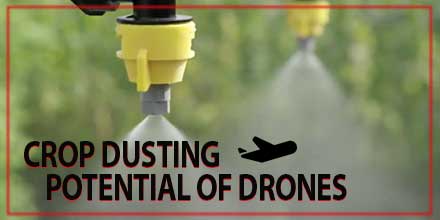
Today, designers and manufacturers of unmanned aerial vehicles are turning their attention to the farm industry. One area of interest is the potential of crop dusting drones. And with drones featured heavily at agricultural shows, farmers are increasingly aware of their potential.  

Industry takes notice

A number of UAV companies – manufacturers and businesses alike – have made inroads into the crop dusting industry. Drone manufacturer DJI recently released the DJI Agras MG-1. Designed specifically for agriculture, it features eight rotors powerful enough to lift over 22 pounds of spraying liquid. Integrated Precision Agriculture, out of Galesburg, Illinois, is currently conducting spraying tests with local farmers. IPA hopes to begin commercial operations early next year once its license is approved. Currently IPA is using two drones – a DJI Inspire for land surveying and a larger vehicle for spraying crops. The company reports that enthusiasm for its surveying and spraying services from farmers is high. The use of drones to spray crops on large farms is similar to the traditional methods widely used today. However, drone technology does offer many useful advantages in crop dusting. To begin, drones can survey crops and gather data on large tracts of land affordably and relatively quickly. Furthermore, with the ability to map the drone's flight path, UAVs are actually a more efficient method of crop dusting.  

Environmental factors

Another crucial benefit is the reduction of chemical drift. Traditional crop dusting planes fly at higher altitudes. This greater height allows some of the pesticide to drift into neighboring fields and environments. Drones, in contrast, offer more targeted dusting. Drone can fly much closer to crops which, in turn, can reduce chemical drift. Plus, drones are battery powered which adds to its environmental credentials. As advances continue, the full potential of crop dusting drones is just a matter of time. What farmer's choose to do with this emerging technology is still in question. Early adopters may simply hire commercial companies such as IPA to replace traditional methods. Other farmers may choose to invest in the technology and conduct their own spraying flights - gaining full control over both projects and expenditures. It is clear that drones have a lot of potential in the crop dusting industry. The many benefits they afford both farmers and the environment makes them an excellent fit for the task at hand.