Industry News

FAA Summer Webinar Series about Waivers Continues with Dark Night: Part I and II

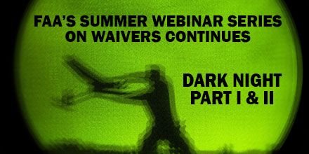
The Federal Aviation Administration (FAA) continues its Summer Webinar Series with Dark Night Part I and Part II. These webinars are no-cost. Any drone operator who is interested in obtaining a daylight operations waiver (107.29) to conduct night-time operations is welcome to attend. Due to heavy demand, the FAA lifted capacity restrictions. Now, both registered and non-registered individuals are invited to login.  

Dark Night: Part I

Dark Night: Part I is on Tuesday, July 24 at 1 pm EST. Discussion centers around the unique challenges involved with operating at night. Additionally, the webinar aims to help operators understand how best to describe the proposed operation -- as is required in the Waiver Safety Explanation Guidelines (WSEG). The one-hour webinar includes time for attendees to ask FAA experts about the application process.  

Dark Night Part II

Dark Night: Part II is on Thursday, July 26 at 1 pm. The topics covered include questions 2-5 of the WSEG. The webinar runs for 30-minutes.  

Accessing the Webinar

The FAA's Summer Webinar Series is hosted entirely online through Adobe Connect. The FAA encourages attendees to login at least 15-minutes prior to the webinar. Those interested in attending can connect via two methods:
  1. Download the Adobe Connect smartphone app and click here. Select the "Enter as a Guest" option; provide a Name and click, "Enter Room".
  2. Officially register for the Summer Webinar Series, by clicking here.
Keep in mind, playback media requires flash. Check to ensure your device has the latest version of Adobe Flash Player. To submit questions to the FAA experts, ensure your microphone works. Participants can always refer to the Adobe Connect How-To guide (PDF). The Summer Series Webinars are free of charge.  

Future Webinars Include:

The FAA began the Summer Webinar Series to help drone operators submit better waiver requests. Each webinar is live and allows attendees to ask FAA experts waiver questions. Upcoming webinars, include: August 7 @ 1 pm EST The Good, The Bad, The Ugly - Using real examples, this session reviews the differences between a success and unsuccessful waiver application. August 21 @ 1 pm EST: Beyond Visual Line of Sight - Why is this so difficult to obtain? This episode focuses on the "holy grail" of waivers. September 4 @ 1 pm EST: Operating Limitations: Altitude - Learn how to fly above the 400' altitude ceiling with an operation limitation (altitude) waiver. September 18 @ 1 pm EST Operations Over People - Why are there so few approvals for this waiver? Session addresses the mitigation necessary to ensure an operation doesn't endanger people on the ground  

Past Webinars

Drone operators who missed previous sessions of the series are in luck. Operators can view each webinar via the FAA's official YouTube channel. Past webinars, include: Where is my Waiver - Find out what is involved in the waiver application process. Learn how to apply for what you really want. Risky Business - Successful waivers include detailed risk assessments. Learn how to identify hazards, assess the risk they pose to your operation and develop methods to reduce the identified risk. Just the Facts - The importance of good data to support your proposed operation and safety case is key to successfully applying for a waiver. Learn why Requests for Information positively support your application and what to do in your safety mitigation.

FAA Warns Operators of Drone Registration Scams

The Federal Aviation Administration (FAA) wants to warn drone owners – especially hobbyists—about companies offering to “help” register their drones with the agency. Remember, the FAA Drone Zone is the place operators should go to register a drone...and it costs only $5.00.  

Drone Registration Scams

There are a number of entities that offer to help drone owners and operators file an application for a registration number. Some attempt to mimic the look of the FAA’s website with similar graphic design and even the FAA logo. Some websites lead visitors to believe they are somehow  “approved” by the agency. They aren’t – and drone operators could potentially lose money. The FAA neither regulates these entities nor will speculate on their legitimacy. However, the FAA recently received reports of vendors charging exorbitant fees up to $150.00 for this service.  

FAA Drone Zone

The actual FAA registration fee is $5.00. For that charge, hobbyists receive one identification number which covers all the drones they own. All others pay the registration fee for each drone they intend to operate. The FAA strongly advises operators to avoid registering unmanned aircraft anywhere but at the FAA Drone Zone. It’s the one site guaranteed to ensure a drone is legally registered and that users get their money’s worth.

Introducing the HA32 UAV Antenna from Hemisphere GNSS

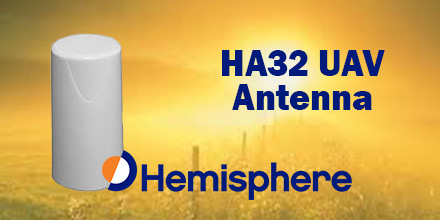
Hemisphere GNSS recently announced the launch of its all-new multi-GNSS, multi-frequency 4-helix HA32 UAV antenna. The HA32 is a high-performance antenna. It supports GPS, GLONASS, Galileo, BeiDou, and Hemisphere's Atlas L-band correction service. Designed specifically for UAVs, GIS, surveying, and RTK. It is also highly suitable for applications requiring high-precision positioning and navigation.  

Proprietary Technology

The HA32 is built on proprietary 4-helix antenna technology. It provides high filtering and anti-jamming performance with LNA features such as low noise figure of 2.0 dB (typical) and up to 30 dB gain (typical). Suitable for most outdoor and harsh operating environments, the HA32 antenna is sealed in a durable and ruggedized IP67-rated enclosure. It is also equipped with an O-ring. The lightweight (40 g typical) and compact (40 mm x 75 mm) design of the antenna makes it resistant to wind when installed on UAVs. It offers easy integration with a single SMA RF connector. “We are very excited to introduce this extremely competitive entry-level UAV GNSS antenna for a wide range of positioning and navigation applications such as UAVs, GIS, and RTK,” said Miles Ware, Director of Marketing with Hemisphere GNSS.  

Hemisphere Atlas

Hemisphere’s Atlas is a flexible, scalable GNSS-based global L-band correction service which provides robust performance and correction data for GPS, GLONASS, and BeiDou. Atlas delivers correction signals via L-band satellites to provide sub-meter to sub-decimeter level accuracy. It leverages approximately 200 reference stations worldwide, providing coverage to virtually the entire globe. Atlas is available on all Hemisphere Atlas-capable single and multi-frequency, multi-GNSS hardware. It complements third-party GNSS receivers by using Atlas corrections with Hemisphere’s BaseLink and SmartLink capabilities. Using multi-frequency hardware, Atlas creates faster convergence times, and is robust and reliable in canopy or foliage covered areas. Atlas Basic provides users of both single and multi-frequency Atlas-capable hardware the ability to achieve better than SBAS performance anywhere in the world where the Atlas correction service is available. Atlas Basic offers a proven accuracy of 30 cm (pass-to-pass 95%) to 50 cm (absolute 95%) and instantaneous sub-meter accuracy.  

Shop Hemisphere GNSS at Unmanned Systems Source.


Raytheon Develops Unmanned Vehicle Swarm Technology

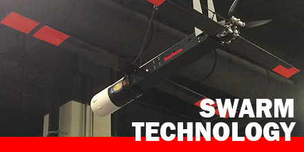
Raytheon‘s BBN Technologies announced it is developing technology to direct and control swarms of small, autonomous air and ground vehicles. This technology falls under DARPA’s Offensive Swarm-Enabled Tactics program. The technology includes:
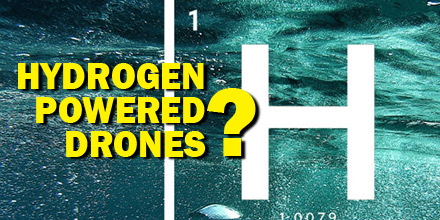
  • a visual interface that allows “drag and drop” creation and manipulation of drone tactics
  • a game-based simulator to evaluate those tactics
  • a physical swarm testbed to perform live tactics evaluations
“Operators use speech or gestures to control the swarm. This is a tremendous advantage during operations,” said Shane Clark, Ph.D. and principal investigator on the program. “The system provides sensor feeds and mission status indicators for complete situational awareness.”  

Flexible, scalable

The flexible, scalable programming software and simulation environment means users can coordinate drone behaviors in teams composed of different vehicle types that use various sensors. DARPA is inviting additional organizations to participate in OFFSET as “sprinters” through an open Broad Agency Announcement. Sprinters can create their own novel swarm tactics and the Raytheon BBN team will work with them to evaluate the tactics in simulation, and possibly field them for live trials. In 2016, Raytheon, as part of the Office of Naval Research LOCUST program, conducted demonstrations that successfully netted together 30 Coyote UAVs in a swarm.  

Hydrogen Powered Drones: The Wave of the Future?

Battery life. This continues to be one of the biggest challenges for drone operators. Currently, the average flight time of most consumer drones is limited to around 20 minutes. Of course, this number varies depending on many things - weather conditions, payload, etc. Ultimately, though, battery life continues to be a challenge for long flight operations. Eventually, a drone must return and recharge or switch out batteries before operations can continue. Battery manufacturers, of course, continuously work to improve battery technology. But, there may be a completely new solution on the horizon...hydrogen fuel cells. Recently, researchers in Sydney, Australia, successfully conducted UAV test flights using hydrogen-powered fuel cells. The results were promising.  

Hydrogen: the future of drone power?

Hydrogen is one of the cleanest energies available on earth. Though hydrogen fuel comes with some risks, the National Hydrogen Association argues that most are overblown. With careful use by qualified professionals, hydrogen may provide the answer to the challenge of a short battery life. The research in Sydney seem to bear this out. Previously, the team tested hydrogen-only fuel cells and determined they were a viable energy source for drones. The most recent tests used a triple hybrid propulsion system which included a combination of batteries, hydrogen fuel cells and a super capacitor. The hybrid propulsion system helped researchers improve the robustness and flexibility of hydrogen fuel powered drones. Plus, the hydrogen fuel provided much greater range and endurance when compared to electric powered UAVs. As such, if the technology develops it could have a revolutionary effect on the drone industry. Benefits include longer flight time, improved flight efficiency, and the development of more advanced UAVs.  

The Wave of the Future?

If the finding by the scientists in Sydney and by other similar projects are anything to go by, it would seem that hydrogen powered drones are the wave of the future. For one, the use of hydrogen enables drone operators to conduct their work for longer periods without interruptions. Plus, continued development of this technology would eventually result in decreased cost and greater implementation. Advantages of using hydrogen fuel cells extend beyond improved efficiency and flight times, too. Plus, vehicles powered by hydrogen fuel cells have faster take-off, enhanced climbing ability and more stable flying. The fuel is more environmentally friendly. It produces no carbon dioxide emissions. In addition, hydrogen-powered drones tend to be much quieter than conventional electric powered ones.  

Overall outlook

Currently, the price tag of this technology is a hindrance to many potential users. Driving down hydrogen fuel cell costs is one of the challenges of widespread adoption of this technology. Researchers in Sydney believe the hybrid solution they implemented could be key to lowering costs. And hybrid technology, similar to hybrid cars which utilize a combination of fossil fuel and electric batteries, may be one way to gain widespread adoption. With so many benefits, hydrogen-powered drones could indeed be the wave of the future.  

Survey Drones and the Future of Road Construction

In recent years, it’s fair to say that drones have come a long way in terms of mainstream acceptance. From the initial skepticism of both the ordinary public and commercial entities, drones moved beyond niche hobbyists to one of the most in-demand technologies. Now, the technology is disrupting the road construction industry, as well.  

Drones and road construction

With the advancement in sUAS coupled with lowered cost, drones use continues to expand into more and more applications. In most cases, drones offer improved efficiency in data collection. Plus, UAVs reduce operational costs by replacing manned aircraft needs and streamlining operations. In addition, drones access environments that may be inaccessible or dangerous for personnel. Now, drones are expanding into a new application: road construction and paving projects. This application expansion paves the way for greater efficiency and reduced costs for the industry. In addition, thanks to ever improving software, drones provide precise data collection, as well. Detailed 3-D survey maps depicting topography, utility lines, drainage slopes, existing hazards -- plus, high resolution images and video -- efficiently secures the data required for building plans and blueprints. This new tool-set may transform the industry.  

The benefits

Cost reduction may be one of the biggest drivers for the wide spread adoption of drone use in the road construction industry. After all, large infrastructure projects require tremendous sums of money. Any cost savings are welcome. For instance, replacing manned survey aircraft with a properly equipped fleet of drones. Furthermore, drones offer capabilities such as lower flight altitudes, hovering functions, and more. Additionally, training and licensing drone operators is less expensive and quicker than securing a pilots license. The use of the technology is not limited to large multinationals and governmental agencies. Privately run construction companies benefit, too. Improved efficiency allows for faster project completion and the ability to move onto new ones. Drone technology also helps improve the safety of construction sites. A drone can replace risky operations such as manned aircraft or abseiling crews.  

Future application adoption

Drone use for road construction surveying is still in its infancy. And, though governmental legislation lags behind the technology, construction companies continue to adopt this technology. The future for survey drones is very bullish, indeed.