Tag - Aeromao

Aeromapper Talon Completes Single-Flight Survey of Island in The Maldives

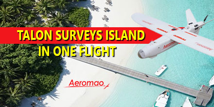
https://www.unmannedsystemssource.com/?s=aeromapper&post_type=product&product_cat=0In December Aeromao Inc., completed a full photogrammetric survey mission of an island with an Aeromapper Talon UAV...in one flight. The survey took place in collaboration with Foresight Surveyors. One of the most unique and exotic islands in the Maldives, the Talon surveyed a total area of approximately 251 acres or 1 Sq. Km. at a GSD of 2cm/pixel.
 

Talon Surveys Island

The Talon UAV flew at a cruise altitude of 100 m AGL and collected 1422 photos with an amazing level of detail. Pix4DMapper software generated a DSM, orthophoto and point cloud. Though the Aeromapper Talon has 2 hour flight endurance capability, the mission finished successfully in only 45 minutes. The UAV flew at a maximum distance from the ground control of 2km. Additionally, the Talon launched and was recovered via parachute from an island roughly 1 km away. The UAV flew without incident. The Aeromapper Talon was not equipped with PPK GNSS system, so 5 GCS points were taken on the island which resulted in a horizontal accuracy of 4.8cm  

The results

The purpose of the survey was to generate an ortho-photo to trace the "as-built" for future developments. Furthermore, the data provided clients with an up-to-date high resolution property map for the project department and decision makers. Also, the othophoto helped with their environmental monitoring and biodiversity mapping.
 

About the Maldives

The Maldives consists of 1,192 coral islands grouped in a double chain of 26 atolls. It spreads over roughly 90,000 square kilometers (35,000 sq mi) and is one of the world’s most dispersed countries. It lies between latitudes 1°S and 8°N, and longitudes 72° and 74°E. Composed of live coral reefs and sand bars, the atolls rise abruptly from the Indian Ocean. These islands are situated on a submarine ridge 960 kilometers (600 mi) long. Maldives is the lowest country in the world. As a result, its natural ground levels average only 2.4 meters (7 ft 10 in) and 1.5 meters (4 ft 11 in) above sea level. However, in areas where construction exists, ground levels have increased several meters.  

About Foresight Surveyors

The first company to introduce unmanned aerial vehicle mapping to the Maldives, Foresight Surveyors chose the Aeromapper Talon because of its ease of use, dependability and affordability. Foresight Surveyors provides a comprehensive range of surveying and survey related consultancy, including: topographical, bathymetry and engineering survey services. The company makes use of traditional techniques and modern technologies to produce accurate data.  

About Aeromao, Inc.

Founded in 2011, Aeromao Inc. is a leading manufacturer of UAVs. Aeromao developed the Aeromapper series of turnkey unmanned aerial vehicles for mapping, surveying, precision agriculture and remote sensing. Canada serves as the company's headquarters. Aeromao Inc. offers a line of products that adapt quickly to market demands and the unique needs of client applications. You can shop the entire line of Aeromapper UAVs at Unmanned System Source.

Aeromao’s UAV ready-to-fly packages land at Unmanned Systems Source

aeromao drone takeoffMarch 4, 2015 – Aeromao’s Aeromapper UAV product line along with their extensive payload options are now available at Unmanned Systems Source. Aeromao’s Aeromapper EV2, Aeromapper Talon, and Aeromapper 300 offer the best value fixed-wing UAV for survey missions and photomapping applications. “We are very excited to bring Aeromao onboard,” said Jennifer Jerrick, President of Unmanned Systems Source. “Their packaged UAV’s help meet the growing demand for consumer friendly, ready-to-fly UAVs.” The Aeromapper EV2 and Aeromapper Talon also offer hot-swappable capabilities for ultimate versatility and unlimited applications. Aeromao brings years of experience and a history of innovative endeavors in the area of UAVs for high-precision mapping and aerial photography uses. Their continued goal is to produce the best-selling, ready to fly UAV for aerial photography and photomapping at an affordable price point. Shop the full line of Aeromao products here.