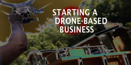
Drones have added a new dimension to a great number of industries and services. Once a pastime for RC enthusiasts, today this technology opens up new opportunities for entrepreneurs looking to start a business.
The real estate industry is one such sector that is taking advantage of the new technology.
It's easy to see how stunning, high definition aerial footage of a listing would benefit a realtor's marketing efforts. In fact, a growing number of realtor's are turning to this technology to gain a competitive edge, especially for their high-end listings. Drone enthusiasts have taken notice.
If you're considering a drone-based business geared towards the real estate industry, there are a number of factors to consider. Read on to learn the 6 top things to consider before you print those business cards.
Step One: Know the Rules and the Regs
It might seem like starting your business is as easy as purchasing a drone, opening the box and launching it into the sky. Well, not quite. In fact, besides securing the normal business licenses, it's important to understand what the FAA requires of all drone operators.
Did you know that there are
operational requirements for anyone who uses a drone to conduct business? This also includes the requirement to either hold a remote pilot airman certificate with a small UAS rating or be under the direct supervision of someone holding a remote pilot airman certificate.
To learn what the rules and regulations are and, most importantly, how they impact you, visit
Know Before You Fly. This non-profit organization is dedicated to educating prospective users about the safe and responsible operation of unmanned aircraft systems (UAS).
Step Two: Flight Proficiency and Safety
The next considerations are flight proficiency and safety; each are important for the initial and long-term success of your new venture. After all, work as a real estate drone photographer requires a high level of flying expertise. After all, this work involves flying in public places and over private property. One wayward move and the entire endeavor could end in disaster.
Flight safety classes area a great place to start.
Whether you take lessons from an approved instructor or decide to shadow an experienced pilot, it pays to put in the hours of practice. As mentioned above, the work of real estate aerial photography involves flying in public. As such, safety is crucial.
A flight safety class will also help you become familiar with your drone.
Once you or an appointed pilot are proficient in flying the drone it's time to consider the next step: choosing the aerial vehicle and equipment.
Step Three: The Right Drone and the Right Equipment
Before you purchase, ask yourself: what type of service do I want to provide? High definition video footage? Aerial photography? What equipment will I need to deliver those services?
There are countless drones and drone packages offered today. Your answers will help make your selection a bit more manageable.
The old adage remains true, you get what you pay for. Investing in a high quality drone usually means better flight capabilities and higher quality equipment. Take time to comparison shop to ensure you get the best bang for your buck.
Some drones come standard with gimbals and flight stabilization software. Others do not. Such equipment ensures the videos and photos you capture are as clear as possible - something that can give you an edge over your competitors.
Step Four: Market Research, Find a Niche and Establish Pricing
It is possible, with a little advanced work, to establish yourself as the go-to real estate photography expert in your area. To do so, it's going to take some research.
Find out who in your area is offering similar services and at what prices. Research how they are marketing their services. Do they have a website? Are they on social media platforms, if so, how are they using these platforms to sell their services?
As you determine pricing, make sure the packages take into account all the expenses you'll incur to provide this service. Consider any pilot fees, equipment costs and the like while maintaining reasonable fees for the area.
Don't limit yourself. There are other areas where your growing skills can be utilized in other industries such as building inspections or land surveying.
Step Five: Business Insurance
The drone industry is still in its formative years and, as of yet, there are no legal requirements for you to insure your drone. However, it is probably a sensible thing to do. From crashes to accidental fly-aways, there are a number of things that can go wrong in a drone related business.
It is also a good idea to meet with an insurance agent to find out how to best protect your entire business. After all, crashing a drone through a client's window is certainly a distinct possibility. Its best to have coverage that protects your business for any eventuality.
Getting your business insured may not seem worth it but consider the fact that damage to your drone or private property can put a hold on your business, or worse. Plus, it will give any potential clients peace of mind to know your insured.
Step 6: Keep an Eye on Costs
The main aim of starting your real estate photography business is to make money. It is easy to get carried away setting up a new business in an area you’re passionate about but a strong business mind is also required to succeed.
As such, it is important to keep an eye on costs. Keep expenditure to a minimum but at the same time never scrimp on quality as this will only affect your final results and customer satisfaction.
In your quest to create a successful business it is now also time to get the word out and acquire some clients. There are many ways to do this, including registering on drone services websites, reaching out to real estate companies, social media, and more. When reaching out to real estate offices persistence is important but remain courteous and professional as they can be quite busy.
The drone industry and its related business possibilities are still in their infancy. Creating a drone based business now will allow you to take advantage of future business opportunities. The tips above are a great place to start.

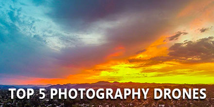 Like any technology that hits the mainstream, drones are changing a variety of industries and applications. One such area is photography.
Today, drones allow for previously unattainable views and angles in imagery. As such, UAVs have become an essential tool for anyone with an interest in photography, be it for recreational use or for business endeavors.
Whether you’re looking for a drone to help you achieve the best imagery, or you’re planning to integrate aerial photography into your business, finding the right drone is an important first step. The truth is that there are a number of good quality photography UAVs out there. The key to narrowing your focus is to define your specific needs and proceed from that point.
The list below can help you make an informed decision as to which drone will best meet your photography needs. With that in mind, read on to discover the top 5 photography drones that won't drain your wallet.
Like any technology that hits the mainstream, drones are changing a variety of industries and applications. One such area is photography.
Today, drones allow for previously unattainable views and angles in imagery. As such, UAVs have become an essential tool for anyone with an interest in photography, be it for recreational use or for business endeavors.
Whether you’re looking for a drone to help you achieve the best imagery, or you’re planning to integrate aerial photography into your business, finding the right drone is an important first step. The truth is that there are a number of good quality photography UAVs out there. The key to narrowing your focus is to define your specific needs and proceed from that point.
The list below can help you make an informed decision as to which drone will best meet your photography needs. With that in mind, read on to discover the top 5 photography drones that won't drain your wallet.
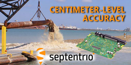 February 13, 2017 - Septentrio GNSS technology continues to provide solutions for challenging situations.
Case in point? The Belgian dredging, environmental and engineering group DEME. They rely on the accuracy and reliability of the AsteRx family of precise GNSS positioning solutions from Septentrio.
DEME is using Septentrio’s AsteRx GNSS receivers to obtain centimeter-level accuracy for all their dredging and marine construction operations worldwide.
These receivers are designed to operate in difficult conditions. From ice-covered Arctic ports to the tropical climates of Southeast Asia; whether dredging a few meters from the coast line to constructing wind turbines kilometers out at sea.
February 13, 2017 - Septentrio GNSS technology continues to provide solutions for challenging situations.
Case in point? The Belgian dredging, environmental and engineering group DEME. They rely on the accuracy and reliability of the AsteRx family of precise GNSS positioning solutions from Septentrio.
DEME is using Septentrio’s AsteRx GNSS receivers to obtain centimeter-level accuracy for all their dredging and marine construction operations worldwide.
These receivers are designed to operate in difficult conditions. From ice-covered Arctic ports to the tropical climates of Southeast Asia; whether dredging a few meters from the coast line to constructing wind turbines kilometers out at sea.
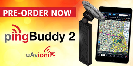 February 8, 2017 – Unmanned Systems Source is pleased to announce that the PingBuddy 2 from uAionix is now available for pre-order.
Units are expected to ship at the end of March 2017.
Thanks to its small form-factor and inexpensive price, the original PingBuddy ADS-B receiver was a popular choice with prosumers and hobbyists, alike.
uAvionix continues its path of innovation by offering a number of improvements to this popular item.
February 8, 2017 – Unmanned Systems Source is pleased to announce that the PingBuddy 2 from uAionix is now available for pre-order.
Units are expected to ship at the end of March 2017.
Thanks to its small form-factor and inexpensive price, the original PingBuddy ADS-B receiver was a popular choice with prosumers and hobbyists, alike.
uAvionix continues its path of innovation by offering a number of improvements to this popular item.
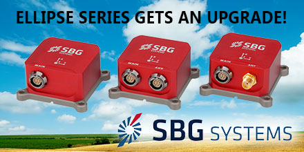 January 31, 2017 – SBG Systems announced the release of a new version of the Ellipse Series, its popular product line of miniature inertial sensors.
The Ellipse is greatly improved, showing unmatched performance in attitude measurement while adding Galileo constellation to its GNSS receiver.
After thousands of Ellipse miniature inertial sensors operational on the field, SBG Systems proves again its capability of continuous innovation.
With these improvements, the Ellipse line of miniature inertial sensors strengthens its position as “best combination of innovation, performance, and reliability” while keeping the same form factor and price level.
Due in part to its small form factor and powerful performance, the Ellipse Series is a popular sensor for Unmanned Systems. It is also an affordable all-in-one solution that provides accurate attitude and position in real-time for Unmanned Systems whether they are terrestrial, aerial, or marine.
January 31, 2017 – SBG Systems announced the release of a new version of the Ellipse Series, its popular product line of miniature inertial sensors.
The Ellipse is greatly improved, showing unmatched performance in attitude measurement while adding Galileo constellation to its GNSS receiver.
After thousands of Ellipse miniature inertial sensors operational on the field, SBG Systems proves again its capability of continuous innovation.
With these improvements, the Ellipse line of miniature inertial sensors strengthens its position as “best combination of innovation, performance, and reliability” while keeping the same form factor and price level.
Due in part to its small form factor and powerful performance, the Ellipse Series is a popular sensor for Unmanned Systems. It is also an affordable all-in-one solution that provides accurate attitude and position in real-time for Unmanned Systems whether they are terrestrial, aerial, or marine.
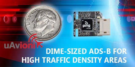 January 30, 2017 - uAvionix Corporation based in Palo Alto, California continues to innovate within the ADS-B transceiver market.
Today, uAvionix announced the development and test of a dime-sized transceiver weighing less than 1 gram.
UAvionix worked under a Collaborative Research and Development Agreement with the FAA and other partners to test this prototype.
January 30, 2017 - uAvionix Corporation based in Palo Alto, California continues to innovate within the ADS-B transceiver market.
Today, uAvionix announced the development and test of a dime-sized transceiver weighing less than 1 gram.
UAvionix worked under a Collaborative Research and Development Agreement with the FAA and other partners to test this prototype.