Drones have transformed a number of industries and services in addition to creating many new ones. The growth of drones is proof of how advancements in technology help perform certain tasks better and more efficiently.
Today, engineers are developing software that allows a swarm of drones to map areas affected by oil spills. Their work is inspired by the swarm and communication behavior of insects and birds.
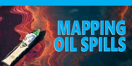
However, given the very location of these disasters, surveying and mapping oil spills at sea or along coastlines is a difficult task. Accurately assessing the level of damage can be a tricky proposition. Researchers believe drones could provide a solution.
Just as ants converge in the thousands to find and carry food to their colony, engineers believe a swarm of low-cost drones could aid in the mapping of oil spills.
Swarms of Drones
Souma Chowdhury, an assistant professor of mechanical and Aerospace engineering at the University of Buffalo’s School of Engineering and Applied sciences, believes a swarm of drones for mapping applications is a possibility.
Chowdhury and his team are pioneering a program that directs a swarm of drones to map an oil spill quickly. Although, the engineer argues, nature may seem random, mathematical principles can help explain swarm behaviors. The key is identifying the right principles so humans can tap into swarm behavior to help solve a range of complex issues, including oil spills.
His team recently presented their vision in a paper at the American Institute of Aeronautics and Astronautics and Technology.
The study simulated the use of a swarm of five drones that mapped a kilometer long spill area. The drones completed this task in less than ten minutes -- which is significantly faster than traditional oil spill-mapping methods currently in use. Plus, swarm mapping drones could provide other benefits.
More efficient means
Mapping oil spills via drone swarms creates efficiency in a number of way. First, a drone swarm's programmed flight pattern avoids areas previously mapped. In addition, drones are programmed to record whether they are over water or oil as well as assume that any space around the spill is also oil. All the while, information is shared among the swarm, in contrast to sharing images or video, thereby using less bandwidth and improving efficiency.
Drones also have the ability to take off and land from a boat and return autonomously when their batteries are low. The UAVs deploying to replace returning drones have the data they need to continue the mapping mission. This shared information is another trait borrowed from the animal kingdom, with the engineers stating that communication is the basis of any swarm.
Remarkably, if drone mapping proves feasible, it requires no human intervention throughout the whole process. Thus, oil spill mapping can take place quickly, even in treacherous conditions.
Low-cost, hi-tech solutions
Chowdhury’s approach tackles a complex problem using simple UAV technology. The engineers used low cost drones outfitted with $35 Raspberry Pi computers, oil spill-mapping software, and affordable cameras.
As far avoiding collisions in flight, Chowdhury looked to nature for inspiration. Researchers at the University of Queensland observed that parrots avoided collisions simply by veering to the right when flying. The engineers seek to implement this principle. The plan is to program drones to turn at a right angle if they sense another is too close.
This developing technology has wider applications for a variety of tasks. In the future, swarms of drones will quickly map forested areas or natural disasters unreachable by humans. Chowdhury’s swarms of smart drones could prove one of the most innovative and important uses of drone technology to date.
