 High-precision GPS receivers mounted on drones able to identify 1mm hairline defects in cooling towers
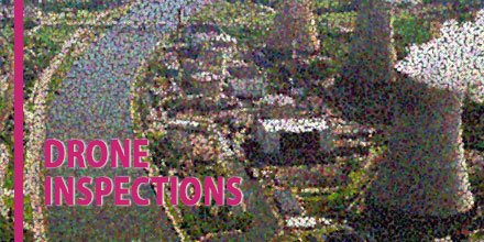
How do you inspect a structure that’s almost 160 m high and 120 m in diameter? With a few weeks to spare, a crash course in abseiling and a head for heights, a person could certainly give it a go.
Imagine, however, that you need to collect enough data for a 3D model with the precision of 1 mm…all within a week.
This was the challenge facing Aetos Drones. The company was tasked with inspecting a cooling tower at Tihange Nuclear Power Station near Liege in Belgium.
The three reactors at the Tihange Power Station came online between 1975 and 1985. This makes the oldest of the three over 40 years old. Cooling towers built in this era have a life expectancy of 15-20 years. But, with careful maintenance, the lifetime can extend a further 20 years.
The Tihange reactors contribute about 25% of all electricity generated in Belgium. The plan is to decommission the towers in 2025. Until then, the cooling towers need to be kept in good working order.
Fortunately, drones equipped with highly precise and reliable GPS receivers can help.
Pressurized Water Reactors, such as at Tihange, have cooling towers. These towers supply cold water to the condenser which works to cool the steam back into water. The steam drives the electricity-generating turbines.
Cooling towers are elegantly simple in their operation. Warm water from the condenser sprays into the tower through a network of sprinklers, warming the surrounding air and causing it to rise. This in turn draws cooler air in through openings in the base of the tower maintaining a constant, natural draft of cool air through the tower.
Corrosion is a possibility in any system where water plays a part.
Cooling towers are hollow, thin-walled structures made from reinforced concrete. Over time, the humid environment can corrode the metal elements of the tower. In every cycle through the cooling tower, about 2% of the water evaporates forming the characteristic steam clouds. This increases the salt concentration in the remaining water which increases its corrosive power.
In addition, high winds and winter icing can also cause damage and weaken the cooling tower.
Aetos Drones, were called in to carry out the inspections. And, Belgian’s first certified drone pilot, Lieve Van Gijsel, took the helm.
An octocopter fitted with a high-resolution camera, a RADAR system and an AsteRx-m UAS receiver conducted the inspection. The air vehicle took photographs at regular intervals as it traveled vertically up and down the sides of the cooling tower.
The RADAR system was AIRobot’s Ranger, an add-on sensor specifically designed for distance detection on UAVs. The octocopter needed to get close enough to get quality images. However, the octocopter needed to maintain enough distance so as not to risk getting tossed around by the turbulence generated by the tower.
Over the course of 4 days, more than 19,000 photographs of the cooling tower were taken.
During the flight, the AsteRx-m UAS receiver logged GNSS measurements and the exact time each photograph was taken.
After the flight, these shutter times and GNSS measurements were combined with GNSS measurements from a nearby base station using Septentrio’s GeoTagZ software. As such, each photograph was stamped with the cm-level precise RTK position of the camera – the ideal input for the next processing stage.
After processing with GeoTagZ, the photographs were then uploaded to the photogrammetry software Agisoft PhotoScan. Over the course of several days, the photographs were stitched together to produce a highly-detailed 3D model of the cooling tower, precise to the level of 1 mm. Experts at Tihange then analyzed the surface of the cooling tower down to any required level of detail.
3D inspection models with 1 mm resolution are made possible using high-quality, multi-frequency GNSS measurements from high-end receivers like the AsteRx-m.
Not only does the positioning have to be precise, it has to be reliable. This requires: accurate error models, continuous tracking during mechanical jolts and advanced satellite integrity monitoring (RAIM).
For large-structure inspections, such as this, multi-constellation positioning is essential to ensure there are always enough satellites available to work with. The receiver will also need a good multipath mitigation filter (APME) to disentangle direct and reflected satellite signals to avoid jumps in the calculated position.
The AsteRx-m UAS established itself as the receiver of choice for UAV applications requiring high-precision positioning. With the recent release of the AsteRx-m2 UAS, drone inspections can take on applications at an entirely new level of difficulty.
The AsteRx-m2 UAS adds BeiDou and Galileo as well as L5 frequency tracking. It also includes the AIM+ interference mitigation system. The additional constellations allow operation in areas where overhead structures limit the scope of single and dual-constellation receivers.
Shop Septentrio’s line of high accuracy receivers at Unmanned Systems Source.
