 In a world increasingly reliant on technology to function, cyber security has quickly become an important issue.
Which begs the question, how safe is your drone from a hacker attack?
Experts predict that the hijacking of drones may be one of the next big cyber threats; which raises the potential for worrying possibilities.
In its 2017 Threats Predictions Report, McAfee Labs listed drone hijackings as one of 14 cyber security issues for the coming year. The report noted that attacks against hardware – such as mobile devices and drones – would increase in 2017.
Drone-jacking is the act of taking control of a drone by hacking into its operating system. While some hackers do this for fun, the biggest threats come from individuals with malicious intent.
Hacks of major sites demonstrate that the devices we now rely on are at risk. With their popularity and consumer success, drones have become a part of that conversation.
One of the growing concerns? Many consumer drones lack adequate protection against hacking. And, unfortunately, even responsible drone operators are at risk.
From recreational users to emergency responders and industrial uses, drones are becoming an integral part of life. Major tech companies such as Amazon, UPS and Domino’s are actively testing drones for use in the delivery of goods. As the number of drones in operation increase, experts fear drone-jacking may be a common occurrence.
The risks associated with drone-jacking are varied. Such dangers range from the potential loss of expensive drones and equipment to the destruction of private property.
For instance, reports of near misses with commercial airplanes could turn from problematic to catastrophic should the drone fall into the wrong hands. Also, military drones could be diverted from their official task and used as lethal missiles by criminal hackers.
In addition to the serious security risks stemming from drone-jacking, commercial operators also stand to lose out. Delivery drones could also be at risk of getting hijacked. Thus, robbing the company and inconveniencing customers, at the very least.
Likewise, most drones still cost a significant amount of money and come equipped with expensive equipment and accessories. So, replacing a drone in the event of a jacking comes at financial cost to the owner.
Thankfully, for every hacker with ill-intentions there are many more fighting for the good use of technology. Many security firms are currently working on strengthening UAV systems.
However, even as more effective defense measures are conceived, attackers continue to develop counter measures.
It is more and more imperative that Drone owners, particularly commercial operators, become vigilant about their hardware’s security. Simple steps include: staying informed, investing in the latest security and keeping software updated.
Other measures include improving the protection of data and software systems related to the UAV as well as detection capabilities and response.
Measures also include protecting the ground controller; if it is a tablet or smartphone using anti-virus software. Pilots may wish to consider using a VPN service to protect the devices’ internet connection from hackers, as well. Other users recommend varying your flight paths to reduce the chances of your UAV becoming an easy target for hackers looking to intercept it.
As a whole, the industry needs to continually develop solutions that make attacks more difficult and expensive for perpetrators to carry out.
In conclusion, both drone enthusiasts and commercial operators need to invest in security as well as robust equipment and technology. Drone-jackings may be the wave of the future but drone owners have steps they can take to protect themselves and their equipment.
 Before you fly, review the steps below to make sure your first flight is a success.
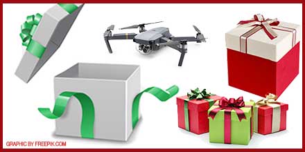
December 22, 2016 – Last Christmas the FAA estimated that over 1 million individuals received a drone as a gift. This year, that number is expected to rise.
The continued popularity of drones, coupled with increased selection and lower prices, means a fair share of holiday gifts will include a drone.
However, with that gift comes responsibility.
So, what exactly do first time flyers need to do before taking that drone out for a spin? Read on to find out.
Whether a drone is for commercial purposes or simply for fun, it must be registered with the FAA. Any drone weighing between 0.55 lbs. and 55 lbs. must be registered. The registry helps create accountable flyers and safer skies.
Any time you fly, make sure you bring your registration information with you. Think of it like a fishing license, it doesn’t do you much good sitting at home. Registration costs $5 and it is a much cheaper than paying a fine up to $27,500 in civil penalties for flying unregistered. Unregistered drones, coupled with criminal penalties, are far steeper and could cost an operator up to $250,000.
Save yourself the stress and risk; take 5 minutes, spend $5 and register your drone with the FAA.
The rules for hobbyist drone operators are quite simple:
As for commercial flyers, they have additional requirements and guidelines they must follow. Plus, there are tests they must pass and licenses they must secure before operating their vehicle.
Those open skies aren’t as open as you may think. In fact, our airspace is crowded with all types of air traffic – commercial and recreational, alike. It is your responsibility to understand what is going on above and around the area you are flying your drone.
It is good practice to stay away from dense, urban areas. Dense areas are littered with trouble spots for drones: powerlines, pedestrians, private property, and moving vehicles…to name a few. Keep it safe, fly in deserted areas far from the city. Also, remember to stay at least 5 miles away from an airport.
That drone may not be as rugged as you think. Keep your equipment safe, take a moment to look at weather conditions. High winds? Low visibility? Air pressure changes? These factors, and more, can significantly impact your drone’s performance…as well as yours, as a novice flyer. For instance, flying in stiff winds can impact the life of your battery and, thus, decrease flight endurance.
As you may guess, it takes a lot of time and a lot of practice to become a proficient drone operator. Though the drone may come out of the box ready-to-fly, it doesn’t mean the operator has the skills to keep it from crashing.
If you’re just starting out, take your time. Get familiar with your drone. Read the manuals. Become comfortable in your operational controls. Practice take-off and landing before venturing out. Once you’re ready for a longer flight, keep it safe…follow the recommended guidelines.
As the skies continue to fill with drone traffic, the actions of individual operators are sure to determine the pace and integration of this technology into daily life. Follow the rules and enjoy!
 December 19, 2016 – With all the new FAA regulations taking affect, many drone operators – professionals and hobbyists, alike – are asking a very important question: “Where can I fly my drone legally?”
As you know, the FAA has rules defining where and when commercial operators and hobbyists can fly legally. The rules, of course, differ for each group.
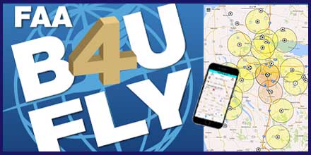
To provide clarity, the FAA developed the B4UFLY app to help operators quickly determine where they can fly legally. The app is offered for both iOS and Android systems.
The B4UFLY app uses the GPS in your phone or tablet to determine your current location on the map. It then uses this information to determine if it is safe and/or legal to fly.
The FAA describes the app as, “providing model aircraft users with situational awareness by considering the user’s current or planned location in relation to operational restrictions to derive a specific status indicator.”
The color coded status indicators inform operators if flight is prohibited, if action is required of the flyer, or if there are no FAA flight restrictions other than standard safe operation of the craft.
The map function does not allow users to view flight status of locations other than where the device is currently. Though user ratings for the app are low, software updates may resolve some of the ongoing issues. If not, there are several apps available that provide similar information.
As regulations continue to evolve, apps such as B4UFLY provide flyers with a valuable resource to help them quickly and easily determine if it is safe and legal to fly. Take a look at your options and consider downloading an app that helps you keep your flight time safe, fun and legal.
![]()
![]() Download the B4UFLY app:
Download the B4UFLY app:
Google Play for Andoid or iTunes for iOS.
 What exactly is ADS-B and do I need it?
Automatic Dependent Surveillance – Broadcast (ADS-B) is part of the Federal Aviation Administration’s NextGen air traffic control modernization mandate. This mandate requires all aircraft within US airspace to transmit “ADS-B Out” information to ADS-B ground stations and other ADS-B equipped aircraft by 2020. The transmitted information includes aircraft identification, altitude, speed, and velocity – thus, creating a new, real-time situational awareness and surveillance program.
Additional system upgrades may allow aircraft to fly outside the typical strict air traffic corridors, thus, introducing more “bandwidth” by expanding into areas that were previously not utilized. Air traffic control towers may also expand into new areas since ADS-B data is available anywhere over the internet.
Currently, several countries utilize ADS-B, including Canada and Australia, with Europe and Asia rolling out their own systems in the coming years. With the mandate looming, many pilots are looking for affordable ADS-B technology solutions they can integrate into their setup.
The ADS-B system is comprised of multiple parts, including ground stations and aircraft installed equipment. The ADS-B equipment package installed on the plane includes a GPS unit for providing location information, processing hardware, and antennas for transmitting and receiving the ADS-B signals.
ADS-B receiver ground stations pick up ADS-B information broadcast by aircraft flying over head. This information is used by air traffic controllers as a supplement to radar-based tracking.
Airspace safety should improve by giving pilots and air traffic controllers additional information about the position of each aircraft in the system, which should help prevent mid-air collisions or close calls during takeoff and landing. As systems such as ADS-B come on-line, existing flight corridors should safely handle an increasing number of daily flights by adding accuracy and redundancy to the existing airline tracking systems.
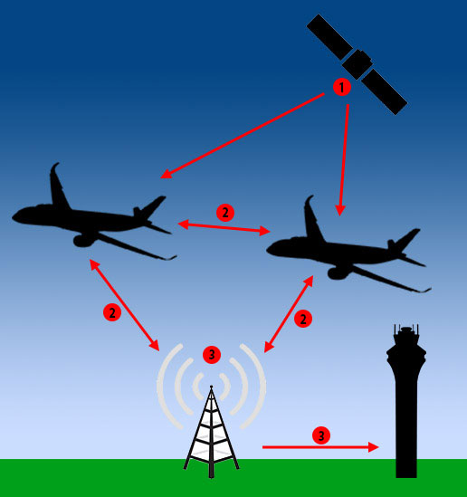 1. GPS satellites provide location information to ADS-B equipped aircraft.
2. ADS-B equipped aircraft transmit altitude, speed and velocity information to other ADS-B equipped aircraft and ADS-B ground stations.
3. ADS-B ground receive stations provide aircraft location back to other aircraft, as well as air traffic control centers.
“ADS-B In” systems can be installed on any aircraft to display location information of other aircraft with ADS-B Out transmitters.
Aircraft also transmit their location directly to other “ADS-B In” equipped aircraft within their transmit area. Thus, forming a long-range mesh network that shares real-time position information.
For pilots flying with Visual Flight Rules cockpit-based ADS-B receiver displays provide earlier warning of aircraft in their flight area. This helps improve safety during inclement weather conditions.
For operators of ADS-B ground stations, Southwest Antennas offers a high performance omni-directional antenna that operates at 1,090 MHz. This product was designed specifically for the ADS-B market; with a peak gain of 5.5 dBi which occurs 5 degrees above the horizon. This design offers long range performance for air-to-ground communication. It features an optimized horizontal pattern to help pull in signals from aircraft that are close to the ADS-B station or at high elevation angles. This antenna is designed for compatibility with any ADS-B receiver.
As more aircraft fill existing routes, ADS-B helps air traffic controllers and pilots track active aircraft with more precision. These improvements not only increase safety but work to ensure the drone industry integrates smoothly and safely into national airspace.
Special thanks to Adam Krumbein of Southwest Antenna for allowing us to reprint this news item. Be sure to shop Southwest Antennas entire line to find affordable solutions for your next project!
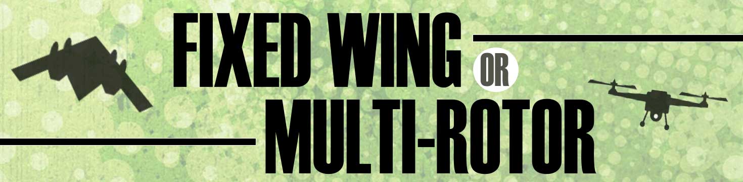
Should I buy a fixed-wing or a multi-rotor for my application?
At Unmanned Systems Source, we receive calls on a daily basis from customers who ask this very question. We always follow up with a question of our own, “I’m not sure, it depends. What’s your application?”.
And so begins a conversation.
Choosing between a multi-rotor or a fixed-wing is not always a straight forward choice. In fact, there are a number of factors that should be considered before making a selection.
Common questions we ask interested buyers, include: What are the project objectives? How much area needs to be covered? What sort of flight duration is required? Are you collecting data? What is your payload? What is your experience level? And, finally, what is your budget?
Once we understand the client’s needs and the operational environment, the choice comes into focus.
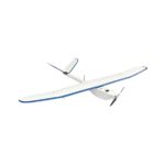
Fixed-wings are generally better suited for rural environments and are work horses for many commercial and scientific applications. Though they may not offer the maneuverability of a multi-rotor, when it comes to flight times and coverage, fixed wings excel.
Other advantages include:
In regards to the operational area required, it depends on the vehicle. Fixed wings need more space for takeoffs and landings. While hand-launched models deploy quickly, others require a launching rail.
The initial costs to purchase a fixed-wing systems are higher but these systems are fairly inexpensive to maintain due to their simpler design. And there is usually less operational “down-time” for fixed-wings.
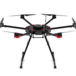 Multi-rotor Considerations
The use of multi-rotors has exploded in recent years in large part due to their affordability and ease of use. But multi-rotor advantages certainly extend beyond these two points.
Other advantages include:
In flight, multi-rotors are incredibly maneuverable and can hover which make them the preferred choice for detailed inspection work and urban areas where space limitations are at a premium. They are also the obvious choice for video and photography work.
Though multi-rotors provide only limited flight duration (15-20 minutes on average), their operational flexibility makes it a favored choice for many urban applications.
Ultimately, the choice between a multi-rotor or fixed-wing for a specific application depends on a variety of factors. Understanding the strengths and limitations of each vehicle goes a long way in helping inform your decision.
Click here for the Fixed Wing or Multirotor Infographic!
 Ideal for HD video and high speed data transmission and reception from mobile platforms and offers great improvements to spatial diversity and spatial streaming in MIMO radio systems.
Southwest Antennas is pleased to introduce its new small form factor “Turbo Cloverleaf” family of circularly polarized (CP) Omni antennas in 1.98 – 2.2 GHz and 2.3 – 2.5 GHz frequencies.
These new and innovative antenna products deliver substantial increases in high data rate throughput and signal-to-noise ratio (SNR) in a very compact, rugged radome that measures less than two inches on any side.
Each antenna in the new family of products also features an integrated 3” RF coaxial gooseneck assembly with ruggedized non-rotating RF connector options that allows for flexible antenna mounting and positioning with other closely located equipment or co-located antennas.
The new Turbo Cloverleaf antennas were designed with radio users in mind who are in need of the performance that only a Cloverleaf style CP Omni antenna can offer, but in a new compact form factor.
The resulting design delivers the world’s smallest cloverleaf style antenna offering robust performance with modern radio systems that are increasingly seeing operation in the wireless broadcast TV / wireless video and live sports markets, UAV / drone video systems, vehicle-mounted radios, and tactical law enforcement and military radios that are utilizing MIMO/MANET system architectures for improved video, voice, and data transmission.
“Typical L/S licensed band and 2.4GHz ISM band Cloverleaf antennas currently available on the market have many inherent design flaws that make them ineffective at best for unmanned systems applications and applications requiring two or more co-located antennas” said Benjamin Culver, President, Southwest Antennas.
The design and size of this new product line makes it a great options for various applications.
“First, the Cloverleaf antennas currently available on the market do not typically have a ruggedized Radome or any Radome at all and they just use exposed wiring to create the antenna cloverleaf radiating element structure that is covered with plastisol or similar insulated coating, leaving the antenna easily susceptible to damage. Second, these antennas measure well over 6” in outside diameter making them impractical for installation on a UAV or drone platform. Third, they have poor and improper impedance matching at the antenna feed point and finally they have poor radiation pattern control over frequency due to inadequate RF choking on the antenna’s cable feed.
“The new Southwest Antennas Turbo Cloverleaf antenna design solves all of these challenging design problems by the implementation of the proprietary new Southwest Antennas design approach which reduces the size of the cloverleaf antenna drastically by over 3X in outside diameter without adversely affecting antenna gain or efficiency. The new design uses SMT components inside the Radome located on the antenna element to tune the antenna performance perfectly right at the antenna feedpoint which is a critical factor in the design of high performance cloverleaf antennas. Other proprietary design techniques are used to maintain excellent radiation pattern control over the entire operational frequency band. In short, Southwest Antennas has solved some huge antenna industry problems with the new Turbo Cloverleaf design and we expect this new design to receive industry wide adoption in a large number of diverse applications where status quo Cloverleaf antenna products will just not meet the system requirements”.
The proprietary Southwest Antennas Turbo Cloverleaf antenna designs offer over 40dB of isolation between two co-located antennas with opposite CP polarizations which is a significant improvement over two co-located vertical or opposite slant polarized antennas. This new design has shown over 50% improvement in data rate throughputs and over 30% improvements in SNR.
These exciting new antenna products are now available for immediate purchase in both Right Hand and Left Hand circular polarizations. Shop now!
About Southwest Antennas
Southwest Antennas specializes in the design and manufacture of rugged, high-performance RF and Microwave antennas, accessory products, and customized antenna solutions built for today’s demanding communication environments. Founded in 2005 and headquartered in San Diego, California, Southwest Antennas offers over 1,000 standard products for broadcast video, military / defense, law enforcement, homeland security, surveillance, aerospace, oil and gas, and M2M markets.
