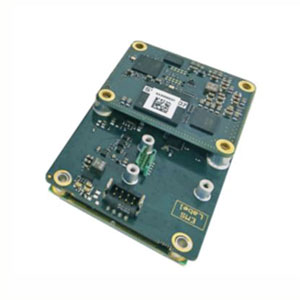
Description
Quanta Extra: Higher Accuracy by SBG Systems
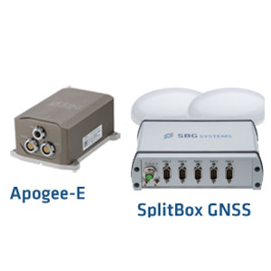
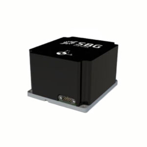
Quanta Extra embeds high-end gyroscopes and accelerometers in the most compact form factor. Additionally, it integrates an RTK GNSS receiver to provide centimetric position.
Bring the highest precision to Mobile Mapping Solutions with Quanta Extra.
Features
- High-end INS/GNSS in an ultra compact form factor
- 8 GB data logger for post-processing
- Low-power consumption
- Datalogger for post-processing
- Web interface
- ITAR-Free
- 2-Year Warranty
The Right Combination for Smooth Direct Georeferencing
- Small Form Factor, Lightweight
- Precise and Robust Roll/Pitch
- Single or Dual Antenna Heading
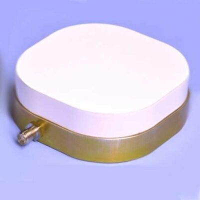
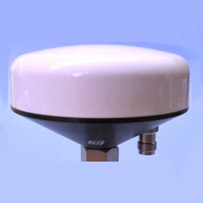
- GPS-GLONASS-GALILEO-BEIDOU
- Robust Real-Time RTK
- The Easiest PPK Software

Quanta Extra: Direct Georeferencing Distinctions
LiDAR & Photogrammetry – UAV or Land based Applications
Quanta directly and precisely geotags your point cloud whether your platform is a UAV or a car. In UAV based photogrammetry, it also reduces the need for GCPs and overlapping thanks to precise orientation and position data.
One Year Free Post-processing with Qinertia UAV
Both Quanta models embed a data logger for post-processing. Qinertia post-processing software enhances SBG INS performance by post-processing inertial data with raw GNSS observables. One year of Qinertia is offered for UAV applications.
Single or Dual Antenna
While a single antenna solution tends to be more practical, the dual antenna mode allows a more precise heading for low dynamics flights (pipes or electrical lines surveys).
Quanta Applications
UAV-based Survey
Real-time and post-processing LiDAR stabilization and point cloud georeferencing – An INS delivers motion and position information. When mounted on a UAV, it precisely synchronizes and stabilizes camera and LiDAR.
In addition, it provides accurate data georeferencing in real-time or at the office using the post-processing software.
Mobile Mapping
Cost-effective and high-performance INS for mobile mapping – An INS fuses inertial data (acceleration and turn rates) with GNSS to compute enhanced orientation and position. It allows precise data georeferencing even when GNSS disturbances or outages occur. Plus, it compensates inaccuracies due to the motion of the vehicle.
Additionally, the INS provides time-stamping and synchronizes various mobile mapping instruments like cameras and LiDARs.
Indoor Mapping
INS for Indoor Mapping Applications – An INS compensates the motion endorsed by the indoor mapping system — whether camera or LiDAR.
In addition, it can aid the SLAM computation — helping to maintain position or heading between two SLAM information.
About SBG Systems
SBG Systems is a fast growing supplier of miniature, high performance and innovative motion sensing systems. They offer a complete line of inertial sensors based on state-of-the-art MEMS technology such as Attitude and Heading Reference System (AHRS), Inertial Measurement Unit (IMU), Inertial Navigation Systems with embedded GPS (INS/GPS).