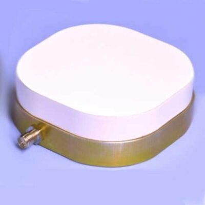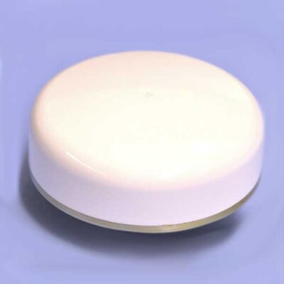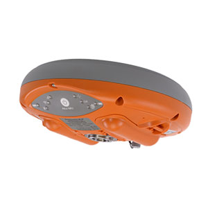

Description
Altus NR3 — compact GNSS rover for surveying and GIS applications – combines easy-to-use, quad-constellation RTK with an unrivaled communications toolset for a successful survey or GIS project every time. It incorporates leading GNSS and wireless technology into a sleek and compact design.
Key features
- Robust, light and portable GNSS receiver
- Quad-constellation, multi-frequency, all-in-view RTK positioning
- AIM+ anti-jamming and monitoring system
- Easy setup and one-touch logging
- All-in-one base and rover operation
AIM+ anti-jamming
AIM+ offers built-in protection against intentional and unintentional jamming using a sophisticated system of sampling and mitigation mechanisms. The Altus NR3 can suppress the widest variety of interferers — from simple continuous narrow-band signals to the more complex wide-band and pulsed transmitters as well as Inmarsat and Iridium satellite transmissions.
The GNSS+ Toolkit
Septentrio’s suite of algorithms to convert bad measurements into good positioning
Mechanical vibrations or shocks caused by rough terrain can wreak havoc with satellite tracking. Lock+ automatically adjusts the tracking loop parameters of the Altus NR3 so you never lose position.
Activity in the ionosphere is a problem for GNSS signals, from loss of RTK fix to total loss of signal lock. Having honed our skills in the most iono-active areas on Earth, the result is IONO+: the most advanced protection against ionospheric disturbances to GNSS signals on any receiver.
Metal and large nearby structures can reflect GNSS signals and produce multipath. The APME+system disentangles direct and reflected signals enhancing both position and measurement quality. APME+ is bias free and, in line with Septentrio’s commitment to maximum configurability, can be disabled.
Use Your Own Device
Thanks to Septentrio’s open architecture, the Altus NR3 is fully compatible with leading third-party hardware and software solutions. Thus, maximizing the use of existing equipment while driving down the cost of ownership over the lifetime of the device.
Collection Made Simple
Unify high-accuracy GNSS data with the power of data collection using either SurvCE or PinPoint Data Collector. SurvCE allows advanced survey data collection while PinPoint-GIS enables simple data collection from the Altus NR3 directly to the cloud.
About Septentrio
Septentrio designs, manufactures and sells highly accurate GPS/GNSS receivers for demanding applications requiring accuracies in the decimeter or centimeter range — even under difficult conditions. Whether it’s on the high sea, in scintillation prone areas or at high latitudes, our customers know that Septentrio receivers deliver fast, accurate and reliable positions. In urban canyons, under canopies or even under circumstances where there is deliberate interference, our receivers make our customers excel.