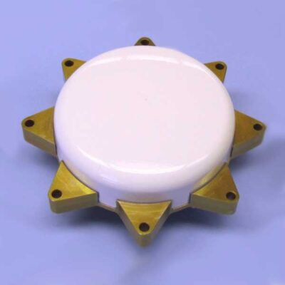
Description
Apogee-D is a highly accurate Inertial Navigation System with dual antenna GNSS receiver for real-time and post-processing operations.
The ITAR Free Apogee-D is the most accurate Dual GNSS/INS based on the robust and cost-effective MEMS technology.
High Accuracy
- 0.008° Roll & Pitch (RTK)
- 0.025° GNSS-based heading (4m baseline)
- 1 cm Position (RTK)
- Post-processing with Qinertia INS/GNSS PPK Software
- 5 cm Real-time Heave
- 2 cm Delayed Heave
Apogee-D embeds
- The latest MEMS gyroscopes and accelerometers
- The latest tri-frequency GNSS receiver with one Survey grade antenna
- A Web Interface for Easy Configuration
- A 48h Internal Data Logger for Post-processing
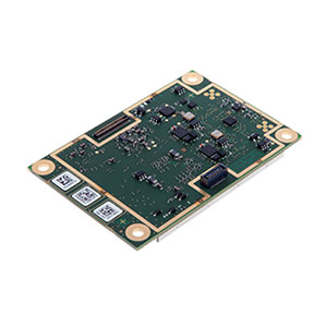
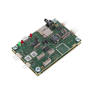
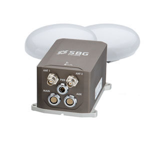
Apogee Models Available

Dual Antenna Tri-frequency GNSS receiver – RTK, TerraStar, Veripos Positioning
This state-of-the-art INS/GNSS integrates the last generation of Tri-frequency GNSS receiver which supports RTK, TerraStar and Veripos positioning services.
Apogee-D comes with a dual antenna GNSS receiver for accurate and robust heading even under low dynamics (marine) and for an extremely fast initial alignment time.
Extensive Heave Calculation
The Apogee provides a real-time heave accurate to 5 cm. For more simplicity, the user doesn’t have to enter the wave frequency; the Apogee automatically detects it and constantly adjusts to it.
Apogee comes also with a unique delayed heave feature with no additional software nor user action. This specific algorithm allows a more extensive calculation, resulting in a heave accurate to 2 cm displayed in real-time with a little delay.
Applications
Marine
The Apogee-D is a compact all-in-one solution for Hydrographic applications. Already compatible with Hypack and QINsy software, the Apogee-D is ready-to-use for multibeam sonar stabilization and georeferencing. Apogee-D is also a smart choice for Unmanned Surface Vehicle navigation, or on-board equipment orientation and motion compensation.
Land
Choose the Apogee-D when accurate heading is needed and a large baseline (minimum 2 m) can be respected on the land vehicle.
Apogee-D can be used for any vehicle navigation encountering GPS outages. This cutting-edge Dual GNSS/INS still provides reliable and accurate trajectory when connected to an odometer.
Aerospace
Apogee-D is the ultimate INS for Aerial Mapping, Photogrammetry or Remote Sensing projects. Thanks to its very low noise gyroscopes, it delivers accurate and stable orientation and position data, both real time or post processing.
It’s also a cutting edge solution for strategic UAV navigation and advanced payload stabilization. It embeds a dual antenna GNSS receiver for accurate heading during long steady flight phases.
Complementary Equipment and Software
Connection, Synchronization and Positioning
The SplitBox provides a simplified interface for easy connection and synchronization with external equipment such as odometer, differential corrections, computers, or survey instruments. The SplitBox with integrated GNSS receiver additionally delivers navigation data with a large choice of positioning services (Marinestar, TerraStar, etc.).
Qinertia INS/GNSS Post-processing Software
Qinertia is the SBG Systems in-house post-processing software. This full-featured software enhances SBG inertial navigation systems performance by post processing inertial data with raw GNSS observables.
Learn more about Qinertia.
About SBG Systems
SBG Systems is a fast growing supplier of miniature, high performance and innovative motion sensing systems. They offer a complete line of inertial sensors based on state-of-the-art MEMS technology such as Attitude and Heading Reference System (AHRS), Inertial Measurement Unit (IMU), Inertial Navigation Systems with embedded GPS (INS/GPS), etc.