- Description
- Specifications
Description
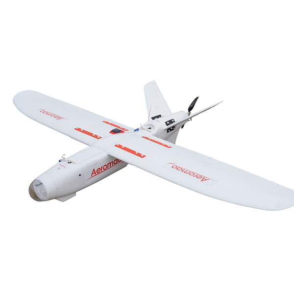
Aeromapper Talon LITE by Aeromao is the affordable BVLOS mapping & inspection drone.
It is a very affordable commercial fixed-wing drone designed to offer high performance features.
The Aeromapper Talon is a fully autonomous drone. It can fly for up to 3 hours and map up to 2,479 acres per flight, thanks to its new hybrid battery system. This is more than twice the coverage of the leading brand of fixed-wing drones but at a fraction of the cost.
Available payloads include:
- RGB
- Multispectral
- HD Video
- Thermal
This professional system is completely modular, customizable, and ideal for applications such as surveying *& mapping, conservation, forestry, inspection, oil& gas, agriculture, surveillance, and scouting.
Why Choose Aeromapper Talon LITE?
The Aeromapper Talon LITE is built for professionals who need the highest level of safety and ease of use. It offers reliable performance and uncomplicated launch and recovery procedures. It automatically belly lands in an area as small as a 50 meter long by 7 meter wide.
If operations require a parachute equipped drone for recovery in tight spaces, consider the Aeromapper Talon standard.
Its proven long-range communications system enables users to fly as far as 30kms away from the Ground Station. It makes it ideal for BVLOS missions and large-scale area mapping.
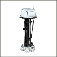
Kit Includes
- Aeromapper Talon LITE
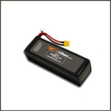
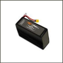
- One set of batteries
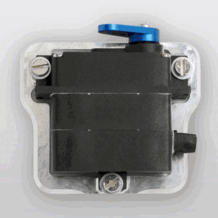
- 30 Km Link system
- User’s Manuals & Documentation
- Mission Planner Software
- Unlimited Support
- Payloads are not included
Aeromapper Talon LITE Features
Incomparable productivity per flight! The Aermoapper Talon LITE can map up to 10 sq. km (2,479 acres) @125m (400 ft.) agl in a single flight. It offers the best area coverage on the market.


Thanks to its impressive endurance and long range communications link, the Aeromapper Talon LITE is the absolute best data acquisition drone.
Add on the PPK solution, and it tackles those very large projects that require centimeter accuracy. The PPK system eliminates or greatly reduces the need for GCPs and achieves an absolute accuracy of up to 3cm.
Wide choice of sensors are available for the Talon LITE. Choose from: multispectral, thermal, RGB, and more.


The Talon LITE automatically belly lands perfectly every time…even in strong crosswind situations. Minimum area required for an automatic belly landing is 50m long x 7m wide. Requires a path clear of obstacles to perform the approach.
The system is modular with interchangeable parts. Spare parts are always kept in stock for immediate shipping worldwide.
Save dollars with a drone that is easy to fix in the field: the mission continues, no matter what.


Keep a constant eye in the sky. Add the new Eyeshot Pro real-time video system to patrol very large areas.
Ideal for situational awareness, inspection, wildlife observation, surveillance, environmental monitoring, infrastructure monitoring, scientific research, and many others.
Field proven BVLOS capabilities thanks to its rock solid long range communications link: fly with confidence as far as 30km away from the operator. Read more, here.


Every Talon LITE is individually flight tested.
Offers very simple and uncomplicated setup and operation. Setup in 5 minutes and fly the mission completely autonomously.
Additional Options for Talon LITE
Purchase additional options for the Aeromapper Talon LITE, including:
- GNSS PPK Upgrade
- Pix4D Mapper Software
- Agisoft Metashape Professional Software
- Hands-on Flight Training
- Online Flight Training
- Parrot Sequoia+ and 24 MP RGB
- FLIR Vue Pro and 24MP RGB dual setup
- Eyeshot Pro real-time video downlink system
- Micasense Rededge MX
- 42 MP RGB Camera: Sony DSC-RX1R II
- ADS-B live air traffic and transponder
- FLIR Duo R and FLIR Duo Pro R: thermal +4K video/stills
- Micasense Altum
- Mapir Survey3W GPS camera, with numerous options
Please email info@shopunmanned.com to request pricing on any of the options listed above.
About Aeromao
Aeromao is a company with the vision of becoming a worldwide leader in UAV innovation by creating the most versatile, small unmanned vehicles for civil applications. Aeromao is backed by years of experience and a history of innovative endeavors in the area of UAVs for high-precision mapping and aerial photography uses.
- Construction: EPO foam (durable, easy to repair, carbon fiber reinforced).
- Wingspan: 2 m.
- Weight:3825 grs.
- Endurance:2 – 3 Hours in standard configuration (depending on payload selection).
- Launch:Very easy to hand-launch.
- Landing: Automatic belly landing.
- Maximum payload: 480 grs.
- Communications link range: +30kms. Tested in real BVLOS flight operations (Beyond Visual Line of Sight).
- Max. Altitude: About 4500 masl.
- Cruise speed: 52 Km/h.
- Flight modes: Manual, Stabilize, Return to Home, Fly be Wire, Auto.
- Wind Tolerance: up to 35 km/h. for flight and autonomous belly landing.
- Maximum speed: +90 Km/h.
- Failsafe: Automatically returns to home & loiter upon loss of RC link. Other failsafe routines available.
- Telemetry: Battery status, alt, ground speed, compass, attitude, distance travelled, time on air (speech enabled), and more than +200 parameters more.
- Moving map display / telemetry: Drone position and heading, commands on map, fly to point on map, altitude changes, remote spot camera trigger, mission route, and more.
- Weather: -20oC to +40oC